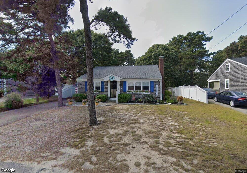
99 Captain Chase Rd Dennis Port, MA 02639
Dennis Port NeighborhoodEstimated Value: $502,000 - $629,000
2
Beds
1
Bath
936
Sq Ft
$618/Sq Ft
Est. Value
About This Home
This home is located at 99 Captain Chase Rd, Dennis Port, MA 02639 and is currently estimated at $578,396, approximately $617 per square foot. 99 Captain Chase Rd is a home located in Barnstable County with nearby schools including Dennis-Yarmouth Regional High School and St. Pius X. School.
Ownership History
Date
Name
Owned For
Owner Type
Purchase Details
Closed on
Aug 29, 1997
Sold by
Sutton-Bing Eguenia
Bought by
Morissette Robert C and Morissette Joyce K
Current Estimated Value
Home Financials for this Owner
Home Financials are based on the most recent Mortgage that was taken out on this home.
Original Mortgage
$68,000
Outstanding Balance
$10,483
Interest Rate
7.41%
Mortgage Type
Purchase Money Mortgage
Estimated Equity
$567,913
Create a Home Valuation Report for This Property
The Home Valuation Report is an in-depth analysis detailing your home's value as well as a comparison with similar homes in the area
Home Values in the Area
Average Home Value in this Area
Purchase History
| Date | Buyer | Sale Price | Title Company |
|---|---|---|---|
| Morissette Robert C | $85,000 | -- |
Source: Public Records
Mortgage History
| Date | Status | Borrower | Loan Amount |
|---|---|---|---|
| Open | Morissette Robert C | $68,000 |
Source: Public Records
Tax History Compared to Growth
Tax History
| Year | Tax Paid | Tax Assessment Tax Assessment Total Assessment is a certain percentage of the fair market value that is determined by local assessors to be the total taxable value of land and additions on the property. | Land | Improvement |
|---|---|---|---|---|
| 2025 | $2,473 | $571,100 | $195,300 | $375,800 |
| 2024 | $2,306 | $525,200 | $187,800 | $337,400 |
| 2023 | $2,238 | $479,200 | $170,700 | $308,500 |
| 2022 | $2,147 | $383,400 | $153,800 | $229,600 |
| 2021 | $2,178 | $361,200 | $172,300 | $188,900 |
| 2020 | $1,965 | $322,100 | $150,800 | $171,300 |
| 2019 | $1,852 | $300,200 | $147,800 | $152,400 |
| 2018 | $1,473 | $279,300 | $140,700 | $138,600 |
| 2017 | $1,629 | $264,900 | $130,700 | $134,200 |
| 2016 | $1,646 | $252,100 | $140,700 | $111,400 |
| 2015 | $1,613 | $252,100 | $140,700 | $111,400 |
| 2014 | $1,473 | $232,000 | $120,600 | $111,400 |
Source: Public Records
Map
Nearby Homes
- 31 Easy St
- 80 Michaels Ave
- 64 Beaten Rd
- 37 Ocean Dr Unit 2
- 22 Wixon Rd
- 154 Old Wharf Rd Unit 26
- 154 Old Wharf Rd Unit 14
- 262 Old Wharf Rd Unit 67
- 262 Old Wharf Rd Unit 5
- 262 Old Wharf Rd Unit 5
- 262 Old Wharf Rd Unit 20
- 262 Old Wharf Rd Unit 87
- 112 Old Wharf Rd Unit E4
- 112 Old Wharf Rd Unit E1
- 37 Beach Hills Rd
- 19 Standish Way
- 217 Old Wharf Rd Unit 64
- 37-A Beach Hills Rd
- 241 Old Wharf Rd Unit 82
- 241 Old Wharf Rd Unit 127
- 99 Captain Chase Rd
- 97 Captain Chase Rd
- 101 Captain Chase Rd
- 93 Captain Chase Rd
- 96 Captain Chase Rd
- 168 Lower County Rd Unit 1
- 91 Captain Chase Rd
- 19 Uncle Ezras Path
- 17 Uncle Ezras Path
- 0 Captain Chase Rd Unit 2008408
- 0 Captain Chase Rd Unit 2011643
- 0 Captain Chase Rd Unit 5011178
- 0 Captain Chase Rd Unit 23 5009259
- 0 Captain Chase Rd Unit 16 2016692
- 0 Captain Chase Rd Unit 7 7032693
- 0 Captain Chase Rd Unit 2 2029410
- 0 Captain Chase Rd Unit 11 2024241
- 0 Captain Chase Rd Unit 15 2033407
- 0 Captain Chase Rd Unit 5004506
- 0 Captain Chase Rd Unit 8 20018