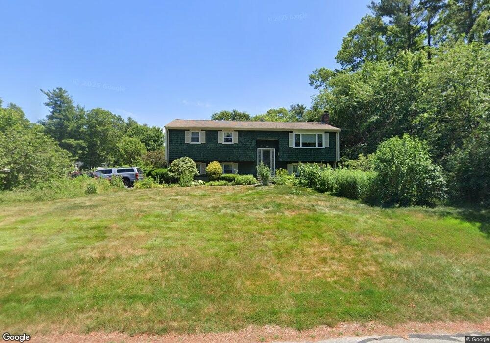
99 Carl Rd Raynham, MA 02767
Estimated Value: $581,796 - $608,000
3
Beds
2
Baths
1,736
Sq Ft
$346/Sq Ft
Est. Value
About This Home
This home is located at 99 Carl Rd, Raynham, MA 02767 and is currently estimated at $599,949, approximately $345 per square foot. 99 Carl Rd is a home located in Bristol County with nearby schools including LaLiberte Elementary School, Merrill Elementary School, and Williams Intermediate School.
Ownership History
Date
Name
Owned For
Owner Type
Purchase Details
Closed on
May 16, 2018
Sold by
Spates Gary C and Spates Cynthia L
Bought by
Spates Irt
Current Estimated Value
Purchase Details
Closed on
Mar 3, 1986
Bought by
Spates Gary C and Spates Cynthia L
Create a Home Valuation Report for This Property
The Home Valuation Report is an in-depth analysis detailing your home's value as well as a comparison with similar homes in the area
Home Values in the Area
Average Home Value in this Area
Purchase History
| Date | Buyer | Sale Price | Title Company |
|---|---|---|---|
| Spates Irt | -- | -- | |
| Spates Gary C | $137,700 | -- |
Source: Public Records
Mortgage History
| Date | Status | Borrower | Loan Amount |
|---|---|---|---|
| Previous Owner | Spates Gary C | $90,000 |
Source: Public Records
Tax History Compared to Growth
Tax History
| Year | Tax Paid | Tax Assessment Tax Assessment Total Assessment is a certain percentage of the fair market value that is determined by local assessors to be the total taxable value of land and additions on the property. | Land | Improvement |
|---|---|---|---|---|
| 2025 | $5,823 | $481,200 | $200,100 | $281,100 |
| 2024 | $5,881 | $473,500 | $192,400 | $281,100 |
| 2023 | $5,682 | $417,800 | $173,200 | $244,600 |
| 2022 | $5,377 | $362,600 | $153,900 | $208,700 |
| 2021 | $5,103 | $347,400 | $146,200 | $201,200 |
| 2020 | $4,918 | $341,300 | $146,200 | $195,100 |
| 2019 | $4,857 | $341,300 | $146,200 | $195,100 |
| 2018 | $4,702 | $315,600 | $146,200 | $169,400 |
| 2017 | $4,417 | $293,900 | $138,600 | $155,300 |
| 2016 | $4,356 | $290,800 | $135,500 | $155,300 |
| 2015 | $4,051 | $265,800 | $136,600 | $129,200 |
Source: Public Records
Map
Nearby Homes
- 970 N Main St
- 1037 N Main St
- 848 N Main St
- 21 Sully Rd
- 643 Center St
- 73 Sherwood Ln
- 100 Francine Rd
- 520 King St
- 2 Maplewood Ln Unit 21-1
- 0 Maplewood Unit 21.3 73426136
- 0 Maplewood Unit 33-1 73420094
- 100 Pleasant St
- 115 Goldfinch Dr
- 53 Queens Cir
- 40 Country Club Dr
- 25 Twin Diamond Dr
- 92 N Main St
- 930 King St
- 120 King St
- 80 Partridge Ln