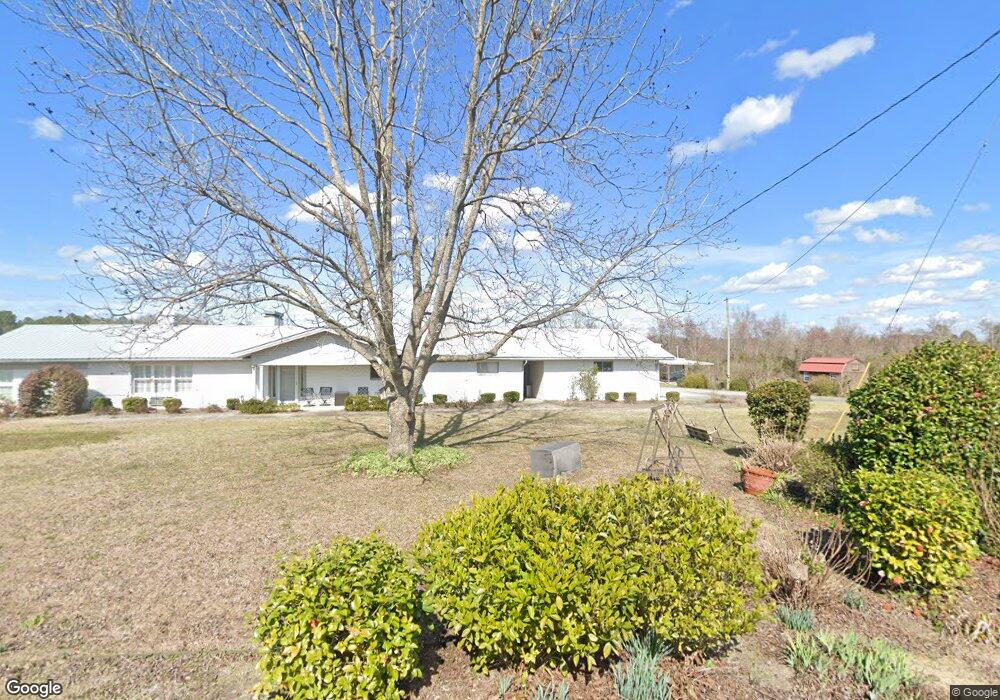
99 Del Ponte Dr Portal, GA 30450
Estimated Value: $125,000 - $205,000
3
Beds
2
Baths
1,418
Sq Ft
$123/Sq Ft
Est. Value
About This Home
This home is located at 99 Del Ponte Dr, Portal, GA 30450 and is currently estimated at $174,407, approximately $122 per square foot. 99 Del Ponte Dr is a home located in Bulloch County with nearby schools including Portal Elementary School and Portal Middle/High School.
Ownership History
Date
Name
Owned For
Owner Type
Purchase Details
Closed on
Sep 16, 2021
Sold by
Anderson Kay C
Bought by
Anderson Jackie W
Current Estimated Value
Purchase Details
Closed on
Mar 30, 2016
Sold by
Anderson Jackie W
Bought by
Anderson Kay C
Purchase Details
Closed on
Nov 30, 2012
Sold by
Mfdt Holdings Llc
Bought by
Anderson Jackie W and Anderson Kay C
Purchase Details
Closed on
May 22, 2012
Sold by
Deal Taylor Mary
Bought by
Mfdt Holdings Llc
Purchase Details
Closed on
Feb 24, 2012
Sold by
Taylor D W D and Taylor Mary D
Bought by
Deal Taylor Mary
Purchase Details
Closed on
Jan 1, 1991
Bought by
Taylor Taylor D and Taylor Mary D
Create a Home Valuation Report for This Property
The Home Valuation Report is an in-depth analysis detailing your home's value as well as a comparison with similar homes in the area
Home Values in the Area
Average Home Value in this Area
Purchase History
| Date | Buyer | Sale Price | Title Company |
|---|---|---|---|
| Anderson Jackie W | -- | -- | |
| Anderson Kay C | -- | -- | |
| Anderson Jackie W | $15,000 | -- | |
| Mfdt Holdings Llc | -- | -- | |
| Deal Taylor Mary | -- | -- | |
| Taylor Taylor D | -- | -- |
Source: Public Records
Tax History Compared to Growth
Tax History
| Year | Tax Paid | Tax Assessment Tax Assessment Total Assessment is a certain percentage of the fair market value that is determined by local assessors to be the total taxable value of land and additions on the property. | Land | Improvement |
|---|---|---|---|---|
| 2024 | $811 | $27,880 | $3,840 | $24,040 |
| 2023 | $512 | $21,040 | $3,840 | $17,200 |
| 2022 | $397 | $18,393 | $3,840 | $14,553 |
| 2021 | $358 | $16,181 | $3,840 | $12,341 |
| 2020 | $358 | $15,760 | $3,840 | $11,920 |
| 2019 | $357 | $15,640 | $3,840 | $11,800 |
| 2018 | $386 | $15,283 | $3,840 | $11,443 |
| 2017 | $390 | $15,297 | $3,840 | $11,457 |
| 2016 | $387 | $14,794 | $3,840 | $10,954 |
| 2015 | $381 | $14,459 | $3,840 | $10,619 |
| 2014 | $354 | $14,459 | $3,840 | $10,619 |
Source: Public Records
Map
Nearby Homes
- 218 Turpentine Dr
- 0 U S 80 Unit 10535643
- 1717 Grady Saunders Rd
- 525 Horsefly Rd
- 2120 Banks Dairy Rd
- 569 Anderson Parrish Rd
- 567 Anderson Parrish Rd
- 2303 Metter Rd
- 296 Pleasant Hill Rd
- 336 Pleasant Hill Rd
- 374 Pleasant Hill Rd
- 788 Dean Nichols Rd
- 0 Dean Nichols Rd
- 0 Ben Grady Collins Rd Unit LOT 3 10534788
- 0 Ben Grady Collins Rd Unit LOT 1 10534784
- 3021 Cowboy Way
- 3969 Ben Grady Collins Rd Unit LOT 2
- Lot 3 Ben Grady Collins Rd
- Lot 1 Ben Grady Collins Rd
- 01 Foxboro Ln
- 99 Del Ponte Dr
- 99 Del Ponte Dr
- 99 Del Ponte Dr
- 110 Womack Rd S
- 26780 U S 80
- 26780 Us Highway 80 W
- 26784 Us Highway 80 W
- 26788 Us Highway 80 W
- 26870 U S 80
- 26870 Us Highway 80 W
- 125 Airport Ln
- 26874 Us Highway 80 W
- 26787 U S 80
- 26787 Us Highway 80 W
- 26878 Us Highway 80 W
- 26779 Us Highway 80 W
- 26775 Us Highway 80 W
- 26775 Us Highway 80 W
- 0 Forest Ave Unit 7280695
- 0 Forest Ave