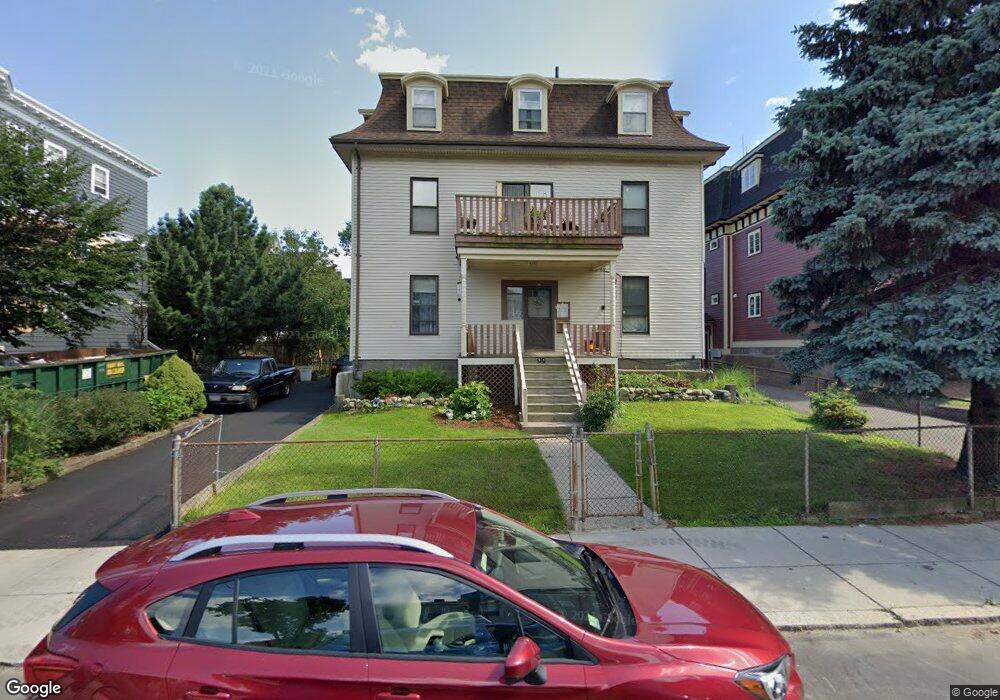
99 Dix St Dorchester, MA 02122
Saint Marks NeighborhoodEstimated Value: $1,172,000 - $1,307,000
7
Beds
4
Baths
3,591
Sq Ft
$349/Sq Ft
Est. Value
About This Home
This home is located at 99 Dix St, Dorchester, MA 02122 and is currently estimated at $1,253,333, approximately $349 per square foot. 99 Dix St is a home located in Suffolk County with nearby schools including Neighborhood House Charter School and Helen Y. Davis Leadership Academy Charter Public School.
Ownership History
Date
Name
Owned For
Owner Type
Purchase Details
Closed on
Jul 29, 2021
Sold by
Grant John W and Grant Helen M
Bought by
John W & Halen M Lt
Current Estimated Value
Create a Home Valuation Report for This Property
The Home Valuation Report is an in-depth analysis detailing your home's value as well as a comparison with similar homes in the area
Home Values in the Area
Average Home Value in this Area
Purchase History
| Date | Buyer | Sale Price | Title Company |
|---|---|---|---|
| John W & Halen M Lt | -- | None Available |
Source: Public Records
Tax History Compared to Growth
Tax History
| Year | Tax Paid | Tax Assessment Tax Assessment Total Assessment is a certain percentage of the fair market value that is determined by local assessors to be the total taxable value of land and additions on the property. | Land | Improvement |
|---|---|---|---|---|
| 2025 | $11,450 | $988,800 | $351,200 | $637,600 |
| 2024 | $10,465 | $960,100 | $338,500 | $621,600 |
| 2023 | $10,311 | $960,100 | $338,500 | $621,600 |
| 2022 | $9,326 | $857,200 | $302,200 | $555,000 |
| 2021 | $8,711 | $816,400 | $287,800 | $528,600 |
| 2020 | $8,405 | $795,900 | $301,700 | $494,200 |
| 2019 | $7,624 | $723,300 | $221,100 | $502,200 |
| 2018 | $7,148 | $682,100 | $221,100 | $461,000 |
| 2017 | $6,619 | $625,000 | $219,600 | $405,400 |
| 2016 | $6,084 | $553,100 | $219,600 | $333,500 |
| 2015 | $5,734 | $473,500 | $168,200 | $305,300 |
| 2014 | $5,367 | $426,600 | $168,200 | $258,400 |
Source: Public Records
Map
Nearby Homes
- 381 Adams St Unit 2
- 381 Adams St Unit 1
- 381 Adams St Unit 3
- 382 Adams St Unit 384-1
- 20 Leslie St
- 20 Parkman St Unit 2
- 334 Centre St Unit 101
- 334 Centre St Unit 2
- 34 Dix St Unit 3
- 17 Lafield St Unit 2
- 28 Dix St Unit 3
- 6 Agawam St
- 32 Gibson St Unit 3
- 96 King St Unit 1
- 104 King St Unit 2
- 108 King St Unit 3
- 1613 Dorchester Ave Unit 1
- 41 King St Unit 1
- 34 Houghton St
- 60 Houghton St Unit 62
- 95 Dix St Unit 6
- 95 Dix St Unit 5
- 95 Dix St Unit 4
- 95 Dix St Unit 3
- 95 Dix St Unit 2
- 95 Dix St Unit 1
- 95 Dix St Unit 95 Dix Street
- 103 Dix St
- 103 Dix St Unit 2
- 103 Dix St Unit 3
- 385 Adams St
- 381 Adams St
- 379 Adams St
- 379 Adams St Unit 2
- 389 Adams St
- 389 Adams St Unit 2
- 91 Dix St Unit 3
- 91 Dix St Unit 2
- 91 Dix St Unit 1
- 7 Adams Terrace