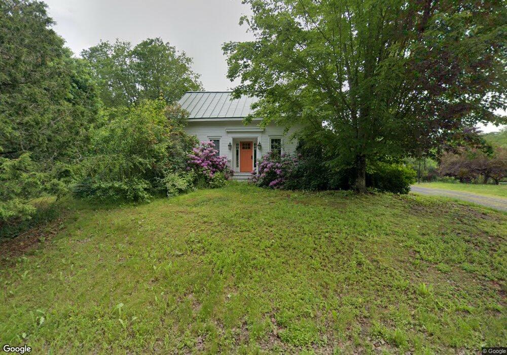
99 Doak Rd Belfast, ME 04915
Estimated Value: $390,000 - $636,000
4
Beds
2
Baths
2,482
Sq Ft
$191/Sq Ft
Est. Value
About This Home
This home is located at 99 Doak Rd, Belfast, ME 04915 and is currently estimated at $473,043, approximately $190 per square foot. 99 Doak Rd is a home located in Waldo County with nearby schools including Cornerspring Children's House and The School At Sweetser - Belfast.
Ownership History
Date
Name
Owned For
Owner Type
Purchase Details
Closed on
Jun 3, 2011
Sold by
Coastal Mountains Land T
Bought by
Ociepka Sean P and Burnett Elizabeth L
Current Estimated Value
Home Financials for this Owner
Home Financials are based on the most recent Mortgage that was taken out on this home.
Original Mortgage
$160,000
Interest Rate
4.85%
Mortgage Type
Commercial
Create a Home Valuation Report for This Property
The Home Valuation Report is an in-depth analysis detailing your home's value as well as a comparison with similar homes in the area
Home Values in the Area
Average Home Value in this Area
Purchase History
| Date | Buyer | Sale Price | Title Company |
|---|---|---|---|
| Ociepka Sean P | -- | -- |
Source: Public Records
Mortgage History
| Date | Status | Borrower | Loan Amount |
|---|---|---|---|
| Previous Owner | Ociepka Sean P | $160,000 |
Source: Public Records
Tax History
| Year | Tax Paid | Tax Assessment Tax Assessment Total Assessment is a certain percentage of the fair market value that is determined by local assessors to be the total taxable value of land and additions on the property. | Land | Improvement |
|---|---|---|---|---|
| 2025 | $6,291 | $385,000 | $66,000 | $319,000 |
| 2024 | $5,911 | $383,800 | $66,000 | $317,800 |
| 2023 | $6,348 | $315,800 | $52,400 | $263,400 |
| 2022 | $6,593 | $308,100 | $52,400 | $255,700 |
| 2021 | $6,778 | $308,100 | $52,400 | $255,700 |
| 2020 | $6,813 | $292,400 | $52,400 | $240,000 |
| 2019 | $669 | $290,100 | $52,400 | $237,700 |
| 2018 | $5,929 | $281,200 | $52,400 | $228,800 |
| 2017 | $5,979 | $273,000 | $52,400 | $220,600 |
| 2016 | $2,688 | $255,200 | $27,400 | $227,800 |
| 2015 | $5,716 | $255,200 | $27,400 | $227,800 |
| 2014 | $5,525 | $255,200 | $27,400 | $227,800 |
| 2013 | $5,308 | $255,200 | $27,400 | $227,800 |
Source: Public Records
Map
Nearby Homes
- 99 Waterville Rd
- 050-C-1 W Waldo Rd
- 3 Waterville Rd
- 1 Waterville Rd
- 86 Oak Hill Rd
- 000 Merriam Rd
- 0 Robbins Rd Unit 1634953
- 225 Waldo Ave
- 20 Springbrook Dr Unit TH-6
- 00 Harriman Rd
- 162 Waldo Ave
- 65 Patterson Hill Rd
- 67 Patterson Hill Rd
- 55 Londonderry Ln
- 101 Waldo Ave Unit 3-1
- Lot 5 Waukeag Way
- 100 Belmont Ave Unit 2
- 2 Swan Lake Ave
- 183 Main St
- 18 Waldo Ave
- 83 Doak Rd
- 65 Head of the Tide Rd
- 75 Doak Rd
- 57 Head of the Tide Rd
- 78 Doak Rd
- 60 Head of the Tide Rd
- 71 Doak Rd
- 51 Head of the Tide Rd
- 76 Doak Rd
- 28 Lupine Rd
- 56 Head of the Tide Rd
- 47 Head of the Tide Rd
- 92 Head of the Tide Rd
- 52 Head of the Tide Rd
- 54 Head of the Tide Rd
- 50 Head of the Tide Rd
- 133 Waterville Rd
- 46 Head of the Tide Rd
- 145 Waterville Road Rt 137 & Lup Dr
- 61 Doak Rd
Your Personal Tour Guide
Ask me questions while you tour the home.