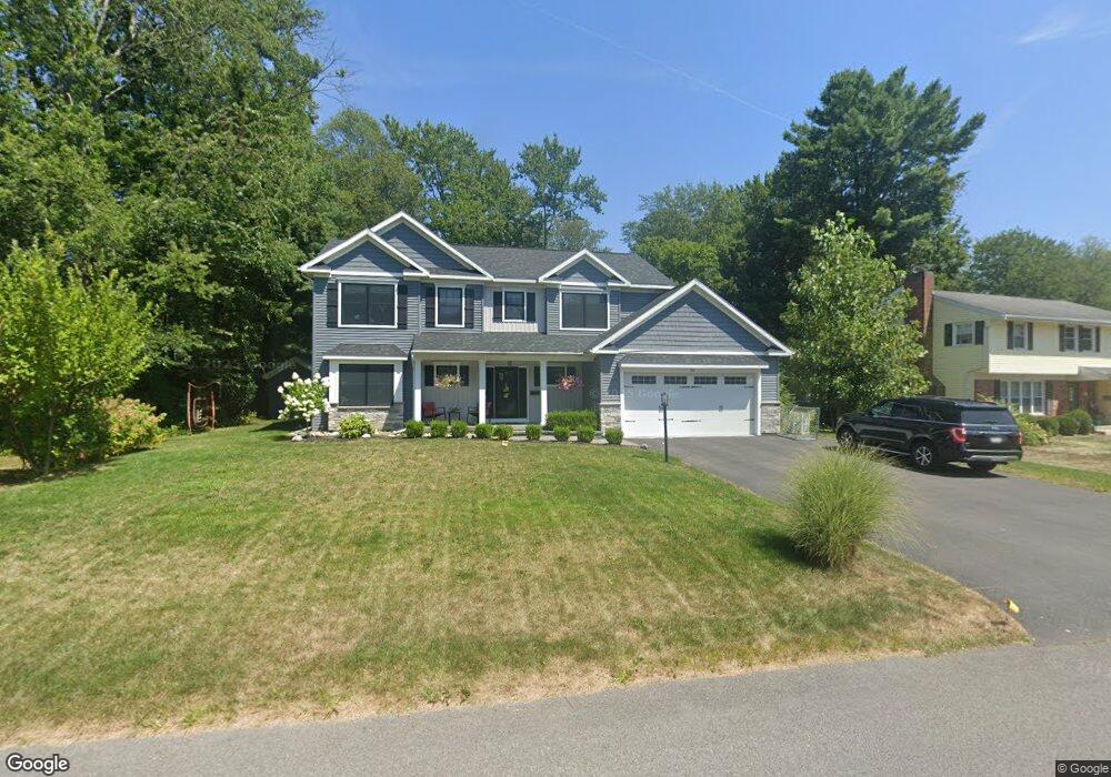
99 Dumbarton Dr Delmar, NY 12054
Estimated Value: $606,776 - $629,000
4
Beds
4
Baths
2,984
Sq Ft
$207/Sq Ft
Est. Value
About This Home
This home is located at 99 Dumbarton Dr, Delmar, NY 12054 and is currently estimated at $617,694, approximately $207 per square foot. 99 Dumbarton Dr is a home located in Albany County with nearby schools including St. Thomas the Apostle School and Mt. Moriah Academy.
Ownership History
Date
Name
Owned For
Owner Type
Purchase Details
Closed on
Feb 9, 2024
Sold by
Hoogkamp Patrick John and Hoogkamp Sonia Lauren
Bought by
Petit Matthew P and Munroe Jacqueline
Current Estimated Value
Home Financials for this Owner
Home Financials are based on the most recent Mortgage that was taken out on this home.
Original Mortgage
$472,500
Outstanding Balance
$465,514
Interest Rate
6.6%
Mortgage Type
New Conventional
Estimated Equity
$152,180
Purchase Details
Closed on
Jan 31, 2000
Sold by
Miller Alan D and Miller Judith
Bought by
Miller Alan
Purchase Details
Closed on
Aug 27, 1998
Create a Home Valuation Report for This Property
The Home Valuation Report is an in-depth analysis detailing your home's value as well as a comparison with similar homes in the area
Home Values in the Area
Average Home Value in this Area
Purchase History
| Date | Buyer | Sale Price | Title Company |
|---|---|---|---|
| Petit Matthew P | $630,000 | Smpr Title | |
| Miller Alan | -- | -- | |
| -- | -- | -- |
Source: Public Records
Mortgage History
| Date | Status | Borrower | Loan Amount |
|---|---|---|---|
| Open | Petit Matthew P | $472,500 |
Source: Public Records
Tax History Compared to Growth
Tax History
| Year | Tax Paid | Tax Assessment Tax Assessment Total Assessment is a certain percentage of the fair market value that is determined by local assessors to be the total taxable value of land and additions on the property. | Land | Improvement |
|---|---|---|---|---|
| 2024 | $11,547 | $350,000 | $68,000 | $282,000 |
| 2023 | $11,235 | $350,000 | $68,000 | $282,000 |
| 2022 | $10,994 | $350,000 | $68,000 | $282,000 |
| 2021 | $11,071 | $350,000 | $68,000 | $282,000 |
| 2020 | $8,669 | $350,000 | $68,000 | $282,000 |
| 2019 | $2,123 | $78,000 | $68,000 | $10,000 |
| 2018 | $7,276 | $290,000 | $68,000 | $222,000 |
| 2017 | $7,321 | $290,000 | $68,000 | $222,000 |
| 2016 | $7,321 | $290,000 | $68,000 | $222,000 |
| 2015 | -- | $290,000 | $68,000 | $222,000 |
| 2014 | -- | $290,000 | $68,000 | $222,000 |
Source: Public Records
Map
Nearby Homes
- L16 Oakwood Place
- 36 Dumbarton Dr
- 65 Berwick Rd
- 17 Dumbarton Dr
- 25 Columbine Dr
- 210 Kenwood Ave
- 234 Kenwood Ave
- 234 (Parcel 2) Bender Ln
- 2 Drury Ln
- 130 E Poplar Dr
- 137A Elsmere Ave
- 14 Norge Rd
- 300 Bender Ln Unit Proposed Bld. Lot
- 43 Madeleine Ln
- 10 Lincoln Ave
- 214 Winne Rd
- 1 Burhans Place
- 196 Winne Rd
- 5 Salisbury Rd
- 3 Groesbeck Place
- 103 Dumbarton Dr
- 83 Greenock Rd
- 80 Brookview Ave
- 79 Greenock Rd
- 76 Brookview Ave
- 98 Dumbarton Dr
- 102 Dumbarton Dr
- 96 Dumbarton Dr
- 74 Brookview Ave
- 104 Dumbarton Dr
- 111 Dumbarton Dr
- 73 Greenock Rd
- 82 Greenock Rd
- 92 Dumbarton Dr
- 79 Brookview Ave
- 74 Greenock Rd
- 110 Dumbarton Dr
- 70 Brookview Ave
- 77 Brookview Ave
- 88 Dumbarton Dr