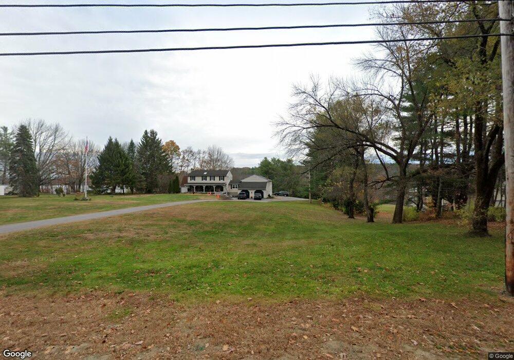
99 Gore Rd Alfred, ME 04002
Estimated Value: $639,000 - $771,607
3
Beds
3
Baths
3,208
Sq Ft
$225/Sq Ft
Est. Value
About This Home
This home is located at 99 Gore Rd, Alfred, ME 04002 and is currently estimated at $722,536, approximately $225 per square foot. 99 Gore Rd is a home located in York County with nearby schools including Massabesic High School and St Thomas Consolidated School.
Ownership History
Date
Name
Owned For
Owner Type
Purchase Details
Closed on
Aug 9, 2024
Sold by
Cyr Christa L and Cyr Nicholas J
Bought by
Cyr Lt and Cyr
Current Estimated Value
Purchase Details
Closed on
Oct 21, 2019
Sold by
Berard Ronald J and Berard Barbara J
Bought by
Cyr Christa L and Cyr Nicholas J
Home Financials for this Owner
Home Financials are based on the most recent Mortgage that was taken out on this home.
Original Mortgage
$200,000
Interest Rate
3.7%
Mortgage Type
New Conventional
Create a Home Valuation Report for This Property
The Home Valuation Report is an in-depth analysis detailing your home's value as well as a comparison with similar homes in the area
Home Values in the Area
Average Home Value in this Area
Purchase History
| Date | Buyer | Sale Price | Title Company |
|---|---|---|---|
| Cyr Lt | -- | None Available | |
| Cyr Lt | -- | None Available | |
| Cyr Christa L | -- | -- | |
| Cyr Christa L | -- | -- | |
| Cyr Christa L | -- | -- |
Source: Public Records
Mortgage History
| Date | Status | Borrower | Loan Amount |
|---|---|---|---|
| Previous Owner | Cyr Christa L | $200,000 |
Source: Public Records
Tax History Compared to Growth
Tax History
| Year | Tax Paid | Tax Assessment Tax Assessment Total Assessment is a certain percentage of the fair market value that is determined by local assessors to be the total taxable value of land and additions on the property. | Land | Improvement |
|---|---|---|---|---|
| 2025 | $7,191 | $745,175 | $239,690 | $505,485 |
| 2024 | $7,042 | $745,175 | $239,690 | $505,485 |
| 2023 | $7,044 | $374,700 | $104,500 | $270,200 |
| 2022 | $6,653 | $369,600 | $104,500 | $265,100 |
| 2021 | $6,376 | $369,600 | $104,500 | $265,100 |
| 2020 | $6,061 | $369,600 | $104,500 | $265,100 |
| 2019 | $6,061 | $369,600 | $104,500 | $265,100 |
| 2018 | $5,877 | $369,600 | $104,500 | $265,100 |
| 2017 | $5,877 | $369,600 | $104,500 | $265,100 |
| 2016 | $5,599 | $369,600 | $104,500 | $265,100 |
| 2015 | $5,359 | $369,600 | $104,500 | $265,100 |
| 2014 | $5,267 | $369,600 | $104,500 | $265,100 |
| 2013 | $5,082 | $369,600 | $104,500 | $265,100 |
Source: Public Records
Map
Nearby Homes
- 232 Waterboro Rd
- TBD Olde Farnham Rd
- 34 Cascade Cir Unit 30
- 74 Lisa Dr
- 51 Sanford Rd
- 58 Sanford Rd
- 22 White House Cove Rd
- 87 Drown Rd
- 67 Carpenter Hill Rd
- 330 Biddeford Rd
- Lot 35 Bennett Rd
- Lot 650 Gebung Rd
- 16 Marcotte Ln
- 0 Sanford Rd
- 65 Old County Rd
- Lot 1 Martin Cir
- 2252 Alfred Rd
- 691 Gore Rd
- 5 Cooper Way
- 15 Scooter Way
- 91 Gore Rd
- 111 Gore Rd
- 79 Gore Rd
- 228 Waterboro Rd
- 230 Waterboro Rd
- 234 Waterboro Rd
- 143 Gore Rd
- 236 Waterboro Rd
- 238 Waterboro Rd
- 240 Waterboro Rd
- 55 Gore Rd
- 210 Waterboro Rd
- Lot 65B1 Shaker Hill Rd
- 1 Shaker Hill Rd
- 242 Waterboro Rd
- 52 Gore Rd
- 36 Sevigny Dr
- 145 Gore Rd
- 19 Shaker Hill Rd
- 200 Waterboro Rd