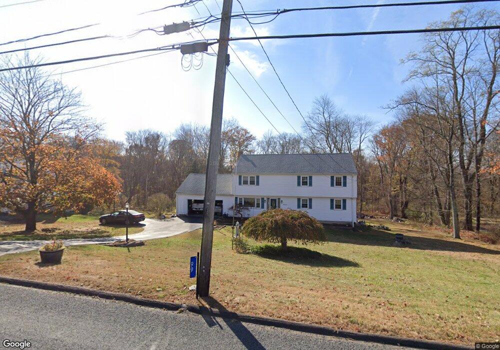
99 Hog Hill Rd East Hampton, CT 06424
Middle Haddam NeighborhoodEstimated Value: $483,051 - $542,000
4
Beds
3
Baths
2,465
Sq Ft
$204/Sq Ft
Est. Value
About This Home
This home is located at 99 Hog Hill Rd, East Hampton, CT 06424 and is currently estimated at $502,263, approximately $203 per square foot. 99 Hog Hill Rd is a home located in Middlesex County with nearby schools including Memorial School, Center Elementary School, and East Hampton Middle School.
Ownership History
Date
Name
Owned For
Owner Type
Purchase Details
Closed on
Jul 16, 2002
Sold by
Carstens Howard P and Carstens Carol B
Bought by
Ennen Robert P and Root-Ennen Karen A
Current Estimated Value
Home Financials for this Owner
Home Financials are based on the most recent Mortgage that was taken out on this home.
Original Mortgage
$196,000
Outstanding Balance
$12,060
Interest Rate
6.75%
Estimated Equity
$490,203
Create a Home Valuation Report for This Property
The Home Valuation Report is an in-depth analysis detailing your home's value as well as a comparison with similar homes in the area
Home Values in the Area
Average Home Value in this Area
Purchase History
| Date | Buyer | Sale Price | Title Company |
|---|---|---|---|
| Ennen Robert P | $245,000 | -- | |
| Ennen Robert P | $245,000 | -- |
Source: Public Records
Mortgage History
| Date | Status | Borrower | Loan Amount |
|---|---|---|---|
| Open | Ennen Robert P | $25,000 | |
| Open | Ennen Robert P | $196,000 | |
| Closed | Ennen Robert P | $196,000 |
Source: Public Records
Tax History Compared to Growth
Tax History
| Year | Tax Paid | Tax Assessment Tax Assessment Total Assessment is a certain percentage of the fair market value that is determined by local assessors to be the total taxable value of land and additions on the property. | Land | Improvement |
|---|---|---|---|---|
| 2025 | $7,510 | $189,110 | $56,520 | $132,590 |
| 2024 | $7,194 | $189,110 | $56,520 | $132,590 |
| 2023 | $6,819 | $189,110 | $56,520 | $132,590 |
| 2022 | $6,555 | $189,110 | $56,520 | $132,590 |
| 2021 | $6,530 | $189,110 | $56,520 | $132,590 |
| 2020 | $6,404 | $193,230 | $57,600 | $135,630 |
| 2019 | $6,569 | $198,210 | $59,210 | $139,000 |
| 2018 | $6,208 | $198,210 | $59,210 | $139,000 |
| 2017 | $6,208 | $198,210 | $59,210 | $139,000 |
| 2016 | $5,835 | $198,210 | $59,210 | $139,000 |
| 2015 | $5,539 | $199,390 | $57,330 | $142,060 |
| 2014 | $4,819 | $199,390 | $57,330 | $142,060 |
Source: Public Records
Map
Nearby Homes
- 9 Long Hill Rd
- 58 Middle Haddam Rd
- 20 Keighley Pond Rd
- 46 Chestnut Hill Rd
- 8 Aldens Crossing
- 29 High Point Dr
- 291 Hog Hill Rd
- 6 Carriage Dr
- 28 Childs Rd
- 76 Skinner St
- 0 Gadpouch Rd
- 36 Champion Hill Rd
- 11 Nutmeg Ln
- 37 S Main St
- 152 Main St
- 29 Watrous St
- 23 Edgerton St
- 4 Watrous St
- 14 Main St
- 50 Haddam Neck Rd
- 101 Hog Hill Rd
- 95 Hog Hill Rd
- 4 Terp Rd
- 91 Hog Hill Rd
- 57 School House Ln
- 101 Middle Haddam Rd
- 94 Hog Hill Rd
- 97 Middle Haddam Rd
- 109 Hog Hill Rd
- 150 Middle Haddam Rd
- 172 Middle Haddam Rd
- 176 Middle Haddam Rd
- 110 Hog Hill Rd
- 8 Terp Rd
- 55 School House Ln
- 90 Hog Hill Rd
- 0 Middle Haddam Rd Unit G10117028
- 72 Middle Haddam Rd
- 3 Middle Haddam Rd