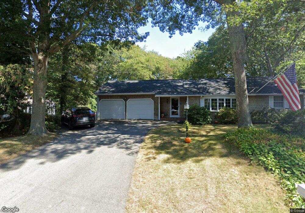
99 Holly Point Rd Centerville, MA 02632
Centerville NeighborhoodEstimated Value: $760,937 - $1,248,000
3
Beds
3
Baths
1,746
Sq Ft
$538/Sq Ft
Est. Value
About This Home
This home is located at 99 Holly Point Rd, Centerville, MA 02632 and is currently estimated at $938,734, approximately $537 per square foot. 99 Holly Point Rd is a home located in Barnstable County with nearby schools including Centerville Elementary School, Barnstable United Elementary School, and Barnstable Intermediate School.
Ownership History
Date
Name
Owned For
Owner Type
Purchase Details
Closed on
Apr 2, 2019
Sold by
Bodley Roger W
Bought by
Bodley Roger W
Current Estimated Value
Purchase Details
Closed on
May 10, 2016
Sold by
Bodley Roger and Bodley Joanne
Bought by
Bodley Roger W
Purchase Details
Closed on
Jul 1, 1997
Sold by
Rose John M and Rose Joan Ann
Bought by
Bodley Robert
Create a Home Valuation Report for This Property
The Home Valuation Report is an in-depth analysis detailing your home's value as well as a comparison with similar homes in the area
Home Values in the Area
Average Home Value in this Area
Purchase History
| Date | Buyer | Sale Price | Title Company |
|---|---|---|---|
| Bodley Roger W | -- | -- | |
| Bodley Roger W | -- | -- | |
| Bodley Robert | $208,000 | -- |
Source: Public Records
Tax History
| Year | Tax Paid | Tax Assessment Tax Assessment Total Assessment is a certain percentage of the fair market value that is determined by local assessors to be the total taxable value of land and additions on the property. | Land | Improvement |
|---|---|---|---|---|
| 2025 | $5,716 | $706,500 | $215,000 | $491,500 |
| 2024 | $5,438 | $696,300 | $215,000 | $481,300 |
| 2023 | $5,140 | $616,300 | $195,400 | $420,900 |
| 2022 | $4,811 | $499,100 | $134,400 | $364,700 |
| 2021 | $4,597 | $438,200 | $136,500 | $301,700 |
| 2020 | $4,685 | $427,500 | $136,500 | $291,000 |
| 2019 | $4,570 | $405,100 | $144,800 | $260,300 |
| 2018 | $4,218 | $375,900 | $168,700 | $207,200 |
| 2017 | $3,941 | $366,300 | $168,700 | $197,600 |
| 2016 | $4,008 | $367,700 | $170,100 | $197,600 |
| 2015 | $3,939 | $363,000 | $165,400 | $197,600 |
Source: Public Records
Map
Nearby Homes
- 357 Lakeside Dr W
- 5 Chickadee Ln
- 481 Lakeside Dr W
- 60 Richards Ln
- 210 Attucks Ln
- 230 Attucks Ln
- 140 Wequaquet Ln
- 10 Sail -A-way
- 10 Sail a Way
- 21 Brian Ln
- 83 Lake Dr
- 522 Lincoln Road Extension
- 423 Lincoln Road Extension
- 66 Tern Ln
- 800 Bearses Way Unit 2SB
- 800 Bearses Way Unit 3NF
- 800 Bearses Way Unit 5NB
- 800 Bearses Way Unit 5NB
- 1029 Iyannough Rd Unit B BLDG 8
- 82 Yacht Club Rd
- 20 Lakeview Ave
- 115 Holly Point Rd
- 273 Huckins Neck Rd
- 30 Lakeview Ave
- 283 Huckins Neck Rd
- 79 Holly Point Rd
- 108 Holly Point Rd
- 94 Holly Point Rd
- 263 Huckins Neck Rd
- 80 Holly Point Rd
- 120 Holly Point Rd
- 50 Lakeview Ave
- 293 Huckins Neck Rd
- 40 Lakeview Ave
- 19 Lakeview Ave
- 253 Huckins Neck Rd
- 129 Holly Point Rd
- 29 Lakeview Ave
- 69 Holly Point Rd
- 130 Holly Point Rd
Your Personal Tour Guide
Ask me questions while you tour the home.