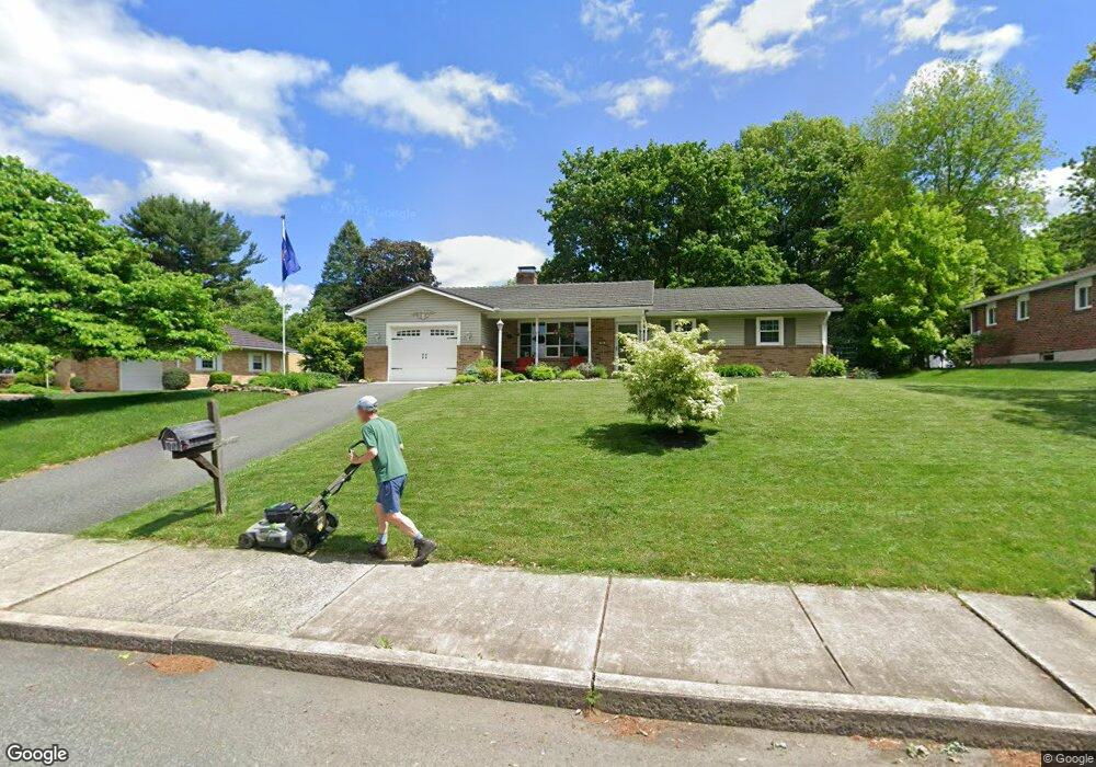
99 Maple St Macungie, PA 18062
Estimated Value: $338,000 - $379,000
3
Beds
2
Baths
1,667
Sq Ft
$217/Sq Ft
Est. Value
About This Home
This home is located at 99 Maple St, Macungie, PA 18062 and is currently estimated at $361,694, approximately $216 per square foot. 99 Maple St is a home located in Lehigh County with nearby schools including Macungie Elementary School, Eyer Middle School, and Emmaus High School.
Ownership History
Date
Name
Owned For
Owner Type
Purchase Details
Closed on
Jul 16, 2018
Sold by
Young Donald S and Young Debra R
Bought by
Young William J
Current Estimated Value
Home Financials for this Owner
Home Financials are based on the most recent Mortgage that was taken out on this home.
Original Mortgage
$125,600
Outstanding Balance
$75,997
Interest Rate
4.5%
Mortgage Type
New Conventional
Estimated Equity
$285,697
Purchase Details
Closed on
Jun 22, 2017
Sold by
Ivory Joel and Ivory Rebecca
Bought by
Young Donald S and Young Debra R
Create a Home Valuation Report for This Property
The Home Valuation Report is an in-depth analysis detailing your home's value as well as a comparison with similar homes in the area
Home Values in the Area
Average Home Value in this Area
Purchase History
| Date | Buyer | Sale Price | Title Company |
|---|---|---|---|
| Young William J | -- | Home Settlement Services | |
| Young Donald S | -- | None Available |
Source: Public Records
Mortgage History
| Date | Status | Borrower | Loan Amount |
|---|---|---|---|
| Open | Young William J | $125,600 |
Source: Public Records
Tax History
| Year | Tax Paid | Tax Assessment Tax Assessment Total Assessment is a certain percentage of the fair market value that is determined by local assessors to be the total taxable value of land and additions on the property. | Land | Improvement |
|---|---|---|---|---|
| 2025 | $5,414 | $186,500 | $45,000 | $141,500 |
| 2024 | $5,259 | $186,500 | $45,000 | $141,500 |
| 2023 | $5,167 | $186,500 | $45,000 | $141,500 |
| 2022 | $5,060 | $186,500 | $141,500 | $45,000 |
| 2021 | $4,967 | $186,500 | $45,000 | $141,500 |
| 2020 | $4,926 | $186,500 | $45,000 | $141,500 |
| 2019 | $4,900 | $186,500 | $45,000 | $141,500 |
| 2018 | $4,798 | $186,500 | $45,000 | $141,500 |
| 2017 | $4,632 | $186,500 | $45,000 | $141,500 |
| 2016 | -- | $186,500 | $45,000 | $141,500 |
| 2015 | -- | $186,500 | $45,000 | $141,500 |
| 2014 | -- | $186,500 | $45,000 | $141,500 |
Source: Public Records
Map
Nearby Homes
- 76 S Buttonwood St
- 830 E Main St
- 725 E Main St
- 52 Willow St
- 167 Aspen Ln
- 6405 Robin Rd
- 0 Mountain Lot 1
- 124 Lindfield Cir Unit KK124
- 3421 Sherman Dr
- 5288 Brocton Ct
- 249 Ridings Cir Unit K249
- 4759 Sheep Rock Rd
- 0 Clauss Hunt Knight Dr Unit 10 Units
- 5314 Beaumont Ln
- 324 Abby Rd
- 324 Abby Rd Unit Lot 13
- 353 Abby Rd Unit Lot 40
- 353 Abby Rd
- 4835 Shimerville Rd
- 2920 Lifford Ln
- 107 Maple St
- 113 Maple St
- 92 S Fairview St
- 115 Maple St
- 117 Maple St
- 94 S Fairview St
- 84 S Fairview St
- 75 Maple St
- 90 Maple St
- 104 S Fairview St
- 121 Maple St
- 76 Maple St
- 114 S Fairview St
- 87 S Chestnut St
- 93 S Fairview St
- 67 Maple St
- 103 S Fairview St
- 124 S Fairview St
- 64 S Fairview St
- 83 S Fairview St
Your Personal Tour Guide
Ask me questions while you tour the home.