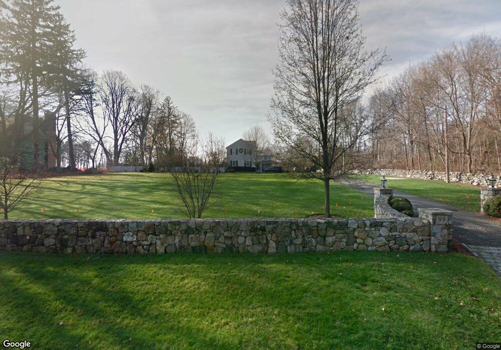
99 Marshall Ridge Rd New Canaan, CT 06840
Estimated Value: $4,111,828 - $4,706,000
6
Beds
8
Baths
6,912
Sq Ft
$641/Sq Ft
Est. Value
About This Home
This home is located at 99 Marshall Ridge Rd, New Canaan, CT 06840 and is currently estimated at $4,428,957, approximately $640 per square foot. 99 Marshall Ridge Rd is a home located in Fairfield County with nearby schools including West Elementary School, Saxe Middle School, and New Canaan High School.
Ownership History
Date
Name
Owned For
Owner Type
Purchase Details
Closed on
Oct 16, 2009
Sold by
Haney Byron Joseph and Haney Linda A
Bought by
Lowe Kaitlyn L and Lowe Robert F
Current Estimated Value
Home Financials for this Owner
Home Financials are based on the most recent Mortgage that was taken out on this home.
Original Mortgage
$1,200,000
Interest Rate
5.5%
Purchase Details
Closed on
Jul 31, 2002
Sold by
Mauk Dallas Paul and Mauk Anne S
Bought by
Haney Byron Joseph and Haney Linda A
Home Financials for this Owner
Home Financials are based on the most recent Mortgage that was taken out on this home.
Original Mortgage
$1,100,000
Interest Rate
4.75%
Purchase Details
Closed on
Oct 25, 1993
Sold by
Howland David and Howland Nancy
Bought by
Mauk Dallas Paul and Mauk Anne
Create a Home Valuation Report for This Property
The Home Valuation Report is an in-depth analysis detailing your home's value as well as a comparison with similar homes in the area
Home Values in the Area
Average Home Value in this Area
Purchase History
| Date | Buyer | Sale Price | Title Company |
|---|---|---|---|
| Lowe Kaitlyn L | $1,900,000 | -- | |
| Haney Byron Joseph | $1,600,000 | -- | |
| Mauk Dallas Paul | $540,000 | -- |
Source: Public Records
Mortgage History
| Date | Status | Borrower | Loan Amount |
|---|---|---|---|
| Open | Mauk Dallas Paul | $2,500,000 | |
| Closed | Mauk Dallas Paul | $950,000 | |
| Closed | Mauk Dallas Paul | $1,200,000 | |
| Previous Owner | Mauk Dallas Paul | $1,100,000 |
Source: Public Records
Tax History Compared to Growth
Tax History
| Year | Tax Paid | Tax Assessment Tax Assessment Total Assessment is a certain percentage of the fair market value that is determined by local assessors to be the total taxable value of land and additions on the property. | Land | Improvement |
|---|---|---|---|---|
| 2025 | $38,379 | $2,299,500 | $760,550 | $1,538,950 |
| 2024 | $37,114 | $2,299,500 | $760,550 | $1,538,950 |
| 2023 | $35,162 | $1,856,470 | $701,540 | $1,154,930 |
| 2022 | $34,103 | $1,856,470 | $701,540 | $1,154,930 |
| 2021 | $33,713 | $1,856,470 | $701,540 | $1,154,930 |
| 2020 | $33,713 | $1,856,470 | $701,540 | $1,154,930 |
| 2019 | $32,602 | $1,787,380 | $701,540 | $1,085,840 |
| 2018 | $22,266 | $1,312,850 | $649,530 | $663,320 |
| 2017 | $20,624 | $1,237,180 | $649,530 | $587,650 |
| 2016 | $20,178 | $1,237,180 | $649,530 | $587,650 |
| 2015 | $20,488 | $1,237,180 | $649,530 | $587,650 |
| 2014 | $19,226 | $1,237,180 | $649,530 | $587,650 |
Source: Public Records
Map
Nearby Homes
- 317 Park St
- 197 Park St Unit 13
- 50 Harrison Ave
- 25 Gower Rd
- 354 South Ave
- 202 Weed St
- 15 Burtis Ave Unit Townhome D
- 15 Burtis Ave Unit West Penthouse B
- 15 Burtis Ave Unit East Penthouse C
- 15 Burtis Ave Unit Townhome A
- 15 Burtis Ave Unit East Plaza 203
- 470 Frogtown Rd Unit Lot 1
- 31 Selleck Place
- 42 Forest St Unit A
- 60 East Ave
- 64 East Ave
- 180 Summer St
- 12 Lincoln Dr
- 100 Spring Water Ln
- 44 Putnam Rd
- 117 Marshall Ridge Rd
- 201 Marshall Ridge Rd
- 539 Weed St
- 211 Marshall Ridge Rd
- 73 Marshall Ridge Rd
- 191 Marshall Ridge Rd
- 131 Marshall Ridge Rd
- 116 Marshall Ridge Rd
- 100 Marshall Ridge Rd
- 90 Marshall Ridge Rd
- 533 Weed St
- 210 Marshall Ridge Rd
- 553 Weed St
- 134 Marshall Ridge Rd
- 128 Marshall Ridge Rd
- 57 Marshall Ridge Rd
- 519 Weed St
- 569 Weed St
- 94 Marshall Ridge Rd
- 144 Marshall Ridge Rd