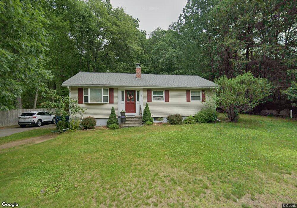
99 N Main St North Easton, MA 02356
Estimated Value: $589,000 - $702,000
3
Beds
2
Baths
1,310
Sq Ft
$498/Sq Ft
Est. Value
About This Home
This home is located at 99 N Main St, North Easton, MA 02356 and is currently estimated at $651,798, approximately $497 per square foot. 99 N Main St is a home located in Bristol County with nearby schools including Easton Middle School.
Ownership History
Date
Name
Owned For
Owner Type
Purchase Details
Closed on
Feb 25, 2002
Sold by
99 N Main St Rt
Bought by
Connolly Sean W and Connolly Leeann
Current Estimated Value
Home Financials for this Owner
Home Financials are based on the most recent Mortgage that was taken out on this home.
Original Mortgage
$255,000
Interest Rate
7.08%
Mortgage Type
Purchase Money Mortgage
Purchase Details
Closed on
Oct 29, 2001
Sold by
Tawfik Mohamed A and Tawfik Elizabeth A
Bought by
99 N Main Street Rt
Purchase Details
Closed on
Sep 1, 1989
Sold by
Rollins Royal H
Bought by
Tawfik Mohamed A
Create a Home Valuation Report for This Property
The Home Valuation Report is an in-depth analysis detailing your home's value as well as a comparison with similar homes in the area
Home Values in the Area
Average Home Value in this Area
Purchase History
| Date | Buyer | Sale Price | Title Company |
|---|---|---|---|
| Connolly Sean W | $268,500 | -- | |
| Connolly Sean W | $268,500 | -- | |
| 99 N Main Street Rt | $142,000 | -- | |
| 99 N Main Street Rt | $142,000 | -- | |
| Tawfik Mohamed A | $125,000 | -- |
Source: Public Records
Mortgage History
| Date | Status | Borrower | Loan Amount |
|---|---|---|---|
| Open | Tawfik Mohamed A | $220,000 | |
| Closed | Tawfik Mohamed A | $254,000 | |
| Closed | Tawfik Mohamed A | $255,000 |
Source: Public Records
Tax History Compared to Growth
Tax History
| Year | Tax Paid | Tax Assessment Tax Assessment Total Assessment is a certain percentage of the fair market value that is determined by local assessors to be the total taxable value of land and additions on the property. | Land | Improvement |
|---|---|---|---|---|
| 2025 | $6,722 | $538,600 | $346,600 | $192,000 |
| 2024 | $6,161 | $461,500 | $268,100 | $193,400 |
| 2023 | $5,846 | $400,700 | $268,100 | $132,600 |
| 2022 | $5,674 | $368,700 | $241,000 | $127,700 |
| 2021 | $5,519 | $356,500 | $228,800 | $127,700 |
| 2020 | $5,340 | $347,200 | $219,500 | $127,700 |
| 2019 | $5,201 | $325,900 | $187,800 | $138,100 |
| 2018 | $4,878 | $300,900 | $177,700 | $123,200 |
| 2017 | $4,834 | $298,000 | $177,700 | $120,300 |
| 2016 | $4,362 | $269,400 | $159,300 | $110,100 |
| 2015 | $4,510 | $268,800 | $161,500 | $107,300 |
| 2014 | $4,252 | $255,400 | $146,700 | $108,700 |
Source: Public Records
Map
Nearby Homes
- 175 N Main St
- 12 Holmes St
- 93 Palisades Cir
- 15 King Ave
- 8 Hobart Way
- 11 Olde Stable Ln
- 1600 West St
- 1 Whittier Ln Unit 1
- 18 Prudence Crandall Ln Unit 18
- 224 Main St
- Lot 8 Cooper Ln
- 225 Main St
- 67 Center St
- 56 Williams St
- 14 Marshall Rd
- 4 Eagle Rock Rd
- 334-336 Main St
- 86 Union St
- 110 Union St
- 32 Spooner St
- 100 N Main St
- 97 N Main St
- 97 N Main St Unit 4
- 97 N Main St Unit 5
- 97 N Main St Unit 3
- 96 N Main St
- 3 Partridge Way
- 95 N Main St
- 129 N Main St
- 3 Vineyard Place
- 2 Partridge Way
- 135 N Main St
- 87 N Main St
- 7 Vineyard Place
- 130 N Main St
- 94 N Main St
- 1 Partridge Way
- 83 N Main St
- 4 Harvey Ln
- 4 Harvey Ln Unit 1