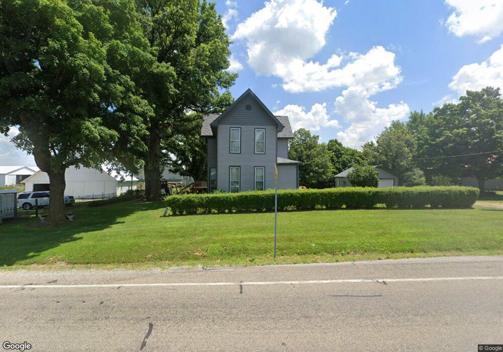
99 N State Road 29 Michigantown, IN 46057
Estimated Value: $191,000 - $312,000
5
Beds
1
Bath
2,718
Sq Ft
$91/Sq Ft
Est. Value
About This Home
This home is located at 99 N State Road 29, Michigantown, IN 46057 and is currently estimated at $248,510, approximately $91 per square foot. 99 N State Road 29 is a home located in Clinton County with nearby schools including Clinton Central Elementary School and Clinton Central Junior/Senior High School.
Ownership History
Date
Name
Owned For
Owner Type
Purchase Details
Closed on
Jul 2, 2014
Sold by
Mulkey Mary L and Hodgin Lisa R
Bought by
Pelling Stanley E and Pelling Janet L
Current Estimated Value
Home Financials for this Owner
Home Financials are based on the most recent Mortgage that was taken out on this home.
Original Mortgage
$584,000
Outstanding Balance
$317,284
Interest Rate
4.12%
Mortgage Type
Farmers Home Administration
Estimated Equity
-$68,774
Create a Home Valuation Report for This Property
The Home Valuation Report is an in-depth analysis detailing your home's value as well as a comparison with similar homes in the area
Home Values in the Area
Average Home Value in this Area
Purchase History
| Date | Buyer | Sale Price | Title Company |
|---|---|---|---|
| Pelling Stanley E | -- | None Available |
Source: Public Records
Mortgage History
| Date | Status | Borrower | Loan Amount |
|---|---|---|---|
| Open | Pelling Stanley E | $584,000 |
Source: Public Records
Tax History Compared to Growth
Tax History
| Year | Tax Paid | Tax Assessment Tax Assessment Total Assessment is a certain percentage of the fair market value that is determined by local assessors to be the total taxable value of land and additions on the property. | Land | Improvement |
|---|---|---|---|---|
| 2024 | $1,285 | $156,600 | $3,000 | $153,600 |
| 2023 | $1,278 | $156,600 | $3,000 | $153,600 |
| 2022 | $879 | $126,200 | $3,000 | $123,200 |
| 2021 | $775 | $115,200 | $3,000 | $112,200 |
| 2020 | $791 | $115,200 | $3,000 | $112,200 |
| 2019 | $799 | $121,600 | $3,000 | $118,600 |
| 2018 | $720 | $115,200 | $3,000 | $112,200 |
| 2017 | $698 | $114,500 | $3,000 | $111,500 |
| 2016 | $540 | $124,200 | $3,000 | $121,200 |
| 2014 | $478 | $129,900 | $4,600 | $125,300 |
Source: Public Records
Map
Nearby Homes
- 5184 E County Road 100 N
- 102 Main St
- 5371 E 500 Rd N
- 404 E 3rd St
- 508 Ohio St
- 1819 N County Road 830 E
- 8994 E Hillis St
- 2775 E State Road 28
- 2696 E Michigantown Rd
- 845 Makenna Cir
- 2174 Washington Ave
- 759 Sunrise Dr Unit 111
- 837 Sunrise Dr Unit 119
- 832 Sunrise Dr Unit 118
- 829 Sunrise Dr Unit 117
- 806 Sunrise Dr Unit 112
- 813 Sunrise Dr Unit 113
- 845 Sunrise Dr Unit 121
- 821 Sunrise Dr Unit 115
- 851 Sunrise Dr Unit 123
- 92 N State Road 29
- 59 N State Road 29
- 80 N State Road 29
- 58 N State Road 29
- 43 N State Road 29
- 29 Indiana 29
- 5978 E Saint Mary St
- 23 N State Road 29
- 5954 E Saint Mary St
- 22 N State Road 29
- 43 N Illinois St
- 6050 E Boyleston 1st St
- 156 N State Road 29
- 23 N Illinois St
- 5954 E Boyleston 1st St
- 19 S State Road 29
- 25 S State Road 29
- 10 N Illinois St
- 24 S State Road 29
- 24 Indiana 29