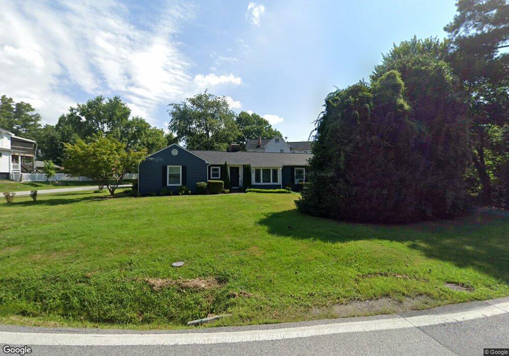
99 S Rolling Rd Catonsville, MD 21228
Estimated Value: $478,000 - $563,000
--
Bed
2
Baths
1,610
Sq Ft
$333/Sq Ft
Est. Value
About This Home
This home is located at 99 S Rolling Rd, Catonsville, MD 21228 and is currently estimated at $536,792, approximately $333 per square foot. 99 S Rolling Rd is a home located in Baltimore County with nearby schools including Hillcrest Elementary School, Catonsville Middle School, and Catonsville High School.
Ownership History
Date
Name
Owned For
Owner Type
Purchase Details
Closed on
May 23, 2006
Sold by
Thomas Eugene F
Bought by
Thomas William R and Thomas Eileen
Current Estimated Value
Purchase Details
Closed on
Mar 16, 2006
Sold by
Thomas Eugene F
Bought by
Thomas William R and Thomas Eileen
Purchase Details
Closed on
Jun 7, 2001
Sold by
Stewart A Augustus
Bought by
Thomas Eugene F and Thomas Eleanora J
Purchase Details
Closed on
Nov 4, 1954
Sold by
Jones James Edward
Bought by
Stewart A Augustus
Create a Home Valuation Report for This Property
The Home Valuation Report is an in-depth analysis detailing your home's value as well as a comparison with similar homes in the area
Home Values in the Area
Average Home Value in this Area
Purchase History
| Date | Buyer | Sale Price | Title Company |
|---|---|---|---|
| Thomas William R | $115,400 | -- | |
| Thomas William R | $115,400 | -- | |
| Thomas Eugene F | $200,000 | -- | |
| Stewart A Augustus | $5,000 | -- |
Source: Public Records
Tax History Compared to Growth
Tax History
| Year | Tax Paid | Tax Assessment Tax Assessment Total Assessment is a certain percentage of the fair market value that is determined by local assessors to be the total taxable value of land and additions on the property. | Land | Improvement |
|---|---|---|---|---|
| 2025 | $4,898 | $391,000 | -- | -- |
| 2024 | $4,898 | $356,100 | $150,400 | $205,700 |
| 2023 | $2,482 | $342,233 | $0 | $0 |
| 2022 | $4,897 | $328,367 | $0 | $0 |
| 2021 | $4,582 | $314,500 | $150,400 | $164,100 |
| 2020 | $4,582 | $307,600 | $0 | $0 |
| 2019 | $4,616 | $300,700 | $0 | $0 |
| 2018 | $4,681 | $293,800 | $120,400 | $173,400 |
| 2017 | $4,217 | $290,167 | $0 | $0 |
| 2016 | $4,194 | $286,533 | $0 | $0 |
| 2015 | $4,194 | $282,900 | $0 | $0 |
| 2014 | $4,194 | $282,900 | $0 | $0 |
Source: Public Records
Map
Nearby Homes
- 2 N Beechwood Ave
- 2 Park Dr
- 8 Seminole Ave
- 206 S Rolling Rd
- 17 N Beaumont Ave
- 1326 Brook Rd
- 16 Locust Dr
- 112 Melvin Ave
- 42 Winters Ln
- 38A Winters Ln
- 0 Melvin Ave
- 1900 Lismore Ln
- 1902 Lismore Ln
- 201 Suter Rd
- 1910 Rollingwood Rd
- 1910 Clifden Rd
- 1218 Mccurley Ave
- 1212 Mccurley Ave
- 133 Wesley Ave
- 127 Bloomsbury Ave
- 1407 Chelton Ave
- 5 S Rolling Rd
- 101 S Rolling Rd
- 3 S Rolling Rd
- 103 S Rolling Rd
- 8 S Rolling Rd
- 8 S Beechwood Ave
- 100 S Rolling Rd
- 105 S Rolling Rd
- 10 S Beechwood Ave
- 6 S Beechwood Ave
- 1 S Rolling Rd
- 12 S Beechwood Ave
- 100 Hilton Ave
- 4 S Beechwood Ave
- 4 S Rolling Rd
- 102 S Rolling Rd
- 107 S Rolling Rd
- 14 S Beechwood Ave
- 2 S Rolling Rd