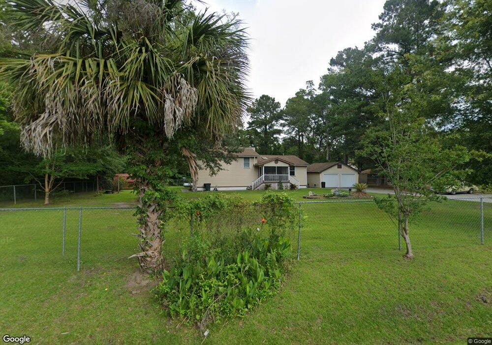
99 Spann Cir Seabrook, SC 29940
Estimated Value: $478,780 - $741,000
--
Bed
--
Bath
2,395
Sq Ft
$244/Sq Ft
Est. Value
About This Home
This home is located at 99 Spann Cir, Seabrook, SC 29940 and is currently estimated at $585,195, approximately $244 per square foot. 99 Spann Cir is a home located in Beaufort County with nearby schools including Whale Branch Elementary School, Whale Branch Middle School, and Whale Branch Early College High School.
Ownership History
Date
Name
Owned For
Owner Type
Purchase Details
Closed on
May 24, 2012
Sold by
Simmons Joretta
Bought by
Simmons Joretta and Morris Janay
Current Estimated Value
Purchase Details
Closed on
May 4, 2012
Sold by
Simmons Josepine
Bought by
Simmons Joretta
Purchase Details
Closed on
May 1, 2012
Sold by
Anthony Richardine
Bought by
Simmons Joretta
Purchase Details
Closed on
Apr 24, 2012
Sold by
Redd Vickie
Bought by
Simmons Joretta
Purchase Details
Closed on
Apr 19, 2012
Sold by
Simmons Ruthie
Bought by
Simmons Joretta
Purchase Details
Closed on
Apr 17, 2012
Sold by
Simmons Geraldine
Bought by
Simmons Joretta
Purchase Details
Closed on
Apr 11, 2012
Sold by
Simmons Connie Deborah
Bought by
Simmons Josephine
Purchase Details
Closed on
Feb 7, 2012
Sold by
Estate Of Theodore Simmons
Bought by
Simmons Joretta
Create a Home Valuation Report for This Property
The Home Valuation Report is an in-depth analysis detailing your home's value as well as a comparison with similar homes in the area
Home Values in the Area
Average Home Value in this Area
Purchase History
| Date | Buyer | Sale Price | Title Company |
|---|---|---|---|
| Simmons Joretta | -- | -- | |
| Simmons Joretta | -- | -- | |
| Simmons Joretta | -- | -- | |
| Simmons Joretta | -- | -- | |
| Simmons Joretta | -- | -- | |
| Simmons Joretta | -- | -- | |
| Simmons Josephine | -- | -- | |
| Simmons Joreita | -- | -- | |
| Simmons Joretta | -- | -- |
Source: Public Records
Tax History Compared to Growth
Tax History
| Year | Tax Paid | Tax Assessment Tax Assessment Total Assessment is a certain percentage of the fair market value that is determined by local assessors to be the total taxable value of land and additions on the property. | Land | Improvement |
|---|---|---|---|---|
| 2024 | $1,464 | $15,880 | $2,392 | $13,488 |
| 2023 | $1,464 | $15,880 | $2,392 | $13,488 |
| 2022 | $1,336 | $9,228 | $1,936 | $7,292 |
| 2021 | $2,437 | $9,228 | $1,936 | $7,292 |
| 2020 | $1,322 | $9,228 | $1,936 | $7,292 |
| 2019 | $1,155 | $9,228 | $1,936 | $7,292 |
| 2018 | $1,105 | $9,230 | $0 | $0 |
| 2017 | $1,178 | $8,200 | $0 | $0 |
| 2016 | $1,145 | $7,510 | $0 | $0 |
| 2014 | $877 | $7,510 | $0 | $0 |
Source: Public Records
Map
Nearby Homes
- 26 Swamprose Ln
- 177 Spann Cir
- 181 Spann Cir
- 29 State Road S-7-769
- 972 Kinloch Rd
- 39 Middlefield Cir
- 250 Wimbee Landing Rd
- 10 Bosquet Marais
- 18 N Breeze Island
- 18 N Breeze Island
- 27 Delaney Cir
- 127 Teal Bluff Blvd
- 117 Teal Bluff Blvd
- 20 McCalley Creek Ln
- 20 Crystal St
- 20 Garrett Ln
- 16 McCalley Creek Ln
- 10 Garrett Ln
- 246 Stuart Point Rd
- 108 Stuart Point Rd