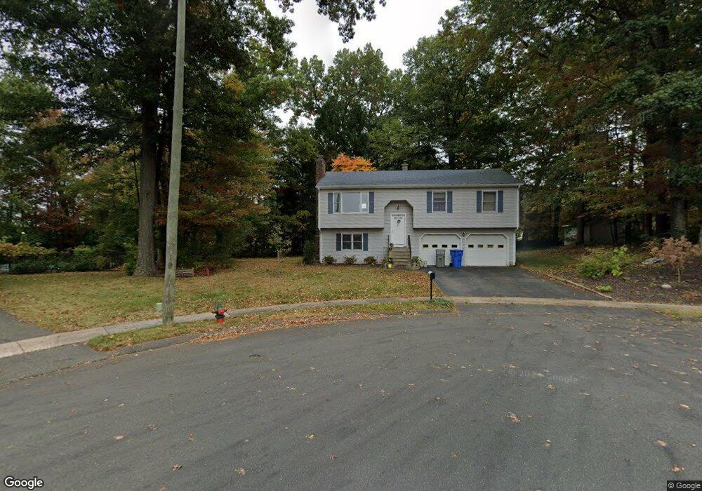
99 Sterling Way Bristol, CT 06010
Forestville NeighborhoodEstimated Value: $402,000 - $431,000
3
Beds
3
Baths
1,180
Sq Ft
$355/Sq Ft
Est. Value
About This Home
This home is located at 99 Sterling Way, Bristol, CT 06010 and is currently estimated at $419,470, approximately $355 per square foot. 99 Sterling Way is a home located in Hartford County with nearby schools including Bristol Central High School, St Matthew School, and St. Joseph School.
Ownership History
Date
Name
Owned For
Owner Type
Purchase Details
Closed on
Jul 30, 2001
Sold by
Lundy Kirt C and Lundy Diane Y
Bought by
Devaney Francis M and Devaney Mary A
Current Estimated Value
Home Financials for this Owner
Home Financials are based on the most recent Mortgage that was taken out on this home.
Original Mortgage
$167,000
Outstanding Balance
$65,285
Interest Rate
7.18%
Estimated Equity
$354,185
Purchase Details
Closed on
Oct 28, 1992
Sold by
Cook Eric J
Bought by
Lundy Kirt C and Lundy Diane Y
Create a Home Valuation Report for This Property
The Home Valuation Report is an in-depth analysis detailing your home's value as well as a comparison with similar homes in the area
Home Values in the Area
Average Home Value in this Area
Purchase History
| Date | Buyer | Sale Price | Title Company |
|---|---|---|---|
| Devaney Francis M | $177,000 | -- | |
| Lundy Kirt C | $160,000 | -- |
Source: Public Records
Mortgage History
| Date | Status | Borrower | Loan Amount |
|---|---|---|---|
| Open | Lundy Kirt C | $75,000 | |
| Closed | Lundy Kirt C | $42,000 | |
| Closed | Lundy Kirt C | $12,000 | |
| Open | Lundy Kirt C | $167,000 |
Source: Public Records
Tax History Compared to Growth
Tax History
| Year | Tax Paid | Tax Assessment Tax Assessment Total Assessment is a certain percentage of the fair market value that is determined by local assessors to be the total taxable value of land and additions on the property. | Land | Improvement |
|---|---|---|---|---|
| 2025 | $7,121 | $210,980 | $68,320 | $142,660 |
| 2024 | $6,720 | $210,980 | $68,320 | $142,660 |
| 2023 | $6,403 | $210,980 | $68,320 | $142,660 |
| 2022 | $6,056 | $157,920 | $53,410 | $104,510 |
| 2021 | $6,056 | $157,920 | $53,410 | $104,510 |
| 2020 | $6,056 | $157,920 | $53,410 | $104,510 |
| 2019 | $6,009 | $157,920 | $53,410 | $104,510 |
| 2018 | $5,824 | $157,920 | $53,410 | $104,510 |
| 2017 | $5,221 | $144,900 | $56,490 | $88,410 |
| 2016 | $5,221 | $144,900 | $56,490 | $88,410 |
| 2015 | $5,015 | $144,900 | $56,490 | $88,410 |
| 2014 | $5,015 | $144,900 | $56,490 | $88,410 |
Source: Public Records
Map
Nearby Homes
- 84 Dino Rd
- 683 Pine St
- 63 Kenney St
- 143 Redstone St
- 279 Redstone Hill Rd Unit 75
- 429 Redstone Hill Rd
- 430 Emmett St Unit L
- 426 Emmett St Unit N
- 426 Emmett St Unit L
- 424 Emmett St Unit K
- 371 Emmett St Unit 6
- 371 Emmett St Unit 48
- 25 Leon Rd
- 158 E Main St
- 370 Emmett St Unit 5-5
- 370 Emmett St Unit 5-2
- 370 Emmett St Unit 5-1
- 370 Emmett St Unit 5-4
- 410 Emmett St Unit 76
- 245 W Main St