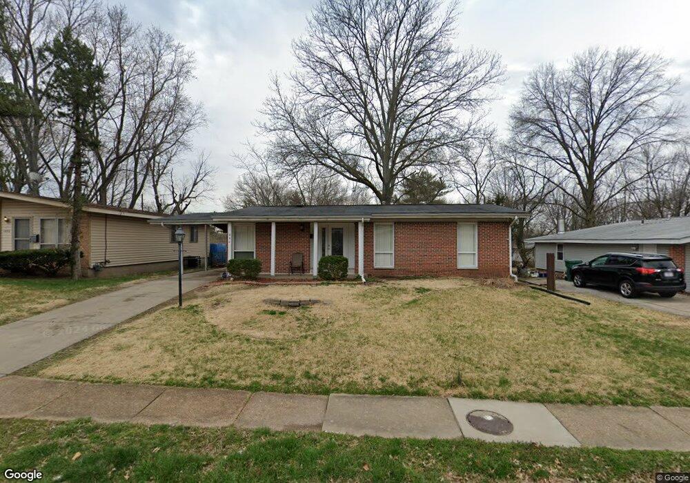
990 Saint Anthony Ln Florissant, MO 63033
Estimated Value: $137,000 - $179,000
3
Beds
2
Baths
1,078
Sq Ft
$149/Sq Ft
Est. Value
About This Home
This home is located at 990 Saint Anthony Ln, Florissant, MO 63033 and is currently estimated at $160,519, approximately $148 per square foot. 990 Saint Anthony Ln is a home located in St. Louis County with nearby schools including Parker Road Elementary School, Cross Keys Middle School, and McCluer North High School.
Ownership History
Date
Name
Owned For
Owner Type
Purchase Details
Closed on
Dec 16, 2011
Sold by
Moazzami Lily
Bought by
Dana Point Investments Llc
Current Estimated Value
Purchase Details
Closed on
Jul 29, 2011
Sold by
Fannie Mae
Bought by
Moazzami Lily
Purchase Details
Closed on
May 31, 2011
Sold by
Tinsley Tawanda R and Tinsley Victor J
Bought by
Federal National Mortgage Association
Purchase Details
Closed on
Aug 5, 2005
Sold by
Mitchell Karola and Mitchell Fredrick Robert
Bought by
Tinsley Victor J and Tinsley Tawanda R
Home Financials for this Owner
Home Financials are based on the most recent Mortgage that was taken out on this home.
Original Mortgage
$92,000
Interest Rate
5.62%
Mortgage Type
Fannie Mae Freddie Mac
Create a Home Valuation Report for This Property
The Home Valuation Report is an in-depth analysis detailing your home's value as well as a comparison with similar homes in the area
Home Values in the Area
Average Home Value in this Area
Purchase History
| Date | Buyer | Sale Price | Title Company |
|---|---|---|---|
| Dana Point Investments Llc | -- | None Available | |
| Moazzami Lily | $38,000 | None Available | |
| Federal National Mortgage Association | $104,782 | None Available | |
| Tinsley Victor J | $115,000 | -- |
Source: Public Records
Mortgage History
| Date | Status | Borrower | Loan Amount |
|---|---|---|---|
| Previous Owner | Tinsley Victor J | $92,000 |
Source: Public Records
Tax History Compared to Growth
Tax History
| Year | Tax Paid | Tax Assessment Tax Assessment Total Assessment is a certain percentage of the fair market value that is determined by local assessors to be the total taxable value of land and additions on the property. | Land | Improvement |
|---|---|---|---|---|
| 2025 | $1,925 | $28,430 | $6,330 | $22,100 |
| 2024 | $1,925 | $24,760 | $4,750 | $20,010 |
| 2023 | $1,918 | $24,760 | $4,750 | $20,010 |
| 2022 | $1,662 | $18,810 | $4,750 | $14,060 |
| 2021 | $1,634 | $21,030 | $4,750 | $16,280 |
| 2020 | $1,618 | $17,560 | $3,650 | $13,910 |
| 2019 | $1,586 | $17,560 | $3,650 | $13,910 |
| 2018 | $1,282 | $12,630 | $2,070 | $10,560 |
| 2017 | $1,275 | $12,630 | $2,070 | $10,560 |
| 2016 | $1,299 | $12,540 | $2,070 | $10,470 |
| 2015 | $1,307 | $12,540 | $2,070 | $10,470 |
| 2014 | $1,559 | $15,510 | $3,650 | $11,860 |
Source: Public Records
Map
Nearby Homes
- 13 Bayberry Ln
- 265 Waterford Dr
- 12 Country Ln
- 2320 Allen Dr
- 785 Bobbins Ln
- 805 Derhake Rd
- 750 Robinwood Dr
- 2505 Saint Catherine St
- 2240 Brook Dr
- 190 Coteau Ln
- 2340 Saint Catherine St
- 130 Dauphin Ln
- 2 Carson Ct
- 505 Ridge Dr
- 105 Capri Dr
- 675 Pimlico Dr
- 3140 Saint Catherine St
- 765 Pimlico Dr
- 2020 Washington St Unit 707
- 2700 Suffolk Place
- 1000 Saint Anthony Ln
- 980 Saint Anthony Ln
- 970 Saint Anthony Ln
- 1020 Saint Anthony Ln
- 995 Cheyenne Dr
- 1005 Cheyenne Dr
- 985 Cheyenne Dr
- 995 Saint Anthony Ln
- 975 Cheyenne Dr
- 1005 Saint Anthony Ln
- 1030 Saint Anthony Ln
- 985 Saint Anthony Ln
- 960 Saint Anthony Ln
- 250 Countryside Dr
- 1015 Saint Anthony Ln
- 1025 Cheyenne Dr
- 975 Saint Anthony Ln
- 1040 Saint Anthony Ln
- 965 Cheyenne Dr
- 1025 Saint Anthony Ln