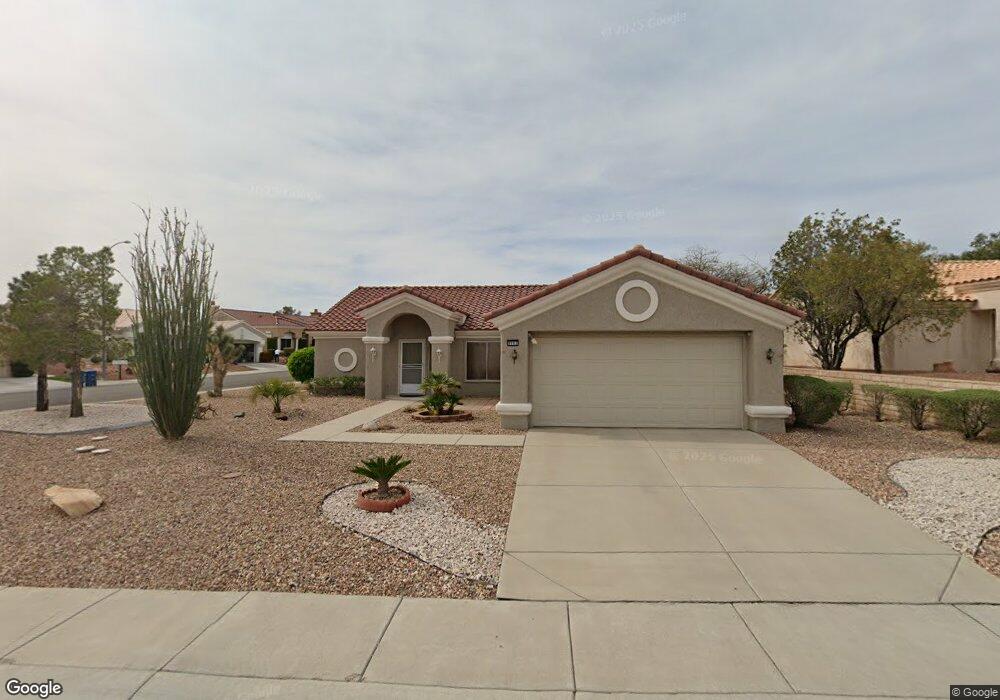
9901 Netherton Dr Las Vegas, NV 89134
Sun City Summerlin NeighborhoodEstimated Value: $432,000 - $490,000
2
Beds
2
Baths
1,360
Sq Ft
$330/Sq Ft
Est. Value
About This Home
This home is located at 9901 Netherton Dr, Las Vegas, NV 89134 and is currently estimated at $448,955, approximately $330 per square foot. 9901 Netherton Dr is a home located in Clark County with nearby schools including William Lummis Elementary School, Ernest Becker Middle School, and Palo Verde High School.
Ownership History
Date
Name
Owned For
Owner Type
Purchase Details
Closed on
Sep 9, 2003
Sold by
Shrout Thomas A and Shrout Jacqueline S
Bought by
Seibert William P and Klinger Seibert Bonnie
Current Estimated Value
Purchase Details
Closed on
May 13, 2002
Sold by
Shrout Thomas and Shrout Jacqueline
Bought by
Shrout Thomas A and Shrout Jacqueline S
Purchase Details
Closed on
Sep 23, 1996
Sold by
Dress Logan B
Bought by
Shrout Thomas and Shrout Jacqueline
Create a Home Valuation Report for This Property
The Home Valuation Report is an in-depth analysis detailing your home's value as well as a comparison with similar homes in the area
Home Values in the Area
Average Home Value in this Area
Purchase History
| Date | Buyer | Sale Price | Title Company |
|---|---|---|---|
| Seibert William P | $179,950 | Nevada Title Company | |
| Shrout Thomas A | -- | -- | |
| Shrout Thomas | $142,000 | United Title |
Source: Public Records
Tax History Compared to Growth
Tax History
| Year | Tax Paid | Tax Assessment Tax Assessment Total Assessment is a certain percentage of the fair market value that is determined by local assessors to be the total taxable value of land and additions on the property. | Land | Improvement |
|---|---|---|---|---|
| 2025 | $2,120 | $98,198 | $43,400 | $54,798 |
| 2024 | $2,120 | $98,198 | $43,400 | $54,798 |
| 2023 | $2,120 | $87,397 | $35,000 | $52,397 |
| 2022 | $2,059 | $83,147 | $35,000 | $48,147 |
| 2021 | $1,999 | $74,841 | $28,700 | $46,141 |
| 2020 | $1,938 | $74,500 | $28,700 | $45,800 |
| 2019 | $1,881 | $69,378 | $24,150 | $45,228 |
| 2018 | $1,826 | $64,227 | $20,300 | $43,927 |
| 2017 | $2,064 | $62,115 | $18,200 | $43,915 |
| 2016 | $1,730 | $60,290 | $16,100 | $44,190 |
| 2015 | $1,726 | $57,036 | $13,300 | $43,736 |
| 2014 | $1,676 | $53,526 | $11,550 | $41,976 |
Source: Public Records
Map
Nearby Homes
- 10009 Netherton Dr
- 2616 High Range Dr
- 10036 Keysborough Dr
- 2652 Youngdale Dr
- 10025 Netherton Dr
- 2816 High Range Dr
- 2601 Lotus Hill Dr
- 2820 High Range Dr
- 2712 Lotus Hill Dr
- 10017 Bundella Dr Unit 34
- 9948 Bundella Dr
- 2725 Byron Dr
- 2801 Byron Dr
- 2540 Youngdale Dr
- 9908 Bundella Dr
- 10012 Bundella Dr
- 2548 Tumble Brook Dr
- 9929 Hemet Dr
- 10144 Hunter Springs Dr
- 10009 Hemet Dr
- 9909 Netherton Dr
- 10000 Keysborough Dr
- 9913 Netherton Dr
- 2708 High Range Dr
- 10004 Keysborough Dr
- 9904 Netherton Dr
- 2704 High Range Dr
- 9900 Netherton Dr
- 9908 Netherton Dr
- 2712 High Range Dr Unit 35
- 2700 High Range Dr
- 10008 Keysborough Dr
- 9917 Netherton Dr
- 9912 Netherton Dr
- 2716 High Range Dr
- 2636 High Range Dr
- 9909 Woodhouse Dr
- 9913 Woodhouse Dr
- 10001 Keysborough Dr
- 10012 Keysborough Dr