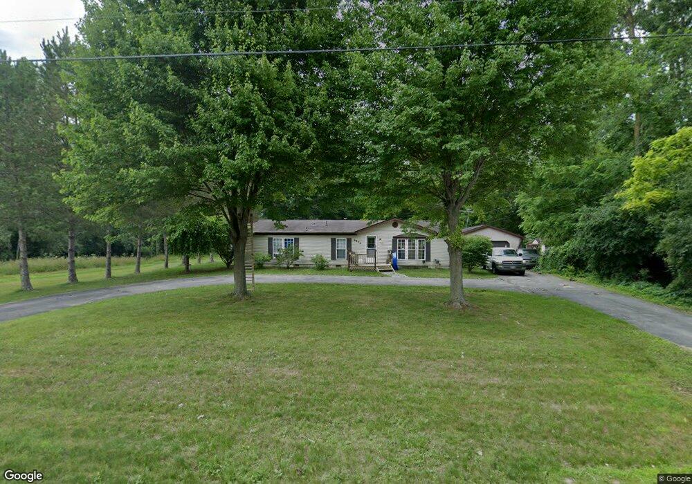
9906 Webster Rd Freeland, MI 48623
Estimated Value: $162,773 - $221,000
3
Beds
2
Baths
1,352
Sq Ft
$147/Sq Ft
Est. Value
About This Home
This home is located at 9906 Webster Rd, Freeland, MI 48623 and is currently estimated at $198,943, approximately $147 per square foot. 9906 Webster Rd is a home located in Saginaw County with nearby schools including Freeland Learning Center, Freeland Elementary School, and Freeland Middle/High School.
Ownership History
Date
Name
Owned For
Owner Type
Purchase Details
Closed on
Oct 30, 2020
Sold by
Austin Michael D
Bought by
Coccaro Richard
Current Estimated Value
Home Financials for this Owner
Home Financials are based on the most recent Mortgage that was taken out on this home.
Original Mortgage
$108,007
Outstanding Balance
$96,283
Interest Rate
2.9%
Mortgage Type
FHA
Estimated Equity
$102,660
Purchase Details
Closed on
Oct 3, 2003
Home Financials for this Owner
Home Financials are based on the most recent Mortgage that was taken out on this home.
Original Mortgage
$90,400
Interest Rate
6.03%
Mortgage Type
Purchase Money Mortgage
Create a Home Valuation Report for This Property
The Home Valuation Report is an in-depth analysis detailing your home's value as well as a comparison with similar homes in the area
Purchase History
| Date | Buyer | Sale Price | Title Company |
|---|---|---|---|
| Coccaro Richard | $110,000 | Title Resource Agency | |
| -- | $113,000 | -- | |
| Austin Michael D | $113,000 | -- |
Source: Public Records
Mortgage History
| Date | Status | Borrower | Loan Amount |
|---|---|---|---|
| Open | Coccaro Richard | $108,007 | |
| Previous Owner | Austin Michael D | $90,400 |
Source: Public Records
Tax History
| Year | Tax Paid | Tax Assessment Tax Assessment Total Assessment is a certain percentage of the fair market value that is determined by local assessors to be the total taxable value of land and additions on the property. | Land | Improvement |
|---|---|---|---|---|
| 2025 | $765 | $76,000 | $0 | $0 |
| 2024 | $742 | $72,600 | $0 | $0 |
| 2023 | $706 | $70,400 | $0 | $0 |
| 2022 | $2,191 | $61,400 | $0 | $0 |
| 2021 | $2,174 | $65,100 | $0 | $0 |
| 2020 | $1,599 | $55,200 | $0 | $0 |
| 2019 | $1,550 | $46,400 | $0 | $0 |
| 2018 | $512 | $46,900 | $0 | $0 |
| 2017 | $2,263 | $45,700 | $0 | $0 |
| 2016 | $2,342 | $47,400 | $0 | $0 |
| 2014 | -- | $54,200 | $0 | $40,800 |
| 2013 | -- | $53,500 | $0 | $0 |
Source: Public Records
Map
Nearby Homes
- 10224 Sarle Rd
- 10585 Prairie View Ct
- 9924 Garner Ln
- 8674 Oakhill Dr
- 8657 Foxtail Trail
- 10832 Carter Rd
- 10138 Scott Rd
- 8535 Summer Ridge Dr
- 8884 Copper Ct
- 8426 Waxwing Dr
- 8981 Highland Dr
- 8442 Oakhill Dr
- 8483 N River Rock River Rock Unit 8487
- 8314 Goldfinch Dr
- 5749 11 Mile Rd
- 10123 Hawk Dr
- 9160 Brook Hollow Ln
- 226 S 7th St
- 315 S 2nd St
- 611 E Dawn Dr
Your Personal Tour Guide
Ask me questions while you tour the home.