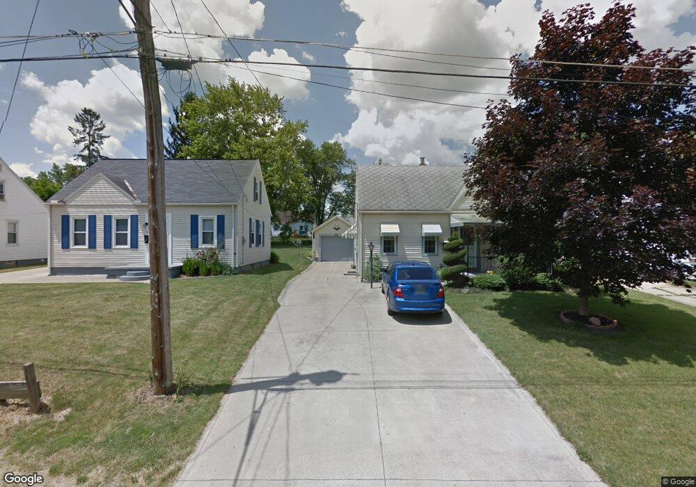
991 Herring Ave Mansfield, OH 44906
Estimated Value: $116,000 - $148,000
3
Beds
1
Bath
900
Sq Ft
$140/Sq Ft
Est. Value
About This Home
This home is located at 991 Herring Ave, Mansfield, OH 44906 and is currently estimated at $125,692, approximately $139 per square foot. 991 Herring Ave is a home located in Richland County with nearby schools including Foundation Academy, Mansfield Elective Academy, and Goal Digital Academy.
Ownership History
Date
Name
Owned For
Owner Type
Purchase Details
Closed on
May 1, 2024
Sold by
Mccabe Timothy M and Mccabe Donna
Bought by
Mccabe Timothy M and Mccabe Donna
Current Estimated Value
Home Financials for this Owner
Home Financials are based on the most recent Mortgage that was taken out on this home.
Original Mortgage
$93,610
Outstanding Balance
$89,653
Interest Rate
7.1%
Mortgage Type
FHA
Estimated Equity
$36,039
Purchase Details
Closed on
Mar 1, 2023
Sold by
Mccabe Rose Marie
Bought by
Mccabe Timothy M
Create a Home Valuation Report for This Property
The Home Valuation Report is an in-depth analysis detailing your home's value as well as a comparison with similar homes in the area
Home Values in the Area
Average Home Value in this Area
Purchase History
| Date | Buyer | Sale Price | Title Company |
|---|---|---|---|
| Mccabe Timothy M | -- | Vantage Point Title | |
| Mccabe Timothy M | -- | -- | |
| Mccabe Timothy M | -- | None Listed On Document |
Source: Public Records
Mortgage History
| Date | Status | Borrower | Loan Amount |
|---|---|---|---|
| Open | Mccabe Timothy M | $93,610 |
Source: Public Records
Tax History
| Year | Tax Paid | Tax Assessment Tax Assessment Total Assessment is a certain percentage of the fair market value that is determined by local assessors to be the total taxable value of land and additions on the property. | Land | Improvement |
|---|---|---|---|---|
| 2024 | $1,112 | $27,170 | $2,880 | $24,290 |
| 2023 | $968 | $27,170 | $2,880 | $24,290 |
| 2022 | $774 | $20,140 | $2,740 | $17,400 |
| 2021 | $765 | $20,140 | $2,740 | $17,400 |
| 2020 | $792 | $20,140 | $2,740 | $17,400 |
| 2019 | $664 | $17,230 | $2,320 | $14,910 |
| 2018 | $627 | $17,230 | $2,320 | $14,910 |
| 2017 | $599 | $17,230 | $2,320 | $14,910 |
| 2016 | $588 | $16,590 | $2,370 | $14,220 |
| 2015 | $588 | $16,590 | $2,370 | $14,220 |
| 2014 | $544 | $16,590 | $2,370 | $14,220 |
| 2012 | $240 | $17,470 | $2,500 | $14,970 |
Source: Public Records
Map
Nearby Homes
- 891 Springmill Rd
- 1077 Benedict Ave
- 640 Hanna Rd
- 933 Fairfax Ave
- 878 Fairfax Ave
- 1087 Fairfax Ave
- 1101 Lenox Ave
- 1092 N Trimble Rd
- 1005 Truxell Dr
- 739 Armstrong St
- 728 N Trimble Rd
- 641 Averill Ave
- 1501 Bowman St
- 572 France St
- 492 Stark St
- 688 Mcpherson St
- 0 State Route 314 Unit 9069650
- 701 Springmill St
- 0 Lemley Ave Unit 9070540
- 340 Boston Ave
- 987 Herring Ave
- 997 Herring Ave
- 981 Herring Ave
- 1001 Herring Ave
- 990 Averill Ave
- 994 Averill Ave
- 984 Averill Ave
- 977 Herring Ave
- 1000 Averill Ave
- 980 Averill Ave
- 992 Herring Ave
- 971 Herring Ave
- 1004 Averill Ave
- 988 Herring Ave
- 998 Herring Ave
- 1011 Herring Ave
- 982 Herring Ave
- 1002 Herring Ave
- 1010 Averill Ave
- 978 Herring Ave
Your Personal Tour Guide
Ask me questions while you tour the home.