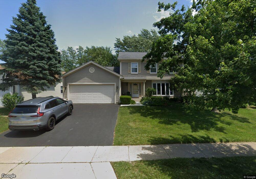
991 Pear Tree Ln Wheeling, IL 60090
Estimated Value: $451,643 - $508,000
4
Beds
2
Baths
1,966
Sq Ft
$248/Sq Ft
Est. Value
About This Home
This home is located at 991 Pear Tree Ln, Wheeling, IL 60090 and is currently estimated at $487,911, approximately $248 per square foot. 991 Pear Tree Ln is a home located in Cook County with nearby schools including Dwight D Eisenhower Elementary School, Anne Sullivan Elementary School, and Betsy Ross Elementary School.
Ownership History
Date
Name
Owned For
Owner Type
Purchase Details
Closed on
Jan 18, 2022
Sold by
Kahn Philip W and Kahn Sherie S
Bought by
Kahn Philip and Kahn Sherie
Current Estimated Value
Purchase Details
Closed on
Dec 13, 2021
Sold by
Kahn Philip W and Kahn Sherie S
Bought by
Kahn Philip and Kahn Sherie
Purchase Details
Closed on
Dec 30, 1993
Sold by
Kahn Philip W and Kahn Sherie S
Bought by
Kahn Philip W and Kahn Sherie S
Create a Home Valuation Report for This Property
The Home Valuation Report is an in-depth analysis detailing your home's value as well as a comparison with similar homes in the area
Home Values in the Area
Average Home Value in this Area
Purchase History
| Date | Buyer | Sale Price | Title Company |
|---|---|---|---|
| Kahn Philip | -- | -- | |
| Kahn Philip | -- | -- | |
| Kahn Philip | -- | -- | |
| Kahn Philip W | -- | -- |
Source: Public Records
Tax History
| Year | Tax Paid | Tax Assessment Tax Assessment Total Assessment is a certain percentage of the fair market value that is determined by local assessors to be the total taxable value of land and additions on the property. | Land | Improvement |
|---|---|---|---|---|
| 2025 | $9,074 | $43,001 | $8,873 | $34,128 |
| 2024 | $9,074 | $34,458 | $7,508 | $26,950 |
| 2023 | $8,614 | $36,488 | $7,508 | $28,980 |
| 2022 | $8,614 | $36,488 | $7,508 | $28,980 |
| 2021 | $7,002 | $27,137 | $5,118 | $22,019 |
| 2020 | $6,945 | $27,137 | $5,118 | $22,019 |
| 2019 | $7,670 | $32,642 | $5,118 | $27,524 |
| 2018 | $6,890 | $27,831 | $4,436 | $23,395 |
| 2017 | $6,826 | $27,831 | $4,436 | $23,395 |
| 2016 | $7,392 | $27,831 | $4,436 | $23,395 |
| 2015 | $7,842 | $27,402 | $3,924 | $23,478 |
| 2014 | $7,657 | $27,402 | $3,924 | $23,478 |
| 2013 | $7,413 | $27,402 | $3,924 | $23,478 |
Source: Public Records
Map
Nearby Homes
- 988 Ridgefield Ln Unit 54
- 448 Bridle Trail Unit 211
- 1201 Pleasant Run Dr Unit 312
- 1111 Pleasant Run Dr Unit 911
- 1125 Pleasant Run Dr Unit 807
- 1105 N Maple Ln
- 270 Violet Ln
- 200 Violet Ln
- 1033 Wheeling Rd
- 1450 Sandpebble Dr Unit 333
- 16 Robert Ave
- 1525 Sander Ct Unit 113
- 1525 Sander Ct Unit 108
- 1525 Sander Ct Unit 103
- 1550 Sandpebble Dr Unit 209
- 651 Garth Rd
- 475 E Merle Ln
- 1211 Highland Dr
- 802 Andover Ct
- 492 Bernice Ct
- 981 Pear Tree Ln Unit 2
- 1001 Pear Tree Ln
- 971 Pear Tree Ln
- 1005 Pear Tree Ln
- 1002 Pear Tree Ln
- 992 Pear Tree Ln
- 1006 Pear Tree Ln
- 982 Pear Tree Ln
- 961 Pear Tree Ln
- 1009 Pear Tree Ln
- 972 Pear Tree Ln
- 1016 Pear Tree Ln
- 1033 Shady Tree Ln
- 951 Pear Tree Ln Unit 2
- 1023 Shady Tree Ln
- 1013 Pear Tree Ln
- 1037 Shady Tree Ln
- 962 Pear Tree Ln
- 1013 Shady Tree Ln
- 1026 Pear Tree Ln
Your Personal Tour Guide
Ask me questions while you tour the home.