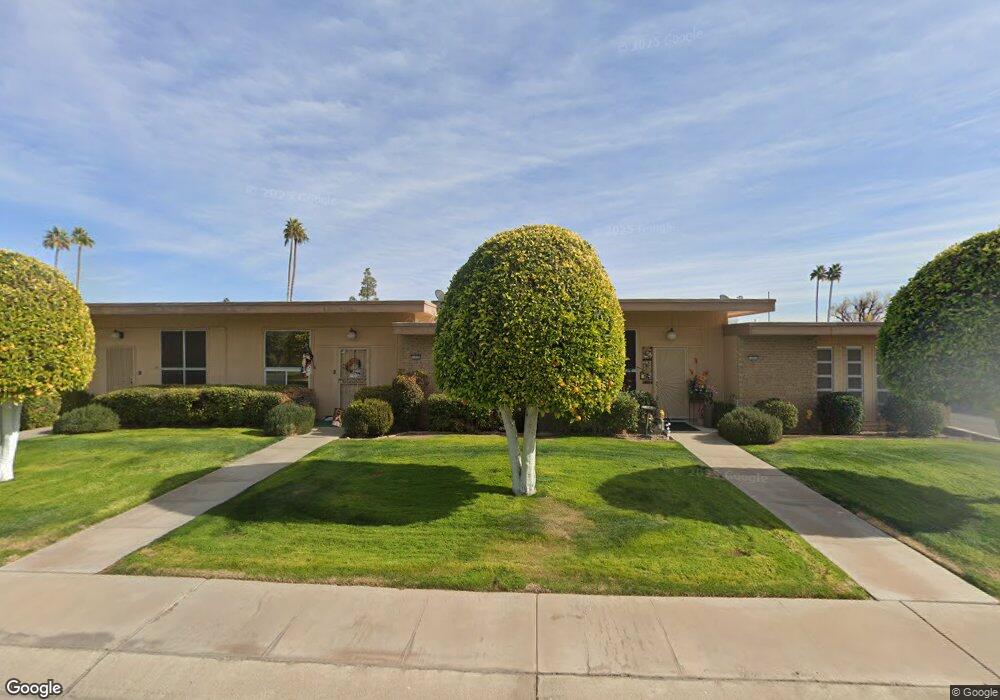
9915 W Lancaster Dr Sun City, AZ 85351
Estimated Value: $180,395 - $209,000
--
Bed
1
Bath
1,224
Sq Ft
$163/Sq Ft
Est. Value
About This Home
This home is located at 9915 W Lancaster Dr, Sun City, AZ 85351 and is currently estimated at $199,349, approximately $162 per square foot. 9915 W Lancaster Dr is a home located in Maricopa County with nearby schools including Desert Mirage Elementary School, Ombudsman - Northwest Charter, and Peoria Accelerated High School.
Ownership History
Date
Name
Owned For
Owner Type
Purchase Details
Closed on
Mar 14, 2001
Sold by
Luebben Robert R
Bought by
Meyers Richard W and Meyers Donna M
Current Estimated Value
Home Financials for this Owner
Home Financials are based on the most recent Mortgage that was taken out on this home.
Original Mortgage
$45,000
Outstanding Balance
$16,435
Interest Rate
7.06%
Mortgage Type
New Conventional
Estimated Equity
$182,914
Purchase Details
Closed on
Oct 15, 1996
Sold by
Brumm Clyde L and Davies Gretchen C
Bought by
Pettey Dorothy B
Create a Home Valuation Report for This Property
The Home Valuation Report is an in-depth analysis detailing your home's value as well as a comparison with similar homes in the area
Home Values in the Area
Average Home Value in this Area
Purchase History
| Date | Buyer | Sale Price | Title Company |
|---|---|---|---|
| Meyers Richard W | $61,900 | First American Title | |
| Pettey Dorothy B | $55,000 | Nations Title Insurance |
Source: Public Records
Mortgage History
| Date | Status | Borrower | Loan Amount |
|---|---|---|---|
| Open | Meyers Richard W | $45,000 |
Source: Public Records
Tax History Compared to Growth
Tax History
| Year | Tax Paid | Tax Assessment Tax Assessment Total Assessment is a certain percentage of the fair market value that is determined by local assessors to be the total taxable value of land and additions on the property. | Land | Improvement |
|---|---|---|---|---|
| 2025 | $203 | $7,354 | -- | -- |
| 2024 | $177 | $7,004 | -- | -- |
| 2023 | $177 | $16,750 | $3,350 | $13,400 |
| 2022 | $166 | $13,320 | $2,660 | $10,660 |
| 2021 | $161 | $12,100 | $2,420 | $9,680 |
| 2020 | $146 | $10,560 | $2,110 | $8,450 |
| 2019 | $133 | $9,350 | $1,870 | $7,480 |
| 2018 | $116 | $8,210 | $1,640 | $6,570 |
| 2017 | $101 | $7,020 | $1,400 | $5,620 |
| 2016 | $49 | $5,760 | $1,150 | $4,610 |
| 2015 | $69 | $5,460 | $1,090 | $4,370 |
Source: Public Records
Map
Nearby Homes
- 13233 N 99th Dr Unit 24B
- 13222 N 99th Dr
- 10038 W Lancaster Dr
- 13215 N Lakeforest Dr
- 13080 N 99th Dr Unit D
- 10050 W Lancaster Dr
- 13428 N 100th Ave
- 9960 W Forrester Dr
- 10072 W Lancaster Dr Unit 24B
- 10019 W Thunderbird Blvd
- 9830 W Teakwood Dr
- 13207 N Branding Iron Dr
- 9955 W Forrester Dr
- 9935 W Thunderbird Blvd
- 13232 N 98th Ave Unit G
- 13232 N 98th Ave Unit K
- 13081 N 100th Ave
- 9971 W Bolivar Dr
- 13420 N Emberwood Dr
- 9961 W Bolivar Dr
- 9917 W Lancaster Dr
- 9913 W Lancaster Dr
- 9919 W Lancaster Dr
- 9921 W Lancaster Dr
- 9921 W Lancaster Dr
- 13237 N 99th Dr
- 13225 N 99th Dr
- 13223 N 99th Dr
- 9907 W Lancaster Dr
- 9905 W Lancaster Dr
- 9911 W Lancaster Dr
- 13227 N 99th Dr Unit 24B
- 9903 W Lancaster Dr
- 13221 N 99th Dr
- 9903 N 99th Dr
- 13241 N 99th Dr
- 13229 N 99th Dr Unit 24B
- 13229 N 99th Dr
- 13219 N 99th Dr
- 9901 W Lancaster Dr