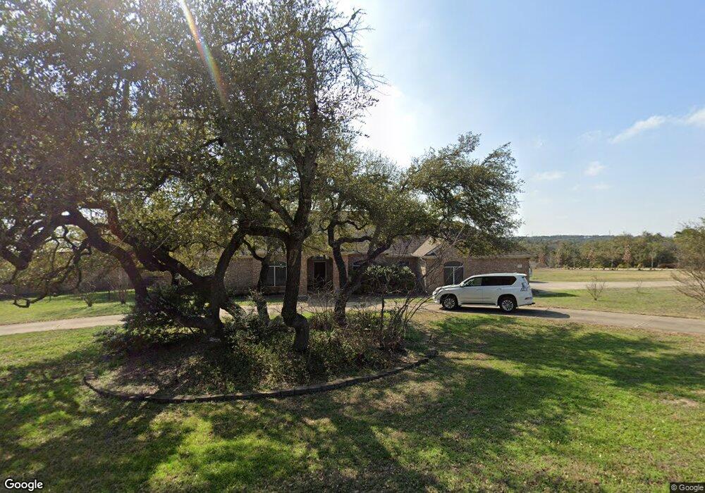
9916 Oliver Dr Austin, TX 78736
Estimated Value: $915,342 - $1,268,000
--
Bed
3
Baths
2,810
Sq Ft
$402/Sq Ft
Est. Value
About This Home
This home is located at 9916 Oliver Dr, Austin, TX 78736 and is currently estimated at $1,128,586, approximately $401 per square foot. 9916 Oliver Dr is a home located in Travis County with nearby schools including Baldwin Elementary School, Small Middle School, and James Bowie High School.
Ownership History
Date
Name
Owned For
Owner Type
Purchase Details
Closed on
Jul 9, 2024
Sold by
Colfack Joanne Simon and Colfack Josephine Anne
Bought by
Colfack Brian Richard
Current Estimated Value
Purchase Details
Closed on
Apr 18, 2005
Sold by
Lastor Jack T and Lastor Nika L
Bought by
Colfack Brian R and Colfack Joanne S
Home Financials for this Owner
Home Financials are based on the most recent Mortgage that was taken out on this home.
Original Mortgage
$308,000
Interest Rate
5.78%
Mortgage Type
Fannie Mae Freddie Mac
Purchase Details
Closed on
Sep 30, 1997
Sold by
Harren Steve G
Bought by
Lastor Jack T and Lastor Nika L
Home Financials for this Owner
Home Financials are based on the most recent Mortgage that was taken out on this home.
Original Mortgage
$147,968
Interest Rate
7.49%
Create a Home Valuation Report for This Property
The Home Valuation Report is an in-depth analysis detailing your home's value as well as a comparison with similar homes in the area
Home Values in the Area
Average Home Value in this Area
Purchase History
| Date | Buyer | Sale Price | Title Company |
|---|---|---|---|
| Colfack Brian Richard | -- | None Listed On Document | |
| Colfack Brian R | -- | Chicago Title Insurance Comp | |
| Lastor Jack T | -- | -- |
Source: Public Records
Mortgage History
| Date | Status | Borrower | Loan Amount |
|---|---|---|---|
| Previous Owner | Colfack Brian R | $308,000 | |
| Previous Owner | Lastor Jack T | $147,968 |
Source: Public Records
Tax History Compared to Growth
Tax History
| Year | Tax Paid | Tax Assessment Tax Assessment Total Assessment is a certain percentage of the fair market value that is determined by local assessors to be the total taxable value of land and additions on the property. | Land | Improvement |
|---|---|---|---|---|
| 2025 | $3,683 | $984,598 | $360,269 | $624,329 |
| 2023 | $3,295 | $564,984 | $0 | $0 |
| 2022 | $7,998 | $513,622 | $0 | $0 |
| 2021 | $7,941 | $466,929 | $125,580 | $341,349 |
| 2020 | $8,849 | $496,617 | $125,580 | $371,037 |
| 2018 | $9,131 | $488,496 | $125,580 | $362,916 |
| 2017 | $9,150 | $484,554 | $125,580 | $358,974 |
| 2016 | $9,253 | $489,990 | $125,580 | $364,410 |
| 2015 | $6,113 | $496,702 | $125,580 | $372,587 |
| 2014 | $6,113 | $451,547 | $0 | $0 |
Source: Public Records
Map
Nearby Homes
- 9909 Oliver Dr
- 10133 Oliver Dr
- 9614 Bronzewood Dr
- 10204 Oak Grove Cir
- 9301 Elm Grove Cir
- 9908 Derecho Bend
- 9805 Ledgestone Terrace
- TBD Highway 290
- 9926 Ledgestone Terrace
- 9114 U S 290
- 9504 Flintrock Cir
- 8004 Kuhn Dr
- 11420 Rim Rock Trail
- 8100 Kuhn Dr
- 9438 Circle Dr
- 9207 Zyle Rd
- 9513 Morninghill Dr
- 11601 Morningsun Dr
- 7817 Aria Loop
- 33400 Brooks Ranch Rd
- 10605 Oliver Cir
- 10604 Oliver Cir
- 9906 Oliver Dr
- 9919 Oliver Dr
- 10200 E Highway 290
- 10200 Highway 290 W
- 10200 W Highway 290
- 9907 Oliver Dr
- 9908 Oliver Dr
- 9914 Highway 290 W Unit F
- 10125 Oliver Dr
- 9905 Oliver Dr
- 9902 Oliver Dr
- 10008 Schmidt Ln
- 10107 Baxter Ln
- 10111 Baxter Ln
- 9908 Hwy 290 W
- 9908 Highway 290 W
- 2026 Oliver Dr
- 2037 Oliver Dr