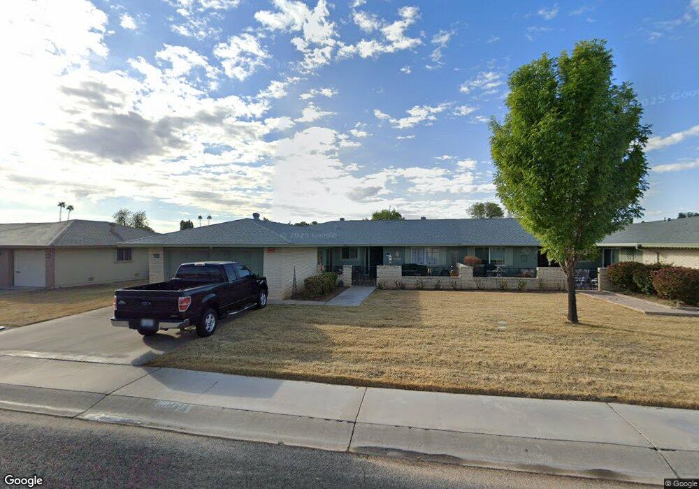
9917 W Shasta Dr Sun City, AZ 85351
Estimated Value: $229,432 - $396,000
--
Bed
2
Baths
1,658
Sq Ft
$178/Sq Ft
Est. Value
About This Home
This home is located at 9917 W Shasta Dr, Sun City, AZ 85351 and is currently estimated at $294,608, approximately $177 per square foot. 9917 W Shasta Dr is a home located in Maricopa County with nearby schools including Sonoran Science Academy-Peoria, Desert Mirage Elementary School, and Black Mountain Science Academy Montessori.
Ownership History
Date
Name
Owned For
Owner Type
Purchase Details
Closed on
Jun 29, 2007
Sold by
Lindseth Richard B and Lindseth Mary D
Bought by
Lindseth Richard B and Lindseth Revocable T Richard B
Current Estimated Value
Purchase Details
Closed on
Nov 25, 1998
Sold by
Lindseth Jon M and Lindseth Julieann L
Bought by
Lindseth Richard B
Home Financials for this Owner
Home Financials are based on the most recent Mortgage that was taken out on this home.
Original Mortgage
$68,000
Interest Rate
6.63%
Purchase Details
Closed on
Jul 27, 1995
Sold by
First Interstate Bank Of Arizona Na
Bought by
Lindseth Jon M and Lindseth Julieann L
Home Financials for this Owner
Home Financials are based on the most recent Mortgage that was taken out on this home.
Original Mortgage
$66,500
Interest Rate
7.88%
Create a Home Valuation Report for This Property
The Home Valuation Report is an in-depth analysis detailing your home's value as well as a comparison with similar homes in the area
Home Values in the Area
Average Home Value in this Area
Purchase History
| Date | Buyer | Sale Price | Title Company |
|---|---|---|---|
| Lindseth Richard B | -- | None Available | |
| Lindseth Richard B | -- | First American Title | |
| Lindseth Jon M | $95,000 | First American Title |
Source: Public Records
Mortgage History
| Date | Status | Borrower | Loan Amount |
|---|---|---|---|
| Closed | Lindseth Richard B | $68,000 | |
| Previous Owner | Lindseth Jon M | $66,500 |
Source: Public Records
Tax History Compared to Growth
Tax History
| Year | Tax Paid | Tax Assessment Tax Assessment Total Assessment is a certain percentage of the fair market value that is determined by local assessors to be the total taxable value of land and additions on the property. | Land | Improvement |
|---|---|---|---|---|
| 2025 | $1,123 | $12,887 | -- | -- |
| 2024 | $1,016 | $12,274 | -- | -- |
| 2023 | $1,016 | $21,250 | $4,250 | $17,000 |
| 2022 | $963 | $17,850 | $3,570 | $14,280 |
| 2021 | $969 | $16,420 | $3,280 | $13,140 |
| 2020 | $944 | $14,750 | $2,950 | $11,800 |
| 2019 | $948 | $13,670 | $2,730 | $10,940 |
| 2018 | $910 | $12,130 | $2,420 | $9,710 |
| 2017 | $865 | $10,970 | $2,190 | $8,780 |
| 2016 | $816 | $9,430 | $1,880 | $7,550 |
| 2015 | $777 | $8,700 | $1,740 | $6,960 |
Source: Public Records
Map
Nearby Homes
- 9915 W Sandstone Dr
- 10009 W Pleasant Valley Rd
- 10336 W Kingswood Cir
- 10019 W Shasta Dr
- 15205 N Desert Rose Dr
- 10319 W Prairie Hills Cir
- 10025 W Shasta Dr
- 10404 W Kingswood Cir
- 10304 W Kingswood Cir
- 15406 N Boswell Blvd
- 10303 W Bright Angel Cir
- 10416 W Prairie Hills Cir Unit 271
- 15602 N Lakeforest Dr
- 10215 W Kingswood Cir
- 10018 W Burns Dr
- 15462 N Lakeforest Dr
- 10213 W Kingswood Cir
- 14818 N 103rd Ave Unit 42
- 9821 W Pleasant Valley Rd
- 10228 W Twin Oaks Dr
- 9919 W Shasta Dr
- 9915 W Shasta Dr
- 9916 W Sandstone Dr Unit 22B
- 9913 W Shasta Dr
- 9921 W Shasta Dr
- 9918 W Sandstone Dr
- 9914 W Sandstone Dr
- 9922 W Shasta Dr
- 9920 W Sandstone Dr
- 9918 W Shasta Dr
- 9923 W Shasta Dr
- 9911 W Shasta Dr
- 9924 W Shasta Dr
- 9912 W Sandstone Dr
- 9916 W Shasta Dr
- 10002 W Sandstone Dr
- 9926 W Shasta Dr
- 9910 W Sandstone Dr
- 9914 W Shasta Dr
- 9909 W Shasta Dr