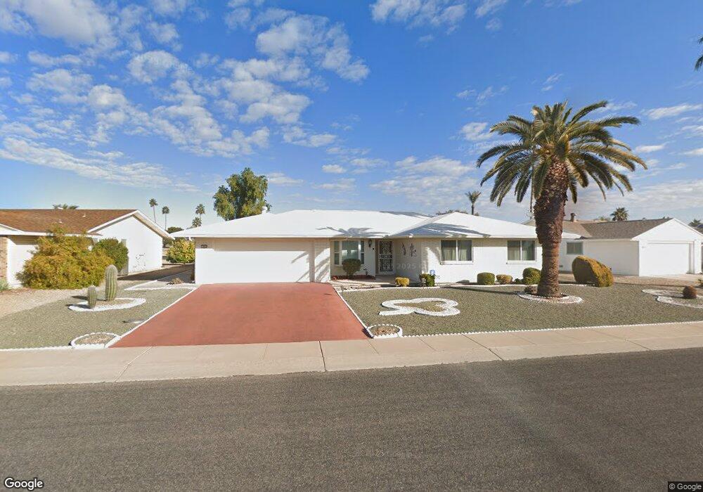
9918 W Desert Rock Dr Sun City, AZ 85351
Estimated Value: $309,503 - $380,000
--
Bed
2
Baths
1,832
Sq Ft
$193/Sq Ft
Est. Value
About This Home
This home is located at 9918 W Desert Rock Dr, Sun City, AZ 85351 and is currently estimated at $352,876, approximately $192 per square foot. 9918 W Desert Rock Dr is a home located in Maricopa County with nearby schools including Sonoran Science Academy-Peoria, Desert Mirage Elementary School, and Black Mountain Science Academy Montessori.
Ownership History
Date
Name
Owned For
Owner Type
Purchase Details
Closed on
Aug 24, 2002
Sold by
Macrow Joel and Macrow Lorelei
Bought by
Macrow Lorelei and The Lorelei Macrow Trust
Current Estimated Value
Purchase Details
Closed on
Dec 12, 1995
Sold by
Stoss John N and Stoss Max
Bought by
Stoss John N and Mary Stoss Revocable Trust
Home Financials for this Owner
Home Financials are based on the most recent Mortgage that was taken out on this home.
Original Mortgage
$110,400
Interest Rate
7.48%
Mortgage Type
New Conventional
Purchase Details
Closed on
Nov 7, 1995
Sold by
Stoss John and The Mary Stoss Revocable Trust
Bought by
Macrow Joel and Macrow Lorelei
Home Financials for this Owner
Home Financials are based on the most recent Mortgage that was taken out on this home.
Original Mortgage
$110,400
Interest Rate
7.48%
Mortgage Type
New Conventional
Purchase Details
Closed on
Jun 27, 1995
Sold by
Stoss Mary
Bought by
The Mary Stoss Revocable Trust
Create a Home Valuation Report for This Property
The Home Valuation Report is an in-depth analysis detailing your home's value as well as a comparison with similar homes in the area
Home Values in the Area
Average Home Value in this Area
Purchase History
| Date | Buyer | Sale Price | Title Company |
|---|---|---|---|
| Macrow Lorelei | -- | -- | |
| Stoss John N | -- | Nations Title Insurance | |
| Macrow Joel | $138,000 | Nations Title Insurance | |
| The Mary Stoss Revocable Trust | -- | -- |
Source: Public Records
Mortgage History
| Date | Status | Borrower | Loan Amount |
|---|---|---|---|
| Previous Owner | Macrow Joel | $110,400 |
Source: Public Records
Tax History Compared to Growth
Tax History
| Year | Tax Paid | Tax Assessment Tax Assessment Total Assessment is a certain percentage of the fair market value that is determined by local assessors to be the total taxable value of land and additions on the property. | Land | Improvement |
|---|---|---|---|---|
| 2025 | $1,745 | $21,602 | -- | -- |
| 2024 | $1,576 | $20,573 | -- | -- |
| 2023 | $1,576 | $29,250 | $5,850 | $23,400 |
| 2022 | $1,474 | $24,900 | $4,980 | $19,920 |
| 2021 | $1,522 | $23,620 | $4,720 | $18,900 |
| 2020 | $1,482 | $21,320 | $4,260 | $17,060 |
| 2019 | $1,462 | $21,100 | $4,220 | $16,880 |
| 2018 | $1,407 | $21,000 | $4,200 | $16,800 |
| 2017 | $1,355 | $17,080 | $3,410 | $13,670 |
| 2016 | $1,273 | $21,000 | $4,200 | $16,800 |
| 2015 | $1,214 | $21,000 | $4,200 | $16,800 |
Source: Public Records
Map
Nearby Homes
- 10018 W Burns Dr
- 9805 W Burns Dr
- 9814 W Gulf Hills Dr
- 10134 W Desert Rock Dr
- 10009 W Pleasant Valley Rd
- 9705 W Oak Ridge Dr
- 15602 N Lakeforest Dr
- 15462 N Lakeforest Dr
- 9821 W Pleasant Valley Rd
- 9921 W Hutton Dr
- 9625 W Oak Ridge Dr Unit 26
- 9814 W Shasta Dr
- 9915 W Sandstone Dr
- 10019 W Shasta Dr
- 10025 W Shasta Dr
- 15205 N Desert Rose Dr
- 9701 W Shasta Dr
- 10202 W Edgewood Dr
- 10319 W Prairie Hills Cir
- 9525 W Cedar Hill Cir
- 9922 W Desert Rock Dr
- 9914 W Desert Rock Dr
- 9910 W Desert Rock Dr
- 9925 W Desert Rock Dr
- 10002 W Desert Rock Dr
- 9929 W Desert Rock Dr
- 9921 W Desert Rock Dr
- 10001 W Desert Rock Dr
- 9917 W Desert Rock Dr Unit 33
- 10006 W Desert Rock Dr
- 15840 N 99th Dr Unit 34
- 15844 N 99th Dr
- 10005 W Desert Rock Dr
- 15848 N 99th Dr
- 9913 W Desert Rock Dr Unit 33
- 9930 W Burns Dr
- 9926 W Burns Dr Unit 33
- 10002 W Burns Dr
- 9922 W Burns Dr
- 16002 N 99th Dr