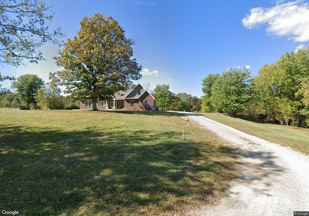
9919 Stardust Rd Tell City, IN 47586
Estimated Value: $400,000 - $615,801
3
Beds
4
Baths
3,746
Sq Ft
$129/Sq Ft
Est. Value
About This Home
This home is located at 9919 Stardust Rd, Tell City, IN 47586 and is currently estimated at $484,934, approximately $129 per square foot. 9919 Stardust Rd is a home located in Perry County with nearby schools including William Tell Elementary School and Tell City Junior/Senior High School.
Ownership History
Date
Name
Owned For
Owner Type
Purchase Details
Closed on
Jun 9, 2020
Sold by
Carney David James
Bought by
Weyer Nicholas R and Weyer Katherine E
Current Estimated Value
Purchase Details
Closed on
Nov 15, 2006
Sold by
Wade John S and Wade Linda L
Bought by
Owl Jason Little
Home Financials for this Owner
Home Financials are based on the most recent Mortgage that was taken out on this home.
Original Mortgage
$80,000
Interest Rate
6.4%
Mortgage Type
New Conventional
Create a Home Valuation Report for This Property
The Home Valuation Report is an in-depth analysis detailing your home's value as well as a comparison with similar homes in the area
Home Values in the Area
Average Home Value in this Area
Purchase History
| Date | Buyer | Sale Price | Title Company |
|---|---|---|---|
| Weyer Nicholas R | -- | None Available | |
| Owl Jason Little | -- | None Available |
Source: Public Records
Mortgage History
| Date | Status | Borrower | Loan Amount |
|---|---|---|---|
| Previous Owner | Owl Jason Little | $80,000 |
Source: Public Records
Tax History Compared to Growth
Tax History
| Year | Tax Paid | Tax Assessment Tax Assessment Total Assessment is a certain percentage of the fair market value that is determined by local assessors to be the total taxable value of land and additions on the property. | Land | Improvement |
|---|---|---|---|---|
| 2024 | $4,420 | $447,700 | $48,400 | $399,300 |
| 2023 | $4,568 | $442,800 | $48,400 | $394,400 |
| 2022 | $125 | $40,000 | $27,200 | $12,800 |
| 2021 | $741 | $37,600 | $28,200 | $9,400 |
| 2020 | $724 | $33,900 | $28,200 | $5,700 |
| 2019 | $715 | $32,900 | $27,200 | $5,700 |
| 2018 | $829 | $36,200 | $27,200 | $9,000 |
| 2017 | $1,516 | $71,800 | $31,200 | $40,600 |
| 2016 | $1,576 | $73,000 | $31,200 | $41,800 |
| 2014 | $2,109 | $94,300 | $31,200 | $63,100 |
| 2013 | $2,109 | $94,900 | $31,200 | $63,700 |
Source: Public Records
Map
Nearby Homes
- 9765 Stardust Rd
- 9702 Brushy Fork Rd
- 9485 Singleton Rd
- Cumberland Craftsman Plan at Forest Canton Heights
- Revolution Craftsman Plan at Forest Canton Heights
- National Craftsman Plan at Forest Canton Heights
- Patriot Craftsman Plan at Forest Canton Heights
- Teton Craftsman Plan at Forest Canton Heights
- Summit Craftsman Plan at Forest Canton Heights
- 0 Starlite Rd
- 0 Brushy Fork Rd
- 10585 Aberdeen Way Unit 19
- 10695 Aberdeen Way Unit 22
- 9040 Steward Rd
- 10501 Old State Road 37 Unit Tell City
- 5345 Annandale Way Unit 5
- 5340 Annandale Way Unit 8
- 5330 Annandale Way Unit 7
- 9225 Sunset Rd
- 5345 Tartan Way Unit 37
- 9805 Stardust Rd
- 9950 Stardust Rd
- 9808 Stardust Rd
- 9755 Stardust Rd
- 9960 Stardust Rd
- 9702 Stardust Rd
- 0 Stardust Rd
- 9625 Stardust Rd
- 9720 Sidonia Rd
- 9715 Sidonia Rd
- 9665 Sidonia Rd
- 0 Stone Rd
- 00 Stone Rd
- 9625 Sidonia Rd
- 3728 Stone Rd
- 9605 Sidonia Rd
- 3852 Stone Rd
- 9650 Sweetwater Rd
- 3790 Stone Rd
- 3800 Stone Rd