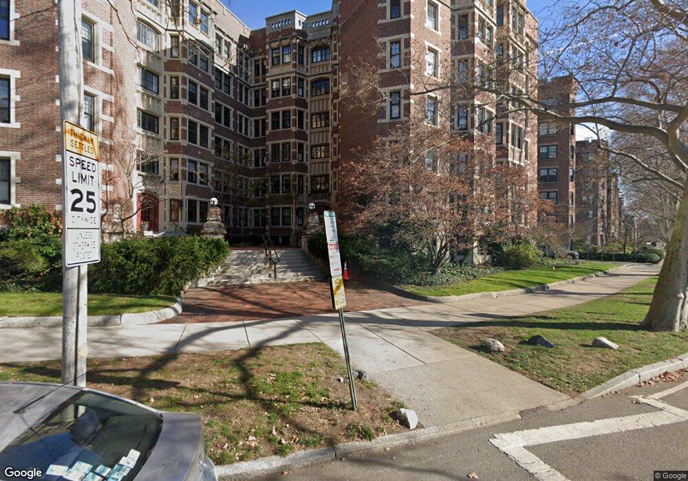
992 Memorial Dr Unit 604 Cambridge, MA 02138
West Cambridge NeighborhoodEstimated Value: $865,210 - $1,275,000
2
Beds
1
Bath
974
Sq Ft
$1,109/Sq Ft
Est. Value
About This Home
This home is located at 992 Memorial Dr Unit 604, Cambridge, MA 02138 and is currently estimated at $1,079,803, approximately $1,108 per square foot. 992 Memorial Dr Unit 604 is a home located in Middlesex County with nearby schools including St Peter School, Buckingham Browne & Nichols School, and Saint Paul's Choir School.
Ownership History
Date
Name
Owned For
Owner Type
Purchase Details
Closed on
Sep 22, 1997
Sold by
Est Smith Anne B and Kidder George H
Bought by
Drager Ursula C
Current Estimated Value
Purchase Details
Closed on
May 30, 1996
Sold by
Chadirji Rifat
Bought by
Smith Anne B
Home Financials for this Owner
Home Financials are based on the most recent Mortgage that was taken out on this home.
Original Mortgage
$130,000
Interest Rate
7.91%
Mortgage Type
Purchase Money Mortgage
Create a Home Valuation Report for This Property
The Home Valuation Report is an in-depth analysis detailing your home's value as well as a comparison with similar homes in the area
Home Values in the Area
Average Home Value in this Area
Purchase History
| Date | Buyer | Sale Price | Title Company |
|---|---|---|---|
| Drager Ursula C | $315,000 | -- | |
| Smith Anne B | $315,000 | -- |
Source: Public Records
Mortgage History
| Date | Status | Borrower | Loan Amount |
|---|---|---|---|
| Previous Owner | Smith Anne B | $130,000 |
Source: Public Records
Tax History Compared to Growth
Tax History
| Year | Tax Paid | Tax Assessment Tax Assessment Total Assessment is a certain percentage of the fair market value that is determined by local assessors to be the total taxable value of land and additions on the property. | Land | Improvement |
|---|---|---|---|---|
| 2025 | $6,180 | $973,200 | $0 | $973,200 |
| 2024 | $5,697 | $962,400 | $0 | $962,400 |
| 2023 | $5,456 | $931,000 | $0 | $931,000 |
| 2022 | $5,418 | $915,200 | $0 | $915,200 |
| 2021 | $5,432 | $928,600 | $0 | $928,600 |
| 2020 | $5,122 | $890,800 | $0 | $890,800 |
| 2019 | $4,904 | $825,600 | $0 | $825,600 |
| 2018 | $4,751 | $755,400 | $0 | $755,400 |
| 2017 | $4,552 | $701,400 | $0 | $701,400 |
| 2016 | $4,413 | $631,400 | $0 | $631,400 |
| 2015 | $4,366 | $558,300 | $0 | $558,300 |
| 2014 | $4,295 | $512,500 | $0 | $512,500 |
Source: Public Records
Map
Nearby Homes
- 988 Memorial Dr Unit 386
- 5 Brewer St Unit 5
- 986 Memorial Dr Unit 404
- 32 Hawthorn St
- 983 Memorial Dr Unit 502
- 984 Memorial Dr Unit 984-503
- 130 Mount Auburn St Unit 108
- 975 Memorial Dr Unit 209
- 975 Memorial Dr Unit 211
- 12 Berkeley St
- 3 Berkeley Place
- 20 Maynard Place
- 1010 Memorial Dr Unit 6G
- 15 Hubbard Park Rd
- 22 Concord Ave Unit 10
- 50 Follen St Unit 505
- 50 Follen St Unit 109
- 48 Hubbard Park Rd
- 44 Garden St
- 153 Brattle St
- 992 Memorial Dr Unit 606
- 992 Memorial Dr Unit 605
- 992 Memorial Dr Unit 506
- 992 Memorial Dr Unit 505
- 992 Memorial Dr Unit 504
- 992 Memorial Dr Unit 502
- 992 Memorial Dr Unit 501
- 992 Memorial Dr Unit 406
- 992 Memorial Dr Unit 405
- 992 Memorial Dr Unit 404
- 992 Memorial Dr Unit 401
- 992 Memorial Dr Unit 306
- 992 Memorial Dr Unit 305
- 992 Memorial Dr Unit 304
- 992 Memorial Dr Unit 206
- 992 Memorial Dr Unit 205
- 992 Memorial Dr Unit 204
- 992 Memorial Dr Unit 203
- 992 Memorial Dr Unit 106
- 992 Memorial Dr Unit 105