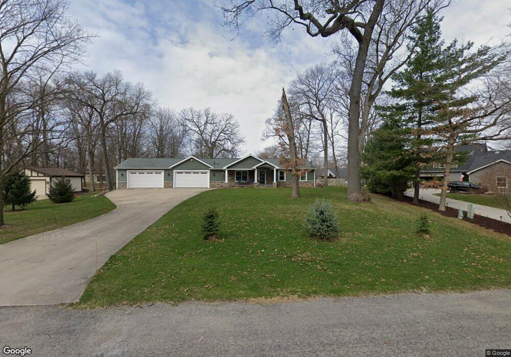
9920 Curie Ln Unit Bldg-Unit Pinckney, MI 48169
Estimated Value: $871,000 - $1,042,000
3
Beds
4
Baths
3,692
Sq Ft
$257/Sq Ft
Est. Value
About This Home
This home is located at 9920 Curie Ln Unit Bldg-Unit, Pinckney, MI 48169 and is currently estimated at $950,058, approximately $257 per square foot. 9920 Curie Ln Unit Bldg-Unit is a home located in Livingston County with nearby schools including Country Elementary School, Navigator School, and Pathfinder School.
Ownership History
Date
Name
Owned For
Owner Type
Purchase Details
Closed on
Jun 19, 2020
Sold by
Cullin Katherine F and Cullin Curt D
Bought by
Cullin Katherine F and Cullin Curt D
Current Estimated Value
Home Financials for this Owner
Home Financials are based on the most recent Mortgage that was taken out on this home.
Original Mortgage
$458,000
Outstanding Balance
$405,982
Interest Rate
3.2%
Mortgage Type
New Conventional
Estimated Equity
$544,076
Purchase Details
Closed on
Jul 31, 2018
Sold by
Sebastian Walter J and Sebastian Marcy L
Bought by
Cullin Katherine F and Cullin Curt D
Purchase Details
Closed on
Mar 28, 2017
Sold by
Sebastian Walter J and Sebastian Marcy L
Bought by
Sebastian Walter J and Sebastian Marcy J
Create a Home Valuation Report for This Property
The Home Valuation Report is an in-depth analysis detailing your home's value as well as a comparison with similar homes in the area
Home Values in the Area
Average Home Value in this Area
Purchase History
| Date | Buyer | Sale Price | Title Company |
|---|---|---|---|
| Cullin Katherine F | -- | None Available | |
| Cullin Katherine F | $625,000 | -- | |
| Sebastian Walter J | -- | None Available |
Source: Public Records
Mortgage History
| Date | Status | Borrower | Loan Amount |
|---|---|---|---|
| Open | Cullin Katherine F | $458,000 |
Source: Public Records
Tax History Compared to Growth
Tax History
| Year | Tax Paid | Tax Assessment Tax Assessment Total Assessment is a certain percentage of the fair market value that is determined by local assessors to be the total taxable value of land and additions on the property. | Land | Improvement |
|---|---|---|---|---|
| 2025 | $10,411 | $461,460 | $0 | $0 |
| 2024 | $3,504 | $428,150 | $0 | $0 |
| 2023 | $3,342 | $396,870 | $0 | $0 |
| 2022 | $6,685 | $369,880 | $0 | $0 |
| 2021 | $9,431 | $369,880 | $0 | $0 |
| 2020 | $7,155 | $284,740 | $0 | $0 |
| 2019 | $6,040 | $210,670 | $0 | $0 |
| 2018 | $5,748 | $206,930 | $0 | $0 |
| 2017 | $5,570 | $206,930 | $0 | $0 |
| 2016 | $5,396 | $233,730 | $0 | $0 |
| 2014 | $5,062 | $207,950 | $0 | $0 |
| 2012 | $5,062 | $246,860 | $0 | $0 |
Source: Public Records
Map
Nearby Homes
- 9929 Curie Ln
- 10087 Margaret Dr
- 00 Lori Ln
- 9550 Bluewater Dr
- 4670 E M 36
- 4790 Downing Dr
- 4825 Downing Dr
- 9862 Zukey Dr
- 10250 Buhl Dr
- 5370 Edgelake Dr
- 5050 Island Shore Dr
- 3590 Habitat Trail Unit 25
- 4405 Shoreview Ln
- 3450 Hooker Rd
- 10868 Bob White Beach Blvd
- 0 Western Ln
- 3569 Recreation
- 4106 Shoreview Ln
- 8625 Creston Dr
- 8532 Pettysville Rd
- 9920 Curie Ln
- 9940 Curie Ln
- 0 Curie Ln
- 9778 Fireside Ct
- 9778 Fireside Ct
- 9770 Beverly Ct
- 9720 Fireside Ct
- 9770 Beverly Dr
- 9960 Curie Ln
- 9737 Beverly Ct
- 9731 Beverly Ct
- 9716 Fireside Ct
- 9728 Beverly Ct
- 9725 Beverly Ct
- 9720 Beverly Ct
- 9749 Beverly Dr
- 9770 Beverly Dr
- 9731 Beverly Dr
- 9755 Beverly Dr
- 9955 Curie Ln