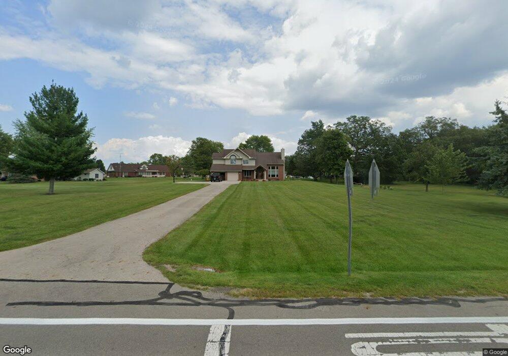
9921 State Route 185 Versailles, OH 45380
Estimated Value: $535,000 - $569,000
4
Beds
2
Baths
2,450
Sq Ft
$227/Sq Ft
Est. Value
About This Home
This home is located at 9921 State Route 185, Versailles, OH 45380 and is currently estimated at $555,837, approximately $226 per square foot. 9921 State Route 185 is a home with nearby schools including Versailles Elementary School, Versailles Middle School, and Versailles High School.
Ownership History
Date
Name
Owned For
Owner Type
Purchase Details
Closed on
Nov 2, 2021
Sold by
Bey Jerome F and Bey Sundra J
Bought by
Huffman Morgan Curtis and Huffman Macy Marie
Current Estimated Value
Home Financials for this Owner
Home Financials are based on the most recent Mortgage that was taken out on this home.
Original Mortgage
$356,000
Outstanding Balance
$325,711
Interest Rate
2.88%
Mortgage Type
New Conventional
Estimated Equity
$230,126
Purchase Details
Closed on
Apr 30, 1999
Sold by
Pohl Roger
Bought by
Bey Jerome F Sundra J
Create a Home Valuation Report for This Property
The Home Valuation Report is an in-depth analysis detailing your home's value as well as a comparison with similar homes in the area
Home Values in the Area
Average Home Value in this Area
Purchase History
| Date | Buyer | Sale Price | Title Company |
|---|---|---|---|
| Huffman Morgan Curtis | $449,000 | None Available | |
| Bey Jerome F Sundra J | $27,000 | -- |
Source: Public Records
Mortgage History
| Date | Status | Borrower | Loan Amount |
|---|---|---|---|
| Open | Huffman Morgan Curtis | $356,000 |
Source: Public Records
Tax History Compared to Growth
Tax History
| Year | Tax Paid | Tax Assessment Tax Assessment Total Assessment is a certain percentage of the fair market value that is determined by local assessors to be the total taxable value of land and additions on the property. | Land | Improvement |
|---|---|---|---|---|
| 2024 | $5,027 | $152,560 | $7,290 | $145,270 |
| 2023 | $5,034 | $152,560 | $7,290 | $145,270 |
| 2022 | $4,643 | $145,130 | $6,110 | $139,020 |
| 2021 | $2,741 | $81,710 | $6,110 | $75,600 |
| 2020 | $2,755 | $81,710 | $6,110 | $75,600 |
| 2019 | $2,239 | $66,590 | $6,110 | $60,480 |
| 2018 | $2,248 | $66,590 | $6,110 | $60,480 |
| 2017 | $1,945 | $66,590 | $6,110 | $60,480 |
| 2016 | $1,947 | $61,300 | $6,010 | $55,290 |
| 2015 | $1,947 | $61,300 | $6,010 | $55,290 |
| 2014 | $2,048 | $61,300 | $6,010 | $55,290 |
| 2013 | $2,099 | $58,390 | $5,730 | $52,660 |
Source: Public Records
Map
Nearby Homes
- 0000 Marker Rd
- 435 Reed Ave
- 447 Reed Ave
- 547 Reed Ave
- 59 W Ward St
- 552 Reed Ave
- 546 Reed Ave
- 304 E Wood St
- 129 E Wood St
- 0 Ohio 121
- 632 N Center St
- 631 N Center St
- 1031 Baker Rd
- 1025 Baker Rd
- 0 St Rt 121 Unit 10041143
- 9072 Stillwater Dr
- 8832 State Route 185
- 8839 Murphy Rd
- 00 State Route 121
- 8363 Horatio-New Harrison Rd
- 8711 Cambridge Dr
- 8725 Cambridge Dr
- 8705 Cambridge Dr
- 8719 Cambridge Dr
- 8729 Cambridge Dr
- 9893 State Route 185
- 9893 Ohio 185
- 8712 Cambridge Dr
- 8706 Cambridge Dr
- 8734 Cambridge Dr
- 8714 Cambridge Dr
- 8733 Cambridge Dr
- 8726 Cambridge Dr
- 8718 Cambridge Dr
- 8722 Cambridge Dr
- 9883 State Route 185
- 8739 Cambridge Dr
- 9888 State Route 185
- 9876 State Route 185
- 9904 State Route 185