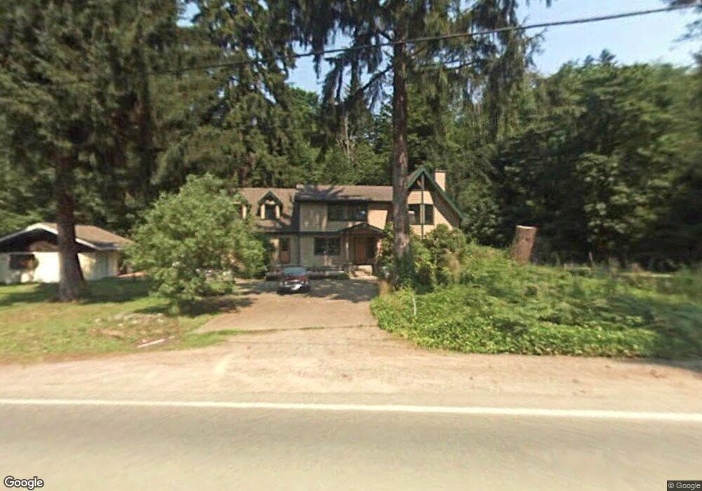
9930 Upper Preston Rd SE Issaquah, WA 98027
Upper Preston NeighborhoodEstimated Value: $1,121,000 - $1,411,000
4
Beds
3
Baths
2,610
Sq Ft
$492/Sq Ft
Est. Value
About This Home
This home is located at 9930 Upper Preston Rd SE, Issaquah, WA 98027 and is currently estimated at $1,283,698, approximately $491 per square foot. 9930 Upper Preston Rd SE is a home located in King County with nearby schools including Clark Elementary School, Issaquah Middle School, and Issaquah High School.
Ownership History
Date
Name
Owned For
Owner Type
Purchase Details
Closed on
Aug 8, 1995
Sold by
Dent Darcy A
Bought by
White Dodge C
Current Estimated Value
Home Financials for this Owner
Home Financials are based on the most recent Mortgage that was taken out on this home.
Original Mortgage
$30,000
Interest Rate
7.41%
Purchase Details
Closed on
Oct 7, 1992
Sold by
Reichenbach Diana Ruth
Bought by
White Dodge C and Dent D'Arcy A
Create a Home Valuation Report for This Property
The Home Valuation Report is an in-depth analysis detailing your home's value as well as a comparison with similar homes in the area
Home Values in the Area
Average Home Value in this Area
Purchase History
| Date | Buyer | Sale Price | Title Company |
|---|---|---|---|
| White Dodge C | -- | Stewart Title Company | |
| White Dodge C | $180,000 | -- |
Source: Public Records
Mortgage History
| Date | Status | Borrower | Loan Amount |
|---|---|---|---|
| Previous Owner | White Dodge C | $30,000 |
Source: Public Records
Tax History Compared to Growth
Tax History
| Year | Tax Paid | Tax Assessment Tax Assessment Total Assessment is a certain percentage of the fair market value that is determined by local assessors to be the total taxable value of land and additions on the property. | Land | Improvement |
|---|---|---|---|---|
| 2024 | $10,976 | $1,047,000 | $311,000 | $736,000 |
| 2023 | $11,073 | $951,000 | $283,000 | $668,000 |
| 2022 | $9,386 | $1,158,000 | $346,000 | $812,000 |
| 2021 | $8,770 | $800,000 | $289,000 | $511,000 |
| 2020 | $8,202 | $684,000 | $268,000 | $416,000 |
| 2018 | $8,053 | $676,000 | $198,000 | $478,000 |
| 2017 | $7,171 | $593,000 | $174,000 | $419,000 |
| 2016 | $7,023 | $530,000 | $162,000 | $368,000 |
| 2015 | $6,117 | $507,000 | $156,000 | $351,000 |
| 2014 | -- | $445,000 | $144,000 | $301,000 |
| 2013 | -- | $375,000 | $161,000 | $214,000 |
Source: Public Records
Map
Nearby Homes
- 10544 Upper Preston Rd SE
- 9305 312th Ave SE
- 33322 SE 114th St
- 9111 Ash Ave SE
- 34700 SE 99th St
- 10412 348th Ave SE
- 33324 SE 126th St
- 7726 Lake Alice Rd SE
- 7727 Lake Alice Rd SE
- 1110 350th Ave SE
- 33512 SE 126th St
- 34530 SE Osprey Ct
- 34606 SE Osprey Ct Unit 8
- 34027 SE Strouf St Unit 18
- 9730 354th Ave SE
- 9006 Venn Ave SE
- 34524 SE Linden Loop
- 8927 Weiting Ave SE
- 35108 SE Kinsey St
- 35101 SE Ridge St
- 9927 Upper Preston Rd SE
- 9937 Upper Preston Rd SE
- 9940 Upper Preston Rd SE
- 9950 Upper Preston Rd SE
- 10017 Upper Preston Rd SE
- 10035 Upper Preston Rd SE
- 9522 315th Ave SE Unit 3
- 10113 Upper Preston Rd SE
- 9578 314th Ave SE Unit 37
- 9702 Upper Preston Rd SE
- 31515 SE 97th St
- 9606 315th Ave SE Unit 1
- 9524 315th Ave SE Unit 10
- 9520 315th Ave SE Unit 12
- 9602 315th Ave SE Unit 7
- 9622 315th Ave SE Unit 3
- 9528 315th Ave SE Unit 9
- 31414 SE 97th St Unit 17
- 9617 315th Ave SE Unit 19
- 9516 315th Ave SE Unit 11