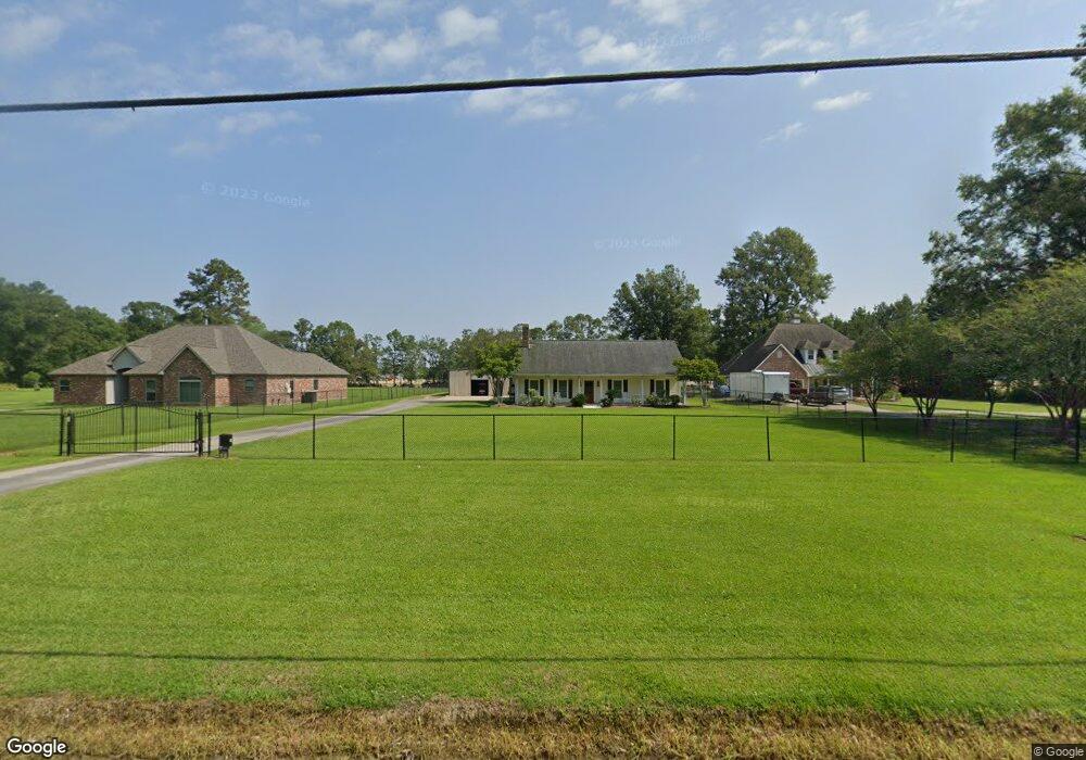
9935 Forrest Delatte Rd Denham Springs, LA 70726
Estimated Value: $314,000 - $383,821
4
Beds
3
Baths
2,081
Sq Ft
$170/Sq Ft
Est. Value
About This Home
This home is located at 9935 Forrest Delatte Rd, Denham Springs, LA 70726 and is currently estimated at $353,455, approximately $169 per square foot. 9935 Forrest Delatte Rd is a home located in Livingston Parish with nearby schools including Lewis Vincent Elementary School, Southside Junior High School, and Denham Springs Freshman High School.
Ownership History
Date
Name
Owned For
Owner Type
Purchase Details
Closed on
Mar 26, 2021
Sold by
Carney-Degruy Debra
Bought by
Staggs Christy and Staggs Harry L
Current Estimated Value
Home Financials for this Owner
Home Financials are based on the most recent Mortgage that was taken out on this home.
Original Mortgage
$259,200
Outstanding Balance
$233,267
Interest Rate
2.8%
Mortgage Type
Purchase Money Mortgage
Estimated Equity
$120,188
Purchase Details
Closed on
Aug 28, 2009
Sold by
Mdjm Properties L L C
Bought by
Degruy Keith Joseph and Degruy Debra Carol Carney
Home Financials for this Owner
Home Financials are based on the most recent Mortgage that was taken out on this home.
Original Mortgage
$180,000
Interest Rate
6%
Mortgage Type
Unknown
Create a Home Valuation Report for This Property
The Home Valuation Report is an in-depth analysis detailing your home's value as well as a comparison with similar homes in the area
Home Values in the Area
Average Home Value in this Area
Purchase History
| Date | Buyer | Sale Price | Title Company |
|---|---|---|---|
| Staggs Christy | $324,000 | None Available | |
| Degruy Keith Joseph | $280,000 | Professional Title Of La Inc |
Source: Public Records
Mortgage History
| Date | Status | Borrower | Loan Amount |
|---|---|---|---|
| Open | Staggs Christy | $259,200 | |
| Previous Owner | Degruy Keith Joseph | $180,000 |
Source: Public Records
Tax History Compared to Growth
Tax History
| Year | Tax Paid | Tax Assessment Tax Assessment Total Assessment is a certain percentage of the fair market value that is determined by local assessors to be the total taxable value of land and additions on the property. | Land | Improvement |
|---|---|---|---|---|
| 2024 | $2,854 | $27,157 | $6,341 | $20,816 |
| 2023 | $2,288 | $19,600 | $4,950 | $14,650 |
| 2022 | $2,304 | $19,600 | $4,950 | $14,650 |
| 2021 | $2,311 | $19,600 | $4,950 | $14,650 |
| 2020 | $2,284 | $19,600 | $4,950 | $14,650 |
| 2019 | $2,131 | $17,990 | $3,810 | $14,180 |
| 2018 | $2,159 | $17,990 | $3,810 | $14,180 |
| 2017 | $2,066 | $17,280 | $3,810 | $13,470 |
| 2015 | $1,619 | $21,030 | $3,300 | $17,730 |
| 2014 | $1,728 | $21,610 | $3,880 | $17,730 |
Source: Public Records
Map
Nearby Homes
- 10669 Deric Ave
- 10656 Deric Ave
- 10638 Deric Ave
- 10688 Deric Ave
- 10602 Deric Ave
- 26524 Vanissa Dr
- 26518 Vanissa Dr
- 26623 Vanissa Dr
- 26572 Vanissa Dr
- 26596 Vanissa Dr
- Lot 4 Powell Ln
- TBD Juban Rd
- TBD Shady Park Dr
- Lot 3 Ivy Ct
- Lot 5 Ivy Ct
- Lot 2 Ivy Ct
- Lot 1 Ivy Ct
- 26725 Juban Rd
- 26661 Juban Rd
- 29433 Juban Rd
- 9955 Forrest Delatte Rd
- 9925 Forrest Delatte Rd
- 9889 Forrest Delatte Rd
- 10662 Deric Ave
- 26554 Vanissa Dr
- 26614 Vanissa Dr
- 9841 Forrest Delatte Rd
- 26925 Lee Ellis Rd
- 26889 Elmcrest Dr
- 10011 Belshire Way
- 1 Forrest Delatte Rd
- 2 Forrest Delatte Rd
- 0 Forrest Delatte Rd
- 10005 Belshire Way
- 26877 Elmcrest Dr
- 9809 Forrest Delatte Rd
- 10085 Forrest Delatte Rd
- TBD Forrest Delatte Rd
- 26859 Elmcrest Dr
- 26506 Vanissa Dr