Estimated Value: $258,000 - $386,000
4
Beds
3
Baths
2,383
Sq Ft
$131/Sq Ft
Est. Value
About This Home
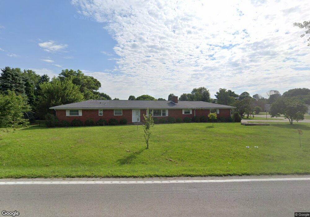
This home is located at 994 Us Route 68 S, Xenia, OH 45385 and is currently estimated at $312,827, approximately $131 per square foot. 994 Us Route 68 S is a home located in Greene County with nearby schools including Xenia High School, Summit Academy Community School for Alternative Learners - Xenia, and Legacy Christian Academy.
Ownership History
Date
Name
Owned For
Owner Type
Purchase Details
Closed on
Apr 28, 2017
Sold by
Thompson Stephen R
Bought by
Ritenour Philip and Ritenour Rebecca
Current Estimated Value
Home Financials for this Owner
Home Financials are based on the most recent Mortgage that was taken out on this home.
Original Mortgage
$118,827
Outstanding Balance
$98,928
Interest Rate
4.14%
Mortgage Type
New Conventional
Estimated Equity
$213,899
Purchase Details
Closed on
Oct 19, 1990
Bought by
Thompson Robert Bomma Trustee
Create a Home Valuation Report for This Property
The Home Valuation Report is an in-depth analysis detailing your home's value as well as a comparison with similar homes in the area
Home Values in the Area
Average Home Value in this Area
Purchase History
| Date | Buyer | Sale Price | Title Company |
|---|---|---|---|
| Ritenour Philip | $125,100 | None Available | |
| Thompson Robert Bomma Trustee | $88,000 | -- |
Source: Public Records
Mortgage History
| Date | Status | Borrower | Loan Amount |
|---|---|---|---|
| Open | Ritenour Philip | $118,827 |
Source: Public Records
Tax History Compared to Growth
Tax History
| Year | Tax Paid | Tax Assessment Tax Assessment Total Assessment is a certain percentage of the fair market value that is determined by local assessors to be the total taxable value of land and additions on the property. | Land | Improvement |
|---|---|---|---|---|
| 2024 | $3,132 | $64,430 | $11,440 | $52,990 |
| 2023 | $3,132 | $64,430 | $11,440 | $52,990 |
| 2022 | $2,777 | $51,780 | $10,790 | $40,990 |
| 2021 | $2,812 | $51,780 | $10,790 | $40,990 |
| 2020 | $2,702 | $51,780 | $10,790 | $40,990 |
| 2019 | $2,519 | $45,310 | $7,550 | $37,760 |
| 2018 | $2,528 | $45,310 | $7,550 | $37,760 |
| 2017 | $2,460 | $45,310 | $7,550 | $37,760 |
| 2016 | $1,775 | $40,880 | $7,550 | $33,330 |
| 2015 | $1,779 | $40,880 | $7,550 | $33,330 |
| 2014 | $1,707 | $40,880 | $7,550 | $33,330 |
Source: Public Records
Map
Nearby Homes
- 966 U S 68
- 0 U S 68
- 260 Pocahontas St
- 979 Mcdowell St
- 0 Gultice Rd Unit 940427
- 1444 Triple Crown Way
- 733 State Route 380
- 104 Ledbetter Rd
- 55 Lake St
- 1736 Winchester Rd
- 46 Lake St
- 847 S Detroit St
- 222 Washington St
- 633 Xenia Ave
- 523 Newport Rd
- 400 S Detroit St
- 654 E 3rd St
- 133 Hivling St
- 293 S Miami Ave
- 36 Leaman St
- 808 Robin Rd
- 978 Us Route 68 S
- 805 Robin Rd
- 983 Livingston Dr
- 821 Robin Rd
- 966 Us Route 68 S
- 967 Livingston Dr
- 980 Livingston Dr
- 970 Livingston Dr
- 1000 Livingston Dr
- 960 Livingston Dr
- 1 Robin Rd
- 1040 Us Route 68 S
- 788 Maple Dr
- 985 Valley Dale Dr
- 983 U S 68 S
- 983 Us Route 68 S
- 991 Valley Dale Dr
- 945 Livingston Dr
- 973 Valley Dale Dr