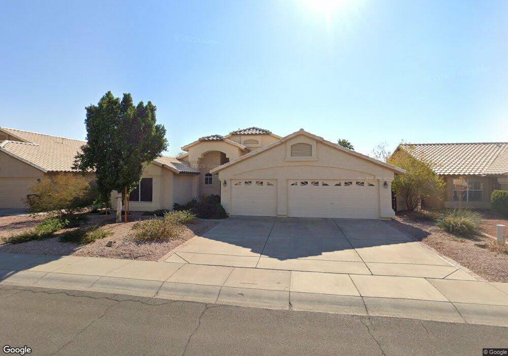
9947 W Mohawk Ln Peoria, AZ 85382
Estimated Value: $560,764 - $669,000
3
Beds
2
Baths
2,286
Sq Ft
$258/Sq Ft
Est. Value
About This Home
This home is located at 9947 W Mohawk Ln, Peoria, AZ 85382 and is currently estimated at $590,691, approximately $258 per square foot. 9947 W Mohawk Ln is a home located in Maricopa County with nearby schools including Parkridge Elementary School, Sunrise Mountain High School, and Guidepost Montessori at Peoria.
Ownership History
Date
Name
Owned For
Owner Type
Purchase Details
Closed on
Nov 16, 2009
Sold by
Heaps Lezlee
Bought by
Perry Suzanne
Current Estimated Value
Home Financials for this Owner
Home Financials are based on the most recent Mortgage that was taken out on this home.
Original Mortgage
$144,000
Outstanding Balance
$93,641
Interest Rate
4.92%
Mortgage Type
New Conventional
Estimated Equity
$497,050
Purchase Details
Closed on
Jul 3, 2004
Sold by
Heaps Michael L and Heaps Leslee
Bought by
Heaps Lezlee
Home Financials for this Owner
Home Financials are based on the most recent Mortgage that was taken out on this home.
Original Mortgage
$193,500
Interest Rate
5.92%
Mortgage Type
New Conventional
Purchase Details
Closed on
Jul 2, 1999
Sold by
Rakovich Emil G and Rakovich Debra
Bought by
Heaps Michael L and Heaps Lezlee
Home Financials for this Owner
Home Financials are based on the most recent Mortgage that was taken out on this home.
Original Mortgage
$140,000
Interest Rate
7.64%
Mortgage Type
New Conventional
Create a Home Valuation Report for This Property
The Home Valuation Report is an in-depth analysis detailing your home's value as well as a comparison with similar homes in the area
Home Values in the Area
Average Home Value in this Area
Purchase History
| Date | Buyer | Sale Price | Title Company |
|---|---|---|---|
| Perry Suzanne | $246,662 | Stewart Title & Trust Of Pho | |
| Heaps Lezlee | -- | Ticor Title Agency Of Az Inc | |
| Heaps Michael L | $190,000 | Capital Title Agency |
Source: Public Records
Mortgage History
| Date | Status | Borrower | Loan Amount |
|---|---|---|---|
| Open | Perry Suzanne | $144,000 | |
| Previous Owner | Heaps Lezlee | $193,500 | |
| Previous Owner | Heaps Michael L | $140,000 |
Source: Public Records
Tax History Compared to Growth
Tax History
| Year | Tax Paid | Tax Assessment Tax Assessment Total Assessment is a certain percentage of the fair market value that is determined by local assessors to be the total taxable value of land and additions on the property. | Land | Improvement |
|---|---|---|---|---|
| 2025 | $2,189 | $28,239 | -- | -- |
| 2024 | $2,214 | $26,895 | -- | -- |
| 2023 | $2,214 | $41,330 | $8,260 | $33,070 |
| 2022 | $2,167 | $31,760 | $6,350 | $25,410 |
| 2021 | $2,316 | $29,320 | $5,860 | $23,460 |
| 2020 | $2,339 | $27,980 | $5,590 | $22,390 |
| 2019 | $2,266 | $25,960 | $5,190 | $20,770 |
| 2018 | $2,170 | $24,930 | $4,980 | $19,950 |
| 2017 | $2,175 | $23,110 | $4,620 | $18,490 |
| 2016 | $2,109 | $22,410 | $4,480 | $17,930 |
| 2015 | $2,008 | $21,730 | $4,340 | $17,390 |
Source: Public Records
Map
Nearby Homes
- 20640 N 100th Ln
- 10001 W Potter Dr
- 9729 W Burnett Rd
- 9818 W Pontiac Dr
- 10169 W Potter Dr
- 9901 W Mescalero Ct
- 20967 N 96th Ln
- 10134 W Pine Springs Dr
- 19838 N Pine Springs Dr
- 20961 N 96th Dr
- 9869 W Chino Dr
- 20424 N 96th Ln
- 19829 N Lake Forest Dr
- 9832 W Behrend Dr
- 10344 W Burnett Rd
- 10379 W Tonopah Dr
- 10347 W Mohawk Ln
- 19702 N 98th Ln
- 9717 W Marco Polo Rd
- 19825 N 100th Ave
- 9953 W Mohawk Ln
- 9941 W Mohawk Ln
- 20526 N 99th Dr
- 9935 W Mohawk Ln
- 9954 W Runion Dr
- 9948 W Mohawk Ln
- 0000 W Runion Dr
- 9960 W Mohawk Ln
- 27504 N 99 Ave Unit 2
- 27500 N 99 Ave Unit 1
- 27602 N 99 Ave
- 20516 N 99th Dr
- 9965 W Mohawk Ln
- 20536 N 99th Dr
- 9960 W Runion Dr
- 9942 W Mohawk Ln
- 9929 W Mohawk Ln
- 9966 W Mohawk Ln
- 9936 W Mohawk Ln
- 9966 W Runion Dr