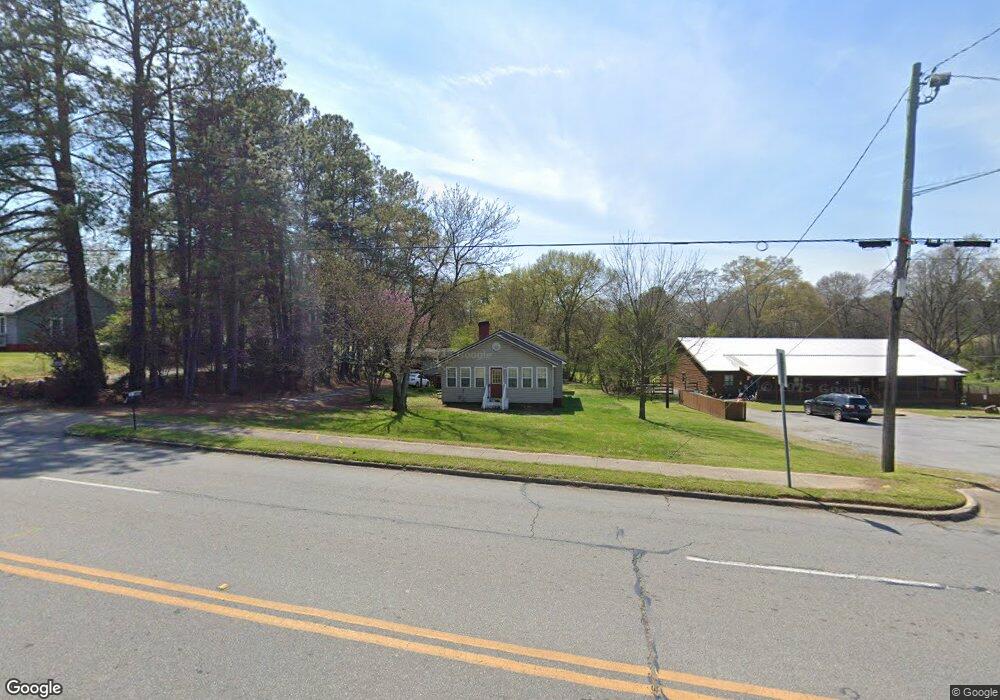
995 Cedartown Hwy Rockmart, GA 30153
Estimated Value: $172,000 - $181,750
2
Beds
1
Bath
1,224
Sq Ft
$146/Sq Ft
Est. Value
About This Home
This home is located at 995 Cedartown Hwy, Rockmart, GA 30153 and is currently estimated at $178,188, approximately $145 per square foot. 995 Cedartown Hwy is a home located in Polk County with nearby schools including Rockmart Middle School.
Ownership History
Date
Name
Owned For
Owner Type
Purchase Details
Closed on
Feb 21, 2024
Sold by
Gore Jan
Bought by
Moates Sara Jo
Current Estimated Value
Purchase Details
Closed on
Apr 26, 2010
Sold by
Moates Billy & Sara D
Bought by
Gore Jan Cope Kathy and Gore Jan Daniel Holland
Purchase Details
Closed on
Mar 29, 1999
Sold by
Kato Pell W and Kato Glenda M
Bought by
Moates Billy and Moates Sara D
Purchase Details
Closed on
Dec 6, 1993
Sold by
Lindsey Richard Keith
Bought by
Kato Pell W and Kato Glenda M
Purchase Details
Closed on
Oct 4, 1990
Sold by
Davis Sara E
Bought by
Lindsey Richard K
Purchase Details
Closed on
Oct 30, 1981
Sold by
Weaver Gus Mrs
Bought by
Davis Sara E
Purchase Details
Closed on
Jan 2, 1945
Bought by
Weaver Gus Mrs
Create a Home Valuation Report for This Property
The Home Valuation Report is an in-depth analysis detailing your home's value as well as a comparison with similar homes in the area
Home Values in the Area
Average Home Value in this Area
Purchase History
| Date | Buyer | Sale Price | Title Company |
|---|---|---|---|
| Moates Sara Jo | -- | -- | |
| Gore Jan Cope Kathy | -- | -- | |
| Moates Billy | $15,000 | -- | |
| Kato Pell W | $33,500 | -- | |
| Lindsey Richard K | $75,000 | -- | |
| Davis Sara E | -- | -- | |
| Weaver Gus Mrs | -- | -- |
Source: Public Records
Tax History Compared to Growth
Tax History
| Year | Tax Paid | Tax Assessment Tax Assessment Total Assessment is a certain percentage of the fair market value that is determined by local assessors to be the total taxable value of land and additions on the property. | Land | Improvement |
|---|---|---|---|---|
| 2024 | $1,174 | $56,178 | $4,800 | $51,378 |
| 2023 | $762 | $32,121 | $4,416 | $27,705 |
| 2022 | $660 | $27,825 | $4,416 | $23,409 |
| 2021 | $669 | $27,825 | $4,416 | $23,409 |
| 2020 | $670 | $27,825 | $4,416 | $23,409 |
| 2019 | $594 | $22,132 | $4,488 | $17,644 |
| 2018 | $594 | $21,572 | $4,488 | $17,084 |
| 2017 | $587 | $21,572 | $4,488 | $17,084 |
| 2016 | $587 | $21,572 | $4,488 | $17,084 |
| 2015 | $589 | $21,572 | $4,488 | $17,084 |
| 2014 | $527 | $19,168 | $2,030 | $17,138 |
Source: Public Records
Map
Nearby Homes
- 1 Pine Mountain Rd
- 132 Highland Dr
- 750 W Church St
- 0 Highway 278 Nathan Dean Bypass Unit 10134156
- 0 Pine Mountain St Unit 10620510
- 0 Pine Mountain St Unit 10620492
- 278 Oak Hill Dr
- 197 Oak Hill Dr
- 300 Church St
- 00 Nathan Dean Pkwy
- 2979 Nathan Dean Pkwy
- 702 Calloway Dr
- 0 Nathan Dean Pkwy Unit 10366146
- 571 N Marble St
- 103 Ivy St
- 2470 Nathan Dean Pkwy
- 119 Pearl St
- 540 N Marble St
- 235 Mountain Way
- 1825 Calloway Path
- 18 Hill St
- 979 Cedartown Hwy
- 34 White St
- 1027 Cedartown Hwy
- 31 Onion Bottom Rd
- 24 Carr Rd
- 38 Onion Bottom Rd
- 21 White St
- 44 White St
- 0 White St Unit 15 LOTS 7295482
- 0 White St Unit 7104882
- 0 Carr Rd
- 1057 Cedartown Hwy
- 53 Brackett Hill Rd
- 34 Hill Ln
- 34 Hill St
- 34 Hill St
- 34 Hill St
- 1048 Cedartown Hwy
- 25 Carr Rd