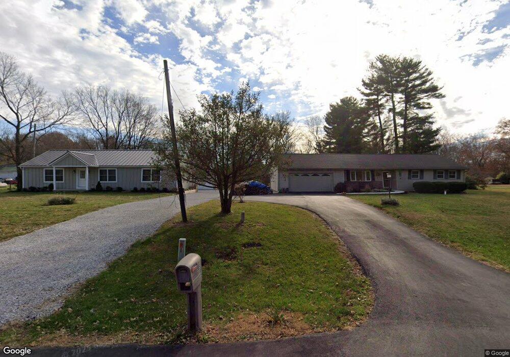
995 Groveport Rd Canal Winchester, OH 43110
Estimated Value: $509,000 - $773,213
4
Beds
4
Baths
3,848
Sq Ft
$181/Sq Ft
Est. Value
About This Home
This home is located at 995 Groveport Rd, Canal Winchester, OH 43110 and is currently estimated at $697,553, approximately $181 per square foot. 995 Groveport Rd is a home with nearby schools including Winchester Trail Elementary School, Indian Trail Elementary School, and Canal Winchester Middle School.
Ownership History
Date
Name
Owned For
Owner Type
Purchase Details
Closed on
Sep 27, 2007
Sold by
Howard Helen and Young Rita M
Bought by
Dowden David and Dowden Shirlee
Current Estimated Value
Purchase Details
Closed on
Oct 20, 1997
Sold by
Estate Of Fleming Howard
Bought by
Howard Claudia M
Purchase Details
Closed on
Feb 10, 1993
Sold by
Howard Claudia and Howard Claudia M
Bought by
Howard Helen C
Create a Home Valuation Report for This Property
The Home Valuation Report is an in-depth analysis detailing your home's value as well as a comparison with similar homes in the area
Home Values in the Area
Average Home Value in this Area
Purchase History
| Date | Buyer | Sale Price | Title Company |
|---|---|---|---|
| Dowden David | $10,600 | Gahanna | |
| Howard Claudia M | -- | -- | |
| Howard Helen C | $2,400 | -- |
Source: Public Records
Tax History Compared to Growth
Tax History
| Year | Tax Paid | Tax Assessment Tax Assessment Total Assessment is a certain percentage of the fair market value that is determined by local assessors to be the total taxable value of land and additions on the property. | Land | Improvement |
|---|---|---|---|---|
| 2024 | $12,565 | $224,950 | $45,960 | $178,990 |
| 2023 | $12,494 | $224,945 | $45,955 | $178,990 |
| 2022 | $11,079 | $168,320 | $24,120 | $144,200 |
| 2021 | $11,196 | $168,320 | $24,120 | $144,200 |
| 2020 | $11,170 | $168,320 | $24,120 | $144,200 |
| 2019 | $10,900 | $140,250 | $20,090 | $120,160 |
| 2018 | $10,050 | $140,250 | $20,090 | $120,160 |
| 2017 | $10,000 | $140,250 | $20,090 | $120,160 |
| 2016 | $8,981 | $105,700 | $18,760 | $86,940 |
| 2015 | $9,006 | $105,700 | $18,760 | $86,940 |
| 2014 | $8,397 | $105,700 | $18,760 | $86,940 |
| 2013 | $4,149 | $105,700 | $18,760 | $86,940 |
Source: Public Records
Map
Nearby Homes
- 963 Groveport Rd
- 0 Groveport Rd
- 6470 Fox Hill Dr
- 6910 Canal St
- 6571 Hemmingford Dr
- 6558 Hemmingford Dr
- 6430 Rossmore Ln
- 6185 Dietz Dr
- 7170 Seymour Ct
- 7412 Connor Ct
- 6516 Lakeview Cir Unit 6516
- 525 Gender Rd
- 7191 Rosemount Way
- 6641 Steen St
- 6668 Cherry Bend
- 7362 Bromfield Dr
- 7288 Bromfield Dr
- 7265 Bromfield Dr
- 6172 Eagle Dr Unit 6172
- 359 W Waterloo St
- 941 Groveport Rd
- 985 Groveport Rd
- 1007 Groveport Rd
- 974 Groveport Rd
- 974 Groveport Rd
- 1037 Groveport Rd
- 93 Gender Rd
- 913 Groveport Rd
- 859 Groveport Rd
- 5050 Dacron Place
- 849 Groveport Rd
- 865 Groveport Rd
- 829 Groveport Rd
- 970 W Walnut St
- 819 Groveport Rd
- 960 W Walnut St
- 978 W Walnut St
- 220 Gender Rd
- 226 Gender Rd
- 0 W Walnut St