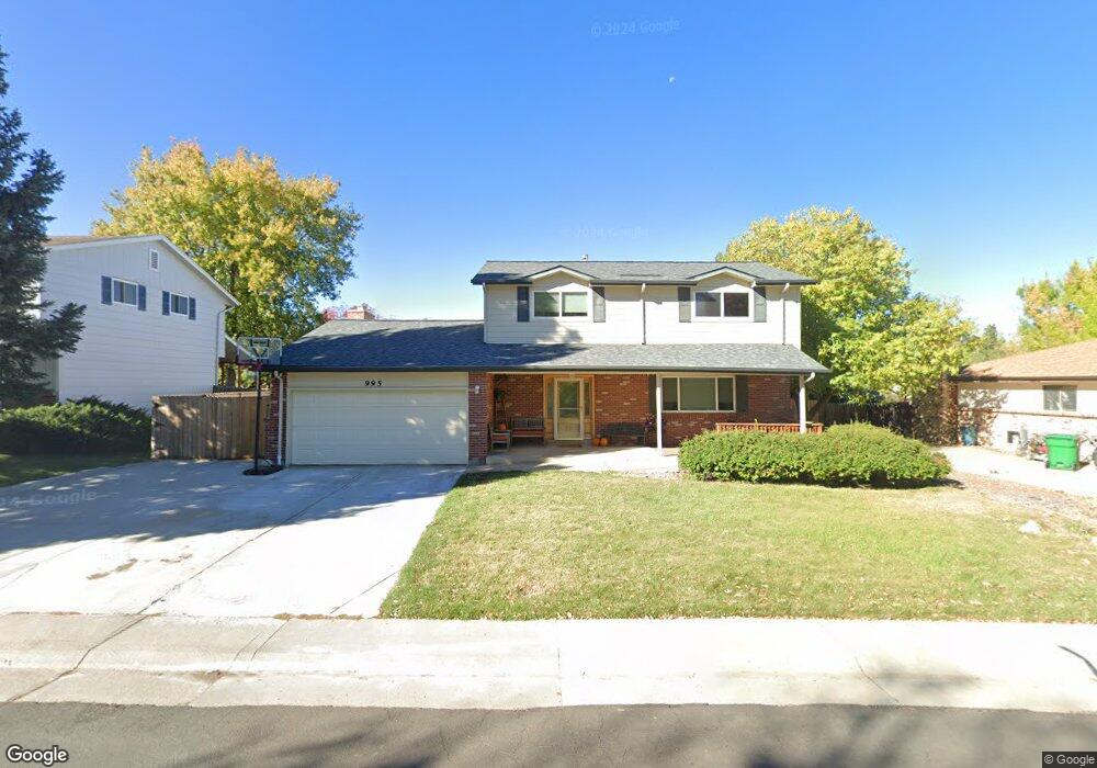
995 Mercury Cir Lone Tree, CO 80124
Estimated Value: $640,721 - $651,000
5
Beds
3
Baths
2,731
Sq Ft
$236/Sq Ft
Est. Value
About This Home
This home is located at 995 Mercury Cir, Lone Tree, CO 80124 and is currently estimated at $645,861, approximately $236 per square foot. 995 Mercury Cir is a home located in Douglas County with nearby schools including Acres Green Elementary School, Cresthill Middle School, and Highlands Ranch High School.
Ownership History
Date
Name
Owned For
Owner Type
Purchase Details
Closed on
Feb 18, 2022
Sold by
Roney Steven W
Bought by
Rooney Kevin D and Rooney Rachel N
Current Estimated Value
Home Financials for this Owner
Home Financials are based on the most recent Mortgage that was taken out on this home.
Original Mortgage
$199,724
Outstanding Balance
$184,750
Interest Rate
3.55%
Mortgage Type
New Conventional
Estimated Equity
$461,111
Purchase Details
Closed on
Apr 4, 1994
Sold by
Gurksnis Thomas William and Gurksnis Gayle Ann
Bought by
Roney Steven W and Roney Linda S
Home Financials for this Owner
Home Financials are based on the most recent Mortgage that was taken out on this home.
Original Mortgage
$127,700
Interest Rate
7.31%
Purchase Details
Closed on
Mar 13, 1987
Sold by
Nuss Gerald L and Nuss Patricia R
Bought by
Gurksnis Thomas William and Gurksnis Gayle Ann
Purchase Details
Closed on
Mar 4, 1983
Sold by
Duncan Robert W and Duncan Elizabeth M
Bought by
Nuss Gerald L and Nuss Patricia R
Create a Home Valuation Report for This Property
The Home Valuation Report is an in-depth analysis detailing your home's value as well as a comparison with similar homes in the area
Home Values in the Area
Average Home Value in this Area
Purchase History
| Date | Buyer | Sale Price | Title Company |
|---|---|---|---|
| Rooney Kevin D | $599,724 | New Title Company Name | |
| Roney Steven W | $141,900 | -- | |
| Gurksnis Thomas William | $98,500 | -- | |
| Nuss Gerald L | $94,900 | -- |
Source: Public Records
Mortgage History
| Date | Status | Borrower | Loan Amount |
|---|---|---|---|
| Open | Rooney Kevin D | $199,724 | |
| Previous Owner | Roney Steven W | $127,700 |
Source: Public Records
Tax History Compared to Growth
Tax History
| Year | Tax Paid | Tax Assessment Tax Assessment Total Assessment is a certain percentage of the fair market value that is determined by local assessors to be the total taxable value of land and additions on the property. | Land | Improvement |
|---|---|---|---|---|
| 2024 | $3,748 | $44,530 | $8,040 | $36,490 |
| 2023 | $3,787 | $44,530 | $8,040 | $36,490 |
| 2022 | $2,533 | $28,440 | $6,820 | $21,620 |
| 2021 | $2,634 | $28,440 | $6,820 | $21,620 |
| 2020 | $2,510 | $27,770 | $6,440 | $21,330 |
| 2019 | $2,519 | $27,770 | $6,440 | $21,330 |
| 2018 | $2,011 | $23,750 | $5,610 | $18,140 |
| 2017 | $2,044 | $23,750 | $5,610 | $18,140 |
| 2016 | $1,831 | $20,840 | $3,990 | $16,850 |
| 2015 | $1,873 | $20,840 | $3,990 | $16,850 |
| 2014 | $1,679 | $17,500 | $3,980 | $13,520 |
Source: Public Records
Map
Nearby Homes
- 789 Hamal Dr
- 13117 Deneb Dr
- 13134 Deneb Dr
- 802 Altair Dr
- 8159 Lodgepole Trail
- 9275 Erminedale Dr
- 9412 La Quinta Way
- 7057 Chestnut Hill St
- 9308 Miles Dr Unit 5
- 7041 Chestnut Hill Trail
- 6887 Chestnut Hill St
- 13483 Achilles Dr
- 181 Dianna Dr
- 7469 La Quinta Place
- 13542 Achilles Dr
- 130 Dianna Dr
- 8822 Fiesta Terrace
- 8860 Kachina Way
- 108 Olympus Cir
- 9390 Yale Ln
- 999 Mercury Cir
- 989 Mercury Cir
- 13082 Peacock Dr
- 13092 Peacock Dr
- 13072 Peacock Dr
- 994 Mercury Cir
- 13031 Mercury Dr
- 985 Mercury Cir
- 988 Mercury Cir
- 13124 Peacock Dr
- 13037 Mercury Dr
- 986 Mercury Cir
- 780 Hamal Dr
- 765 Mercury Cir
- 13134 Peacock Dr
- 752 Mercury Cir
- 13143 Spica Dr
- 756 Mercury Cir
- 984 Mercury Cir
- 13030 Mercury Dr