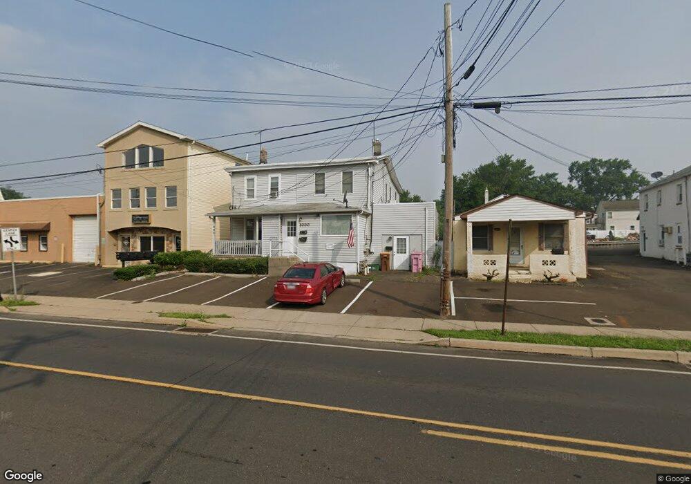
996 Bristol Pike Bensalem, PA 19020
Estimated Value: $312,000 - $404,000
4
Beds
1
Bath
1,408
Sq Ft
$240/Sq Ft
Est. Value
About This Home
This home is located at 996 Bristol Pike, Bensalem, PA 19020 and is currently estimated at $337,257, approximately $239 per square foot. 996 Bristol Pike is a home located in Bucks County with nearby schools including Robert K. Shafer Middle School, School Lane Charter School, and St Charles Borromeo School.
Ownership History
Date
Name
Owned For
Owner Type
Purchase Details
Closed on
Jun 11, 2008
Sold by
Shubert Joseph and Webb Raymond
Bought by
Shubert Joseph
Current Estimated Value
Purchase Details
Closed on
Apr 13, 2005
Sold by
Knoblauch & Blaszczyk Partnership
Bought by
Shubert Joseph and Webb Raymond
Home Financials for this Owner
Home Financials are based on the most recent Mortgage that was taken out on this home.
Original Mortgage
$228,000
Interest Rate
5.78%
Mortgage Type
Unknown
Create a Home Valuation Report for This Property
The Home Valuation Report is an in-depth analysis detailing your home's value as well as a comparison with similar homes in the area
Home Values in the Area
Average Home Value in this Area
Purchase History
| Date | Buyer | Sale Price | Title Company |
|---|---|---|---|
| Shubert Joseph | $116,494 | None Available | |
| Shubert Joseph | $285,000 | -- |
Source: Public Records
Mortgage History
| Date | Status | Borrower | Loan Amount |
|---|---|---|---|
| Previous Owner | Shubert Joseph | $228,000 |
Source: Public Records
Tax History Compared to Growth
Tax History
| Year | Tax Paid | Tax Assessment Tax Assessment Total Assessment is a certain percentage of the fair market value that is determined by local assessors to be the total taxable value of land and additions on the property. | Land | Improvement |
|---|---|---|---|---|
| 2025 | $2,008 | $9,200 | $4,800 | $4,400 |
| 2024 | $2,008 | $9,200 | $4,800 | $4,400 |
| 2023 | $423 | $9,200 | $4,800 | $4,400 |
| 2022 | $1,940 | $9,200 | $4,800 | $4,400 |
| 2021 | $1,940 | $9,200 | $4,800 | $4,400 |
| 2020 | $1,921 | $9,200 | $4,800 | $4,400 |
| 2019 | $1,878 | $9,200 | $4,800 | $4,400 |
| 2018 | $1,834 | $9,200 | $4,800 | $4,400 |
| 2017 | $1,823 | $9,200 | $4,800 | $4,400 |
| 2016 | $1,823 | $9,200 | $4,800 | $4,400 |
| 2015 | -- | $9,200 | $4,800 | $4,400 |
| 2014 | -- | $9,200 | $4,800 | $4,400 |
Source: Public Records
Map
Nearby Homes
- 1080 Buttonwood Ave
- 1039 Clinton Ave
- 827 Mitchell Ave
- 1103 Colonial Ave
- 1126 Evelyn Ave
- 4161 Orchard Ln
- 1236 Whittier Ave
- 124 Meadow Ln
- 3727 Pitt Place
- 227 Dimarco Dr
- 3750 00 Clarendon Unit 221
- 3750 Clarendon Ave Unit 3
- 3726 Clarendon Ave
- 102 Village Ln
- 3720 Clarendon Ave
- 3627 N Hereford Ln
- 3623 N Hereford Ln
- 4374 Deerpath Ln
- 3624 E Crown Ave
- 3583 Nottingham Ln
- 984 Bristol Pike
- 1002 Bristol Pike
- 1003 Bristol Pike Unit A
- 972 Bristol Pike
- 1029 Buttonwood Ave
- 1001 Bristol Pike
- 987 Bristol Pike
- 968 Bristol Pike
- 1024 Elwood Ave
- 1011 Bristol Pike
- 1037 Buttonwood Ave
- 1029 Bristol Pike
- 1023 Bristol Pike
- 962 Bristol Pike
- 1039 Buttonwood Ave
- 956 Bristol Pike
- 1044 Elwood Ave
- 1045 Buttonwood Ave
- 1032 Elwood Ave
- 961 Bristol Pike