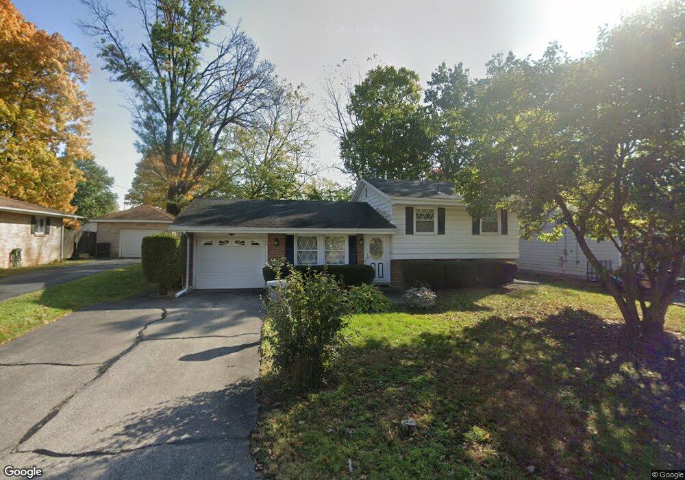
996 Edison Ave Marion, OH 43302
Estimated Value: $137,000 - $147,000
3
Beds
1
Bath
925
Sq Ft
$153/Sq Ft
Est. Value
About This Home
This home is located at 996 Edison Ave, Marion, OH 43302 and is currently estimated at $141,296, approximately $152 per square foot. 996 Edison Ave is a home located in Marion County with nearby schools including William McKinley Elementary School, Ulysses S. Grant Middle School, and Harding High School.
Ownership History
Date
Name
Owned For
Owner Type
Purchase Details
Closed on
Nov 29, 2023
Sold by
Temple Barney B
Bought by
Hensley Barry D and Hensley Carrie A
Current Estimated Value
Purchase Details
Closed on
Jul 7, 2009
Sold by
Temple Barney B
Bought by
Temple Randall A
Purchase Details
Closed on
Nov 13, 2006
Sold by
Estate Of Vera V Temple
Bought by
Temple Barney B
Create a Home Valuation Report for This Property
The Home Valuation Report is an in-depth analysis detailing your home's value as well as a comparison with similar homes in the area
Home Values in the Area
Average Home Value in this Area
Purchase History
| Date | Buyer | Sale Price | Title Company |
|---|---|---|---|
| Hensley Barry D | $717 | None Listed On Document | |
| Hensley Barry D | $717 | None Listed On Document | |
| Temple Randall A | $80,000 | None Available | |
| Temple Barney B | -- | None Available |
Source: Public Records
Tax History
| Year | Tax Paid | Tax Assessment Tax Assessment Total Assessment is a certain percentage of the fair market value that is determined by local assessors to be the total taxable value of land and additions on the property. | Land | Improvement |
|---|---|---|---|---|
| 2025 | $1,401 | $49,710 | $4,140 | $45,570 |
| 2024 | $1,401 | $36,520 | $4,040 | $32,480 |
| 2023 | $1,401 | $36,520 | $4,040 | $32,480 |
| 2022 | $965 | $36,520 | $4,040 | $32,480 |
| 2021 | $765 | $28,540 | $3,510 | $25,030 |
| 2020 | $765 | $28,540 | $3,510 | $25,030 |
| 2019 | $764 | $28,540 | $3,510 | $25,030 |
| 2018 | $638 | $25,270 | $3,470 | $21,800 |
| 2017 | $646 | $25,270 | $3,470 | $21,800 |
| 2016 | $641 | $25,270 | $3,470 | $21,800 |
| 2015 | $1,006 | $24,660 | $3,300 | $21,360 |
| 2014 | $1,008 | $24,660 | $3,300 | $21,360 |
| 2012 | $628 | $24,440 | $2,820 | $21,620 |
Source: Public Records
Map
Nearby Homes
- 981 Davids St
- 780 Sheridan Rd
- 839 Merkle Ave
- 1215 Heritage Ln
- 764 Merkle Ave
- 793 Congress St
- 863 Congress St
- 1025 Congress St
- 681 Davids St
- 982 Oak Grove Ave
- 645 Henry St
- 589 Uncapher Ave
- 579 Henry St
- 4 Poppy Place
- 1316 Hickory Dr
- 638 Miami St
- 340 Marion Ave
- 545 Blaine Ave
- 472 Clinton St
- 363 S Prospect St
- 988 Edison Ave
- 1004 Edison Ave
- 980 Edison Ave
- 1012 Edison Ave
- 0 Edison Ave
- 997 Edison Ave
- 989 Edison Ave
- 1005 Edison Ave
- 1007 Uncapher Ave
- 981 Edison Ave
- 972 Edison Ave
- 1021 Uncapher Ave
- 1015 Edison Ave
- 1001 Uncapher Ave
- 1022 Edison Ave
- 1025 Uncapher Ave
- 973 Edison Ave
- 964 Edison Ave
- 1033 Uncapher Ave
- 979 Uncapher Ave
Your Personal Tour Guide
Ask me questions while you tour the home.