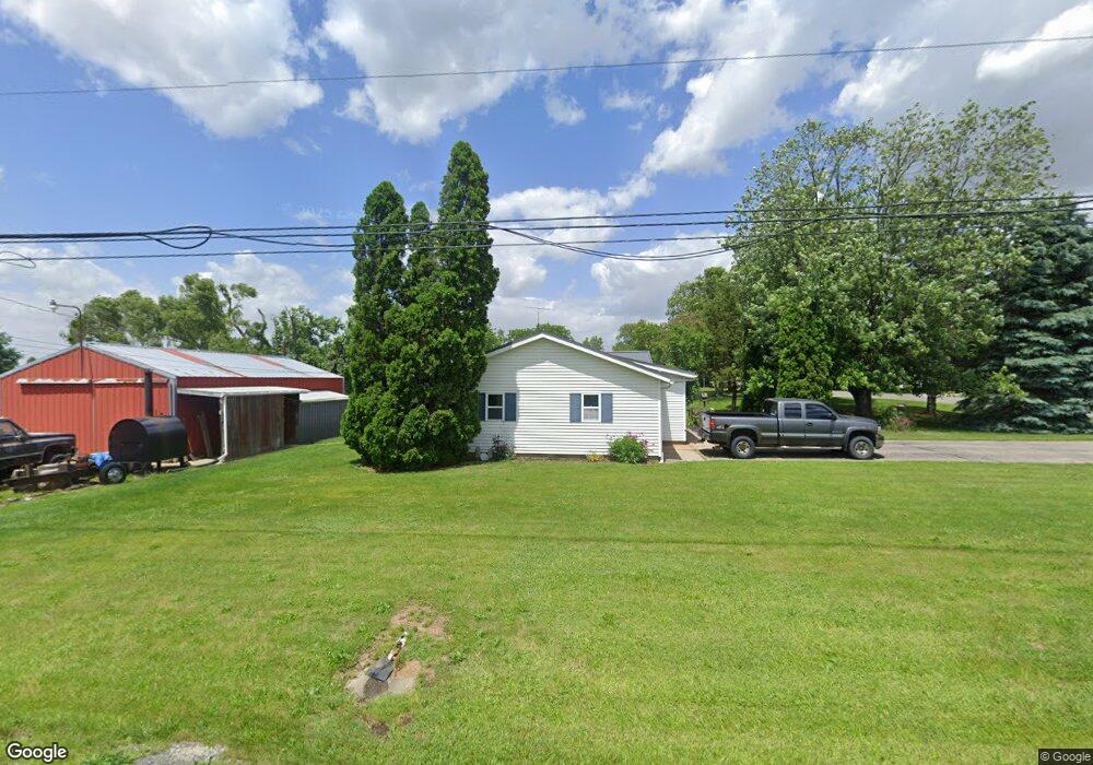
996 S Delaney Rd Owosso, MI 48867
Estimated Value: $118,000 - $202,000
--
Bed
--
Bath
--
Sq Ft
0.3
Acres
About This Home
This home is located at 996 S Delaney Rd, Owosso, MI 48867 and is currently estimated at $160,230. 996 S Delaney Rd is a home located in Shiawassee County with nearby schools including Owosso High School, Spring Vale Christian School, and Salem Lutheran School.
Ownership History
Date
Name
Owned For
Owner Type
Purchase Details
Closed on
Jan 23, 2023
Sold by
Kline Tonya Lynn
Bought by
Kline Butch
Current Estimated Value
Purchase Details
Closed on
Feb 8, 2021
Sold by
Kline Butch and Kline Tonya Lynn
Bought by
Kline Butch
Purchase Details
Closed on
Sep 21, 2020
Sold by
Kline Butch
Bought by
Kline Butch and Kline Tonya
Purchase Details
Closed on
Sep 2, 2020
Sold by
Kline Tonya Lynn and Kline Butch
Bought by
Kline Butch
Purchase Details
Closed on
Oct 4, 2017
Sold by
Kline Butch
Bought by
Kline Butch and Kline Tonya
Purchase Details
Closed on
Feb 19, 2015
Sold by
Donelson Danny L and Donelson Robin
Bought by
Donelson Robin and Donelson Danny L
Create a Home Valuation Report for This Property
The Home Valuation Report is an in-depth analysis detailing your home's value as well as a comparison with similar homes in the area
Home Values in the Area
Average Home Value in this Area
Purchase History
| Date | Buyer | Sale Price | Title Company |
|---|---|---|---|
| Kline Butch | -- | -- | |
| Kline Butch | -- | None Available | |
| Kline Butch | -- | None Available | |
| Kline Butch | -- | None Available | |
| Kline Butch | -- | None Available | |
| Donelson Robin | -- | -- |
Source: Public Records
Tax History Compared to Growth
Tax History
| Year | Tax Paid | Tax Assessment Tax Assessment Total Assessment is a certain percentage of the fair market value that is determined by local assessors to be the total taxable value of land and additions on the property. | Land | Improvement |
|---|---|---|---|---|
| 2025 | $1,407 | $73,100 | $0 | $0 |
| 2024 | $1,432 | $70,900 | $0 | $0 |
| 2023 | $497 | $66,300 | $0 | $0 |
| 2022 | $473 | $60,000 | $0 | $0 |
| 2021 | $1,256 | $50,000 | $0 | $0 |
| 2020 | $1,255 | $47,600 | $0 | $0 |
| 2019 | $1,235 | $44,600 | $0 | $0 |
| 2018 | $1,248 | $43,800 | $0 | $0 |
| 2017 | $1,024 | $41,800 | $0 | $0 |
| 2016 | -- | $41,800 | $0 | $0 |
| 2015 | -- | $39,000 | $0 | $0 |
| 2014 | $5 | $36,100 | $0 | $0 |
Source: Public Records
Map
Nearby Homes
- 539 W Wildwood Dr
- 1701 W Stewart St
- 717 Nafus St
- 1510 S Chipman St
- V/L W South St
- 1610 W South St
- 1318 W Stewart St
- Vacant Ash St
- 411 Robbins St
- 1560 S M 52
- 1627 Michigan 52
- 1434 S Pearce St
- 1300 S Pearce St
- 117 Elliot St
- 1046 S Pearce St
- 821 Fletcher St
- 309 State St
- 3006 W M 21
- 606 Ryan St
- 1114 Beehler St
- 988 S Delaney Rd
- 0 S Delaney Rd
- 980 S Delaney Rd
- 985 S Delaney Rd
- 2098 Krouse Rd
- 1007 S Delaney Rd
- 2122 Krouse Rd
- 2184 Krouse Rd
- 2142 Krouse Rd
- 833 S Delaney Rd
- 1175 S Delaney Rd
- 1175 S Delaney Rd
- 1185 S Delaney Rd
- 809 S Delaney Rd
- 1195 S Delaney Rd
- 2226 Krouse Rd
- 1788 Krouse Rd
- 1257 S Delaney Rd
- 1784 Krouse Rd