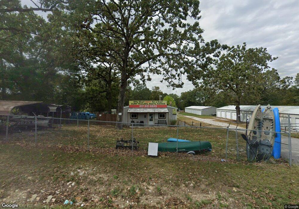
9965 State Highway 76 Forsyth, MO 65653
Estimated Value: $376,286
--
Bed
1
Bath
9,000
Sq Ft
$42/Sq Ft
Est. Value
About This Home
This home is located at 9965 State Highway 76, Forsyth, MO 65653 and is currently priced at $376,286, approximately $41 per square foot. 9965 State Highway 76 is a home located in Taney County with nearby schools including Forsyth Elementary School, Forsyth Middle School, and Forsyth High School.
Ownership History
Date
Name
Owned For
Owner Type
Purchase Details
Closed on
Jan 30, 2024
Sold by
3308 Dunkirk Dr Llc
Bought by
G & S Branson Llc
Current Estimated Value
Purchase Details
Closed on
Dec 29, 2023
Sold by
Thibodeaux Family Irrevocable Trust
Bought by
3308 Dunkirk Dr Llc
Purchase Details
Closed on
May 5, 2021
Sold by
Dvs Investments Inc
Bought by
Thibodeaux Family Irrevocable Trust
Home Financials for this Owner
Home Financials are based on the most recent Mortgage that was taken out on this home.
Original Mortgage
$335,000
Interest Rate
3.2%
Mortgage Type
Seller Take Back
Create a Home Valuation Report for This Property
The Home Valuation Report is an in-depth analysis detailing your home's value as well as a comparison with similar homes in the area
Home Values in the Area
Average Home Value in this Area
Purchase History
| Date | Buyer | Sale Price | Title Company |
|---|---|---|---|
| G & S Branson Llc | -- | None Listed On Document | |
| 3308 Dunkirk Dr Llc | -- | None Listed On Document | |
| Thibodeaux Family Irrevocable Trust | -- | None Listed On Document |
Source: Public Records
Mortgage History
| Date | Status | Borrower | Loan Amount |
|---|---|---|---|
| Previous Owner | Thibodeaux Family Irrevocable Trust | $335,000 |
Source: Public Records
Tax History Compared to Growth
Tax History
| Year | Tax Paid | Tax Assessment Tax Assessment Total Assessment is a certain percentage of the fair market value that is determined by local assessors to be the total taxable value of land and additions on the property. | Land | Improvement |
|---|---|---|---|---|
| 2025 | $1,749 | $34,720 | -- | -- |
| 2023 | $1,749 | $34,110 | $0 | $0 |
| 2022 | $1,733 | $34,110 | $0 | $0 |
| 2021 | $1,729 | $34,110 | $0 | $0 |
| 2019 | $1,694 | $34,110 | $0 | $0 |
| 2018 | $1,688 | $34,110 | $0 | $0 |
| 2017 | $1,688 | $34,110 | $0 | $0 |
| 2016 | $1,184 | $24,020 | $0 | $0 |
| 2015 | $1,184 | $24,020 | $0 | $0 |
| 2014 | $1,150 | $22,930 | $0 | $0 |
Source: Public Records
Map
Nearby Homes
- 302 Field Rd
- 315 Mccann Rd
- 33 Robin Ln
- 1 Lookout
- 2 Lookout
- 3 Lookout Rd
- 949 Wayland Dr
- 000 Burmingham Rd
- 644 Wayland Dr
- 352 Scenic Dr
- Lot 18 Long View Point
- 421 Newport Dr
- 443 Newport Dr
- 340 Shady Oaks Shore
- 925 Wayland Dr
- 235 Shady Oaks Shore Unit Lot 45
- 000 Shady Oaks Shore Unit Lot 46
- 11675 State Highway 76
- 000 State Highway Y
- 249 Mount Vernon Rd
- 9955 State Highway 76
- 9901 State Highway 76
- 10000 State Highway 76
- 9871 State Highway 76
- 10033 State Highway 76
- 10033 State Highway 76
- 9831 State Highway 76
- 230 E Silver Creek
- 230 E Silver Creek Rd
- 9817 State Highway 76
- 10102 State Highway 76
- 124 E Silver Creek Rd
- 162 E Silver Creek
- 10116 State Highway 76
- Tbd Missouri 76
- Lot 2 Missouri 76
- Lot 3 Missouri 76
- 000 Missouri 76
- 0 Missouri 76
- 10124 State Highway 76