Estimated Value: $215,000 - $348,000
Studio
2
Baths
1,202
Sq Ft
$233/Sq Ft
Est. Value
About This Home
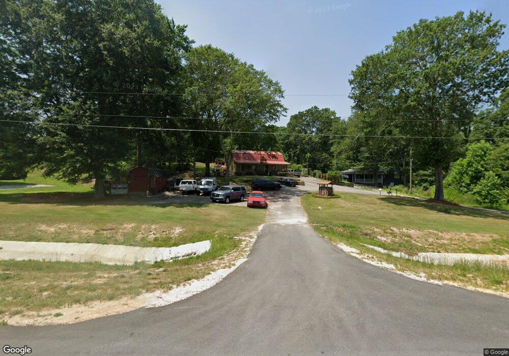
This home is located at 9965 Us Highway 129 N, Talmo, GA 30575 and is currently estimated at $280,533, approximately $233 per square foot. 9965 Us Highway 129 N is a home located in Jackson County with nearby schools including North Jackson Elementary School, West Jackson Middle School, and Jackson County High School.
Ownership History
Date
Name
Owned For
Owner Type
Purchase Details
Closed on
May 24, 2013
Sold by
Northeast Georgia Bank
Bought by
Pruitt Billy
Current Estimated Value
Purchase Details
Closed on
Oct 5, 2010
Sold by
White Tail Meadows Associa
Bought by
Northeast Grorgia Bank
Purchase Details
Closed on
Dec 6, 2005
Sold by
Mccaslin Carl I
Bought by
White Tail Meadows Associates Llc
Home Financials for this Owner
Home Financials are based on the most recent Mortgage that was taken out on this home.
Original Mortgage
$130,250
Interest Rate
6.29%
Mortgage Type
New Conventional
Purchase Details
Closed on
Feb 19, 1998
Sold by
Pethel Frederick and Pethel S
Bought by
Mccaslin Carl I
Purchase Details
Closed on
Jan 18, 1982
Sold by
Breedlove Edward
Bought by
Pethel Frederick and Pethel Shirley
Create a Home Valuation Report for This Property
The Home Valuation Report is an in-depth analysis detailing your home's value as well as a comparison with similar homes in the area
Home Values in the Area
Average Home Value in this Area
Purchase History
| Date | Buyer | Sale Price | Title Company |
|---|---|---|---|
| Pruitt Billy | -- | -- | |
| Northeast Grorgia Bank | $117,478 | -- | |
| White Tail Meadows Associates Llc | $115,000 | -- | |
| Mccaslin Carl I | $60,000 | -- | |
| Pethel Frederick | $43,500 | -- | |
| Pethel Frederick | -- | -- |
Source: Public Records
Mortgage History
| Date | Status | Borrower | Loan Amount |
|---|---|---|---|
| Previous Owner | White Tail Meadows Associates Llc | $130,250 |
Source: Public Records
Tax History
| Year | Tax Paid | Tax Assessment Tax Assessment Total Assessment is a certain percentage of the fair market value that is determined by local assessors to be the total taxable value of land and additions on the property. | Land | Improvement |
|---|---|---|---|---|
| 2024 | $1,543 | $60,800 | $29,640 | $31,160 |
| 2023 | $1,559 | $60,800 | $29,640 | $31,160 |
| 2022 | $1,020 | $35,040 | $10,080 | $24,960 |
| 2021 | $1,030 | $35,040 | $10,080 | $24,960 |
| 2020 | $986 | $30,600 | $10,080 | $20,520 |
| 2019 | $1,006 | $30,600 | $10,080 | $20,520 |
| 2018 | $982 | $29,600 | $10,080 | $19,520 |
| 2017 | $959 | $28,618 | $10,081 | $18,537 |
| 2016 | $964 | $28,618 | $10,081 | $18,537 |
| 2015 | $968 | $28,618 | $10,081 | $18,537 |
| 2014 | $464 | $26,588 | $8,539 | $18,050 |
| 2013 | -- | $27,284 | $8,538 | $18,745 |
Source: Public Records
Map
Nearby Homes
- 815 A J Irvin Rd
- 49 Sweetgum St
- 1 Point Dr
- 259 Cochran Rd
- 1620 Pond Fork Church Rd
- 37 Sealy Place
- 0 Guy Cooper Rd Unit 10545221
- 3930 Mabery Rd
- 4515 Highway 60
- 121 Hewett Rd
- 135 Russell Rd
- 749 Hubert Pittman Tract 3 Rd
- 749 Hubert Pittman Tract 2 Rd
- 749 Hubert Pittman Rd Unit TRACT 2
- 749 Hubert Pittman Rd Unit TRACT 2 AND 3
- 749 Hubert Pittman Rd
- 749 Hubert Pittman Rd Unit TRACT 3
- 393 Walnut Grove Way
- 296 Walnut Grove Way
- 195 Cedar Dr
- 9965 Us Highway 129 N
- 9985 Us Highway 129 N
- 400 Main St
- 404 Main St
- 0 Main St Unit 9025794
- 0 Main St Unit 9025768
- 9468 Us-129 N
- 338 Main St
- 0 Highway 129 N Unit 8381646
- 0 Highway 129 N Unit 7040361
- 0 Highway 129 N Unit 3039974
- 0 Highway 129 N Unit 3240875
- 0 Highway 129 N Unit 3285979
- 0 Highway 129 N Unit 7070278
- 0 Highway 129 N Unit 7159129
- 0 Highway 129 N Unit 7243811
- 0 Highway 129 N Unit 7343287
- 0 Highway 129 N Unit 7429008
- 0 Highway 129 N Unit 10191969
- 0 Highway 129 N Unit 9026619