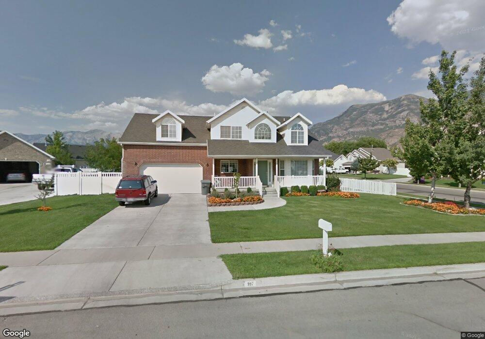
997 E 1370 N American Fork, UT 84003
Estimated Value: $600,000 - $664,000
4
Beds
3
Baths
2,126
Sq Ft
$301/Sq Ft
Est. Value
About This Home
This home is located at 997 E 1370 N, American Fork, UT 84003 and is currently estimated at $639,494, approximately $300 per square foot. 997 E 1370 N is a home located in Utah County with nearby schools including Deerfield Elementary School, Mountain Ridge Junior High School, and American Fork High School.
Ownership History
Date
Name
Owned For
Owner Type
Purchase Details
Closed on
Mar 10, 2006
Sold by
Love Robert H and Love Carolyn
Bought by
Asplund Mark and Asplund Joelle L
Current Estimated Value
Home Financials for this Owner
Home Financials are based on the most recent Mortgage that was taken out on this home.
Original Mortgage
$150,500
Outstanding Balance
$85,107
Interest Rate
6.18%
Mortgage Type
Fannie Mae Freddie Mac
Estimated Equity
$554,387
Purchase Details
Closed on
Nov 26, 1996
Sold by
Patterson Construction Inc
Bought by
Love Robert H and Love Carolyn
Home Financials for this Owner
Home Financials are based on the most recent Mortgage that was taken out on this home.
Original Mortgage
$169,900
Interest Rate
7.91%
Create a Home Valuation Report for This Property
The Home Valuation Report is an in-depth analysis detailing your home's value as well as a comparison with similar homes in the area
Home Values in the Area
Average Home Value in this Area
Purchase History
| Date | Buyer | Sale Price | Title Company |
|---|---|---|---|
| Asplund Mark | -- | Timp Title Insurance Agency | |
| Love Robert H | -- | -- |
Source: Public Records
Mortgage History
| Date | Status | Borrower | Loan Amount |
|---|---|---|---|
| Open | Asplund Mark | $150,500 | |
| Previous Owner | Love Robert H | $169,900 |
Source: Public Records
Tax History
| Year | Tax Paid | Tax Assessment Tax Assessment Total Assessment is a certain percentage of the fair market value that is determined by local assessors to be the total taxable value of land and additions on the property. | Land | Improvement |
|---|---|---|---|---|
| 2025 | $2,578 | $308,000 | -- | -- |
| 2024 | $2,578 | $286,440 | $0 | $0 |
| 2023 | $2,449 | $288,530 | $0 | $0 |
| 2022 | $2,827 | $328,680 | $0 | $0 |
| 2021 | $2,483 | $450,900 | $165,200 | $285,700 |
| 2020 | $2,414 | $425,100 | $153,000 | $272,100 |
| 2019 | $2,119 | $385,900 | $142,300 | $243,600 |
| 2018 | $2,175 | $378,800 | $135,200 | $243,600 |
| 2017 | $2,175 | $204,435 | $0 | $0 |
| 2016 | $1,961 | $171,270 | $0 | $0 |
| 2015 | $1,883 | $156,090 | $0 | $0 |
| 2014 | -- | $140,965 | $0 | $0 |
Source: Public Records
Map
Nearby Homes
- 4568 W Temple Shadows Dr
- 9587 N 4500 W
- 4552 W Windsor Cir
- 1077 N 950 E
- 4531 W Cambridge Dr
- 4979 W Willowbank Dr
- 1125 N 1270 E
- 9752 N Dorchester Dr
- 1045 N 930 E Unit 58
- 5032 W Northwood Ln
- 4968 W Evergreen Ln
- 3518 N 1450 W
- 5061 W Evergreen Ln
- 5042 W Green Ash Ln
- 5034 W Green Ash Ln
- 5056 W Green Ash Ln
- 4998 W Green Ash Ln
- 5022 W Green Ash Ln
- 5092 Elmfield Way
- 4814 W Washoe Ct
Your Personal Tour Guide
Ask me questions while you tour the home.