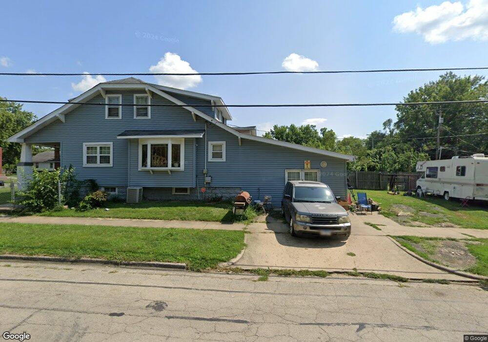
997 N Oakland Ave Decatur, IL 62522
Garfield Park NeighborhoodEstimated Value: $40,000 - $61,073
3
Beds
2
Baths
1,366
Sq Ft
$41/Sq Ft
Est. Value
About This Home
This home is located at 997 N Oakland Ave, Decatur, IL 62522 and is currently estimated at $55,518, approximately $40 per square foot. 997 N Oakland Ave is a home located in Macon County with nearby schools including Stephen Decatur Middle School, St. Patrick School, and Teen Challenge-Home For Girls.
Ownership History
Date
Name
Owned For
Owner Type
Purchase Details
Closed on
May 21, 2008
Sold by
Wace Bank N A
Bought by
Evans Eddie W and Evans Linda K
Current Estimated Value
Home Financials for this Owner
Home Financials are based on the most recent Mortgage that was taken out on this home.
Original Mortgage
$15,200
Interest Rate
6.42%
Mortgage Type
New Conventional
Purchase Details
Closed on
Jan 1, 1994
Create a Home Valuation Report for This Property
The Home Valuation Report is an in-depth analysis detailing your home's value as well as a comparison with similar homes in the area
Home Values in the Area
Average Home Value in this Area
Purchase History
| Date | Buyer | Sale Price | Title Company |
|---|---|---|---|
| Evans Eddie W | $19,000 | None Available | |
| -- | $24,000 | -- |
Source: Public Records
Mortgage History
| Date | Status | Borrower | Loan Amount |
|---|---|---|---|
| Previous Owner | Evans Eddie W | $15,200 |
Source: Public Records
Tax History Compared to Growth
Tax History
| Year | Tax Paid | Tax Assessment Tax Assessment Total Assessment is a certain percentage of the fair market value that is determined by local assessors to be the total taxable value of land and additions on the property. | Land | Improvement |
|---|---|---|---|---|
| 2024 | $814 | $10,690 | $436 | $10,254 |
| 2023 | $837 | $10,312 | $421 | $9,891 |
| 2022 | $967 | $9,451 | $389 | $9,062 |
| 2021 | $908 | $8,827 | $364 | $8,463 |
| 2020 | $895 | $8,418 | $348 | $8,070 |
| 2019 | $895 | $8,418 | $348 | $8,070 |
| 2018 | $969 | $9,221 | $224 | $8,997 |
| 2017 | $992 | $9,467 | $230 | $9,237 |
| 2016 | $1,010 | $9,563 | $232 | $9,331 |
| 2015 | $960 | $9,394 | $228 | $9,166 |
| 2014 | $837 | $8,731 | $1,244 | $7,487 |
| 2013 | $865 | $9,059 | $1,291 | $7,768 |
Source: Public Records
Map
Nearby Homes
- 1065 W Green St
- 917 N Wilder Ave
- 837 W Grand Ave
- 1319 W Waggoner St
- 1451 W Marietta St
- 875 N Monroe St
- 933 W Division St
- 958 W William St
- 1535 N Mcclellan Ave
- 925 W Olive St
- 1530 W Cushing St
- 1545 N Monroe St
- 1645 W Center St
- 1653 N Maple Ave
- 1504 N Monroe St
- 415 W Green St
- 1675 W Center St
- 254 N Pine St
- 844 N Edward St
- 1415 N Dennis Ave
- 989 N Oakland Ave
- 1408 N Oakland Ave
- 985 N Oakland Ave
- 1005 N Oakland Ave
- 1131 W Marietta St
- 1089 W Marietta St
- 1098 W Marietta St
- 970 N Oakland Ave
- 1090 W Marietta St
- 1138 W Marietta St
- 1083 W Marietta St
- 1145 W Marietta St
- 971 N Oakland Ave
- 954 N Hill Ave
- 1009 N Oakland Ave
- 1080 W Marietta St
- 1142 W Marietta St
- 1098 W View St
- 950 N Hill Ave
- 1155 W Marietta St