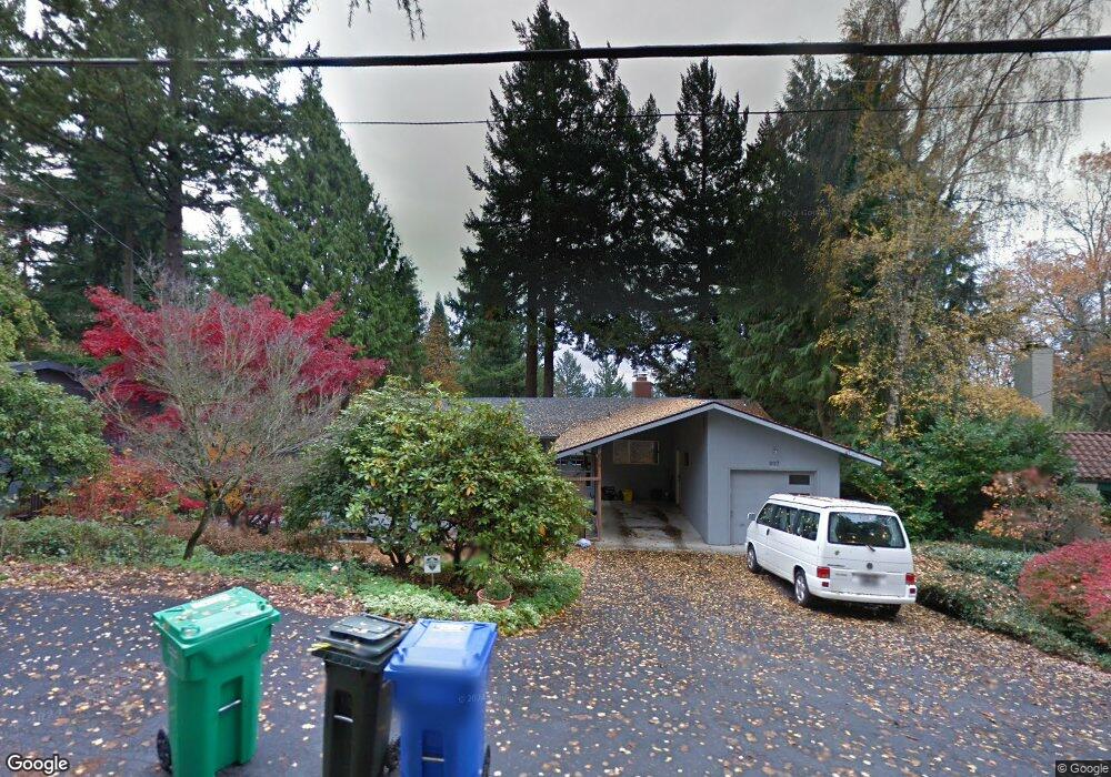
997 SW Westwood Dr Portland, OR 97239
Hillsdale NeighborhoodEstimated Value: $809,000 - $970,000
3
Beds
2
Baths
2,938
Sq Ft
$297/Sq Ft
Est. Value
About This Home
This home is located at 997 SW Westwood Dr, Portland, OR 97239 and is currently estimated at $872,402, approximately $296 per square foot. 997 SW Westwood Dr is a home located in Multnomah County with nearby schools including Rieke Elementary School, Robert Gray Middle School, and Ida B. Wells-Barnett High School.
Ownership History
Date
Name
Owned For
Owner Type
Purchase Details
Closed on
May 16, 2014
Sold by
Terdal Leif G
Bought by
Andreyuk Michael Peter and Andreyuk Jill Kaplan
Current Estimated Value
Home Financials for this Owner
Home Financials are based on the most recent Mortgage that was taken out on this home.
Original Mortgage
$359,200
Outstanding Balance
$273,470
Interest Rate
4.38%
Mortgage Type
New Conventional
Estimated Equity
$598,932
Create a Home Valuation Report for This Property
The Home Valuation Report is an in-depth analysis detailing your home's value as well as a comparison with similar homes in the area
Home Values in the Area
Average Home Value in this Area
Purchase History
| Date | Buyer | Sale Price | Title Company |
|---|---|---|---|
| Andreyuk Michael Peter | $479,000 | First American |
Source: Public Records
Mortgage History
| Date | Status | Borrower | Loan Amount |
|---|---|---|---|
| Open | Andreyuk Michael Peter | $359,200 |
Source: Public Records
Tax History Compared to Growth
Tax History
| Year | Tax Paid | Tax Assessment Tax Assessment Total Assessment is a certain percentage of the fair market value that is determined by local assessors to be the total taxable value of land and additions on the property. | Land | Improvement |
|---|---|---|---|---|
| 2025 | $12,051 | $447,670 | -- | -- |
| 2024 | $11,618 | $434,640 | -- | -- |
| 2023 | $11,172 | $421,990 | $0 | $0 |
| 2022 | $10,930 | $409,700 | $0 | $0 |
| 2021 | $10,745 | $397,770 | $0 | $0 |
| 2020 | $9,856 | $386,190 | $0 | $0 |
| 2019 | $9,494 | $374,950 | $0 | $0 |
| 2018 | $9,215 | $8,350 | $0 | $0 |
| 2017 | $8,832 | $353,430 | $0 | $0 |
| 2016 | $8,082 | $343,140 | $0 | $0 |
| 2015 | $7,870 | $333,150 | $0 | $0 |
Source: Public Records
Map
Nearby Homes
- 1125 SW Westwood Ct
- 5570 SW Menefee Dr
- 0 SW Westwood Ct
- 6254 SW Burlingame Ave Unit A
- 6196 SW Capitol Hwy Unit 6196
- 0 SW Ralston Dr
- 6220 SW Capitol Hwy Unit 8
- 6220 SW Capitol Hwy Unit 7
- 5862 SW Ralston Dr
- 6028 SW 18th Dr
- 6022 SW 18th Dr
- 6020 SW 18th Dr
- 6026 SW 18th Dr
- 6008 SW 18th Dr
- 0 SW Barbur Blvd
- 6731 SW 11th Dr
- 0 SW View Point Terrace Unit 24554973
- 5425 SW View Point Terrace Unit 107
- 6442 SW Parkhill Dr
- 16 S Boundary St
- 1001 SW Westwood Dr
- 751 SW Westwood Dr
- 745 SW Westwood Dr
- 759 SW Westwood Dr
- 985 SW Westwood Dr
- 1002 SW Westwood Ct
- 1003 SW Westwood Dr
- 801 SW Westwood Dr
- 0 SW Westwood Dr
- 1005 SW Westwood Dr
- 971 SW Westwood Dr
- 1010 SW Westwood Ct
- 805 SW Westwood Dr
- 780 SW Menefee Ln
- 795 SW Menefee Ln
- 1021 SW Westwood Ct
- 815 SW Westwood Dr
- 964 SW Westwood Dr
- 746 SW Westwood Dr
- 1007 SW Westwood Dr