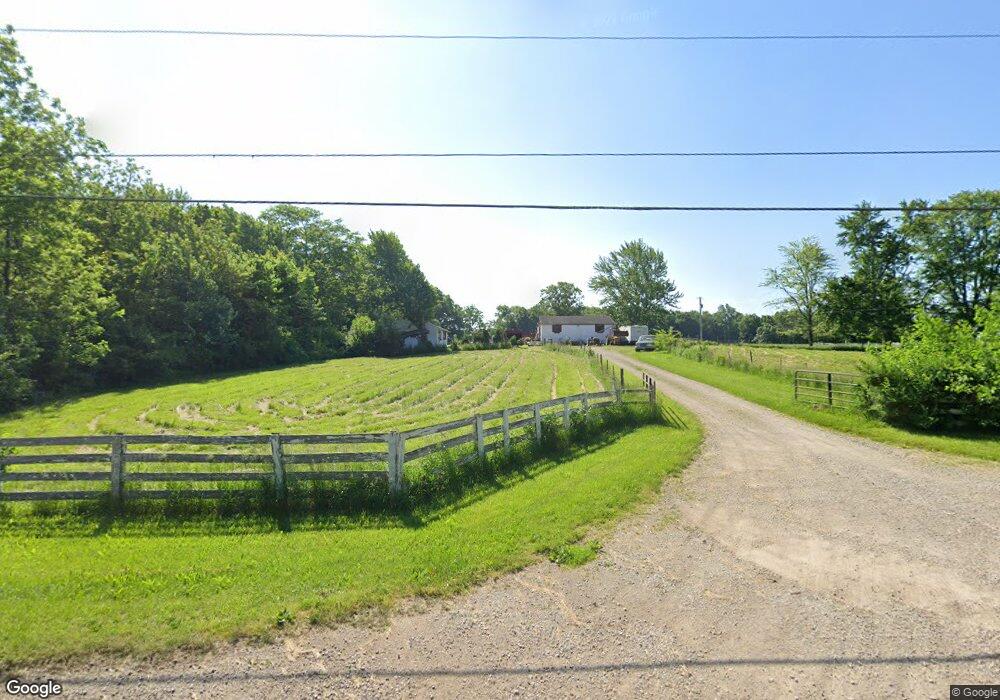
9970 Us Highway 42 N Plain City, OH 43064
Estimated Value: $232,000 - $622,000
1
Bed
1
Bath
864
Sq Ft
$513/Sq Ft
Est. Value
About This Home
This home is located at 9970 Us Highway 42 N, Plain City, OH 43064 and is currently estimated at $443,457, approximately $513 per square foot. 9970 Us Highway 42 N is a home located in Union County with nearby schools including Plain City Elementary School, Jonathan Alder Junior High School, and Canaan Middle School.
Ownership History
Date
Name
Owned For
Owner Type
Purchase Details
Closed on
Jun 14, 2023
Sold by
Rymer Anita R and Rymer Jeffrey G
Bought by
Rsa Developers Us42 Llc
Current Estimated Value
Purchase Details
Closed on
Oct 14, 2005
Sold by
Smith Carl C and Smith Carolyn L
Bought by
Glemalo
Purchase Details
Closed on
Sep 15, 2004
Sold by
Dean Robert C and Wolf Kathryn
Bought by
Smith Carl C
Home Financials for this Owner
Home Financials are based on the most recent Mortgage that was taken out on this home.
Original Mortgage
$515,000
Interest Rate
6.08%
Mortgage Type
Unknown
Create a Home Valuation Report for This Property
The Home Valuation Report is an in-depth analysis detailing your home's value as well as a comparison with similar homes in the area
Home Values in the Area
Average Home Value in this Area
Purchase History
| Date | Buyer | Sale Price | Title Company |
|---|---|---|---|
| Rsa Developers Us42 Llc | $1,002,100 | None Listed On Document | |
| Glemalo | $350,000 | -- | |
| Smith Carl C | $295,000 | -- |
Source: Public Records
Mortgage History
| Date | Status | Borrower | Loan Amount |
|---|---|---|---|
| Previous Owner | Smith Carl C | $515,000 |
Source: Public Records
Tax History Compared to Growth
Tax History
| Year | Tax Paid | Tax Assessment Tax Assessment Total Assessment is a certain percentage of the fair market value that is determined by local assessors to be the total taxable value of land and additions on the property. | Land | Improvement |
|---|---|---|---|---|
| 2024 | $2,255 | $57,100 | $20,030 | $37,070 |
| 2023 | $2,255 | $57,100 | $20,030 | $37,070 |
| 2022 | $2,306 | $57,100 | $20,030 | $37,070 |
| 2021 | $2,066 | $64,580 | $31,750 | $32,830 |
| 2020 | $1,959 | $64,580 | $31,750 | $32,830 |
| 2019 | $1,966 | $64,580 | $31,750 | $32,830 |
| 2018 | $1,667 | $39,360 | $14,570 | $24,790 |
| 2017 | $1,561 | $37,320 | $14,570 | $22,750 |
| 2016 | $1,574 | $37,320 | $14,570 | $22,750 |
| 2015 | $1,494 | $33,860 | $14,570 | $19,290 |
| 2014 | $1,494 | $33,860 | $14,570 | $19,290 |
| 2013 | $1,512 | $33,930 | $14,570 | $19,360 |
Source: Public Records
Map
Nearby Homes
- 10260 Carmel Dr
- 9601 Bur Oak Dr Unit Lot 148
- 9561 Bur Oak Dr Unit Lot 152
- 9602 Bur Oak Dr Unit Lot 119
- 11033 Sacramento Ct
- Biscayne Plan at Reserve at New California
- Galveston Plan at Reserve at New California
- Bradenton Plan at Reserve at New California
- Barrington Plan at Reserve at New California
- Sanibel Plan at Reserve at New California
- Augustine Plan at Reserve at New California
- Manchester Plan at Reserve at New California
- Brookhaven Plan at Reserve at New California
- McKenzie Plan at Reserve at New California
- Stonehurst Plan at Reserve at New California
- Aberdeen Plan at Reserve at New California
- Lauderdale Plan at Reserve at New California
- 9794 Mimosa Ct
- 10700 Laguna Cir
- 9755 Fresno Ct
- 9970 U S 42
- 9942 Us Highway 42 N
- 9999 Industrial Pkwy
- 9971 Industrial Pkwy
- 10280 Carmel Dr
- 10270 Carmel Dr
- 9898 Us Highway 42 N
- 9959 Industrial Pkwy
- 9945 Industrial Pkwy
- 10250 Carmel Dr
- 9626 Monteray Dr
- 10067 Industrial Pkwy
- 10290 Carmel Dr
- 9631 Bluestem Dr
- 9702 Brindlewood Dr
- 9702 Brindlewood Dr Unit 2620360-48633
- 9640 Monteray Dr
- 9583 Coach Line Ave
- 10300 Carmel Dr
- 10265 Carmel Dr