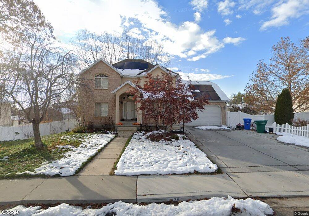
9975 Mulberry Dr Pleasant Grove, UT 84062
Estimated Value: $675,000 - $755,000
3
Beds
4
Baths
2,054
Sq Ft
$348/Sq Ft
Est. Value
About This Home
This home is located at 9975 Mulberry Dr, Pleasant Grove, UT 84062 and is currently estimated at $715,773, approximately $348 per square foot. 9975 Mulberry Dr is a home located in Utah County with nearby schools including Deerfield Elementary School, Mountain Ridge Junior High School, and Lone Peak High School.
Ownership History
Date
Name
Owned For
Owner Type
Purchase Details
Closed on
Mar 29, 2022
Sold by
Jones Brian W and Jones Wendy S
Bought by
Jay Peter and Jay Kira
Current Estimated Value
Home Financials for this Owner
Home Financials are based on the most recent Mortgage that was taken out on this home.
Original Mortgage
$647,000
Outstanding Balance
$608,817
Interest Rate
4.42%
Mortgage Type
New Conventional
Estimated Equity
$106,956
Purchase Details
Closed on
Dec 1, 2017
Sold by
Johnson Matthew M and Johnson Jennie L
Bought by
Jones Brain W and Jones Wendy S
Home Financials for this Owner
Home Financials are based on the most recent Mortgage that was taken out on this home.
Original Mortgage
$356,250
Interest Rate
3.94%
Mortgage Type
New Conventional
Purchase Details
Closed on
Nov 8, 2010
Sold by
Bac Home Loans Servicing Lp
Bought by
Johnson Matthew M and Johnson Jennie L
Home Financials for this Owner
Home Financials are based on the most recent Mortgage that was taken out on this home.
Original Mortgage
$213,350
Interest Rate
4.17%
Mortgage Type
FHA
Purchase Details
Closed on
Jan 25, 2010
Sold by
Mullen Andrew J
Bought by
Bac Home Loans Servicing Lp
Purchase Details
Closed on
May 3, 2007
Sold by
Mullen Andrew J
Bought by
Mullen Andrew J and Mullen Malinda
Purchase Details
Closed on
Jan 24, 2006
Sold by
Mullen Malinda D
Bought by
Mullen Andrew J
Home Financials for this Owner
Home Financials are based on the most recent Mortgage that was taken out on this home.
Original Mortgage
$232,000
Interest Rate
1%
Mortgage Type
Fannie Mae Freddie Mac
Purchase Details
Closed on
Nov 9, 2001
Sold by
Smith Stephen E and Smith Erin K
Bought by
Mullen Andrew J and Mullen Malinda D
Purchase Details
Closed on
Feb 4, 1998
Sold by
Sullivan Mark and Sullivan Carole
Bought by
Smith Stephen E and Smith Erin K
Home Financials for this Owner
Home Financials are based on the most recent Mortgage that was taken out on this home.
Original Mortgage
$187,150
Interest Rate
6.95%
Create a Home Valuation Report for This Property
The Home Valuation Report is an in-depth analysis detailing your home's value as well as a comparison with similar homes in the area
Home Values in the Area
Average Home Value in this Area
Purchase History
| Date | Buyer | Sale Price | Title Company |
|---|---|---|---|
| Jay Peter | -- | New Title Company Name | |
| Jones Brain W | -- | First American Title | |
| Johnson Matthew M | -- | First American Union Park | |
| Bac Home Loans Servicing Lp | $233,955 | Backman | |
| Mullen Andrew J | -- | Integrated Title Insurance | |
| Mullen Andrew J | -- | Integrated Title Insurance | |
| Mullen Andrew J | -- | First American Title Insuran | |
| Smith Stephen E | -- | -- |
Source: Public Records
Mortgage History
| Date | Status | Borrower | Loan Amount |
|---|---|---|---|
| Open | Jay Peter | $647,000 | |
| Previous Owner | Jones Brain W | $356,250 | |
| Previous Owner | Johnson Matthew M | $213,350 | |
| Previous Owner | Mullen Andrew J | $232,000 | |
| Previous Owner | Smith Stephen E | $187,150 |
Source: Public Records
Tax History Compared to Growth
Tax History
| Year | Tax Paid | Tax Assessment Tax Assessment Total Assessment is a certain percentage of the fair market value that is determined by local assessors to be the total taxable value of land and additions on the property. | Land | Improvement |
|---|---|---|---|---|
| 2025 | $2,874 | $354,035 | $241,700 | $402,000 |
| 2024 | $2,874 | $340,340 | $0 | $0 |
| 2023 | $2,742 | $348,920 | $0 | $0 |
| 2022 | $2,642 | $328,405 | $0 | $0 |
| 2021 | $2,338 | $432,900 | $151,800 | $281,100 |
| 2020 | $2,191 | $395,800 | $135,500 | $260,300 |
| 2019 | $1,949 | $365,700 | $117,200 | $248,500 |
| 2018 | $1,883 | $332,800 | $109,900 | $222,900 |
| 2017 | $1,894 | $179,025 | $0 | $0 |
| 2016 | $1,829 | $160,765 | $0 | $0 |
| 2015 | $1,731 | $144,045 | $0 | $0 |
| 2014 | $1,576 | $130,185 | $0 | $0 |
Source: Public Records
Map
Nearby Homes
- 9900 N Meadow Dr
- 4198 W Sage Rd N
- 9752 N Dorchester Dr
- 10207 N Cottonwood Dr
- 248 N Deerfield Ln
- 3870 Mountaintop Cir
- 9681 N Peach Ct
- 10052 N Marigold Ln
- 4631 W Harvey Blvd
- 9587 N 4500 W
- 4441 W Bridgestone Dr
- 3851 W Mountaintop Cir Unit 5
- 4616 W Carriage Ln
- 4292 W Joshua Ln
- 4696 W Camellia Ln
- 4124 N 810 W
- 9506 N 4000 W
- 1172 Murdock Dr
- 4811 Pocosin Ct
- 4812 W Pocosin Ct
- 9975 N Mulberry Dr
- 9951 N Mulberry Dr
- 9991 Mulberry Dr
- 4283 Walnut Cove
- 4293 Walnut Cove
- 4278 Pinnacle Dr
- 9978 N Mulberry Dr
- 9978 Mulberry Dr
- 9956 N Mulberry Dr
- 9988 Mulberry Dr
- 9988 N Mulberry Dr
- 4279 W Walnut Cove
- 4296 W Pinnacle Dr
- 4303 W Walnut Cove
- 9930 N Wildflower Cir
- 9930 Wildflower Cir
- 9929 N Mulberry Dr
- 4231 Cedar Hills Dr
- 4267 W Cedar Hills Dr
- 9982 Wildflower Cir