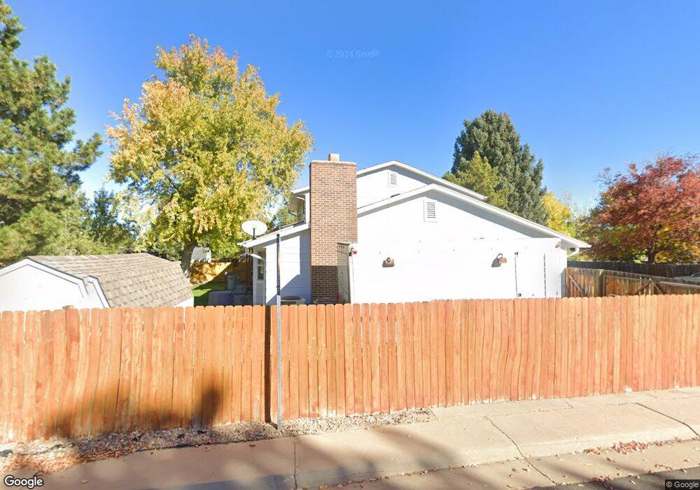
999 Mercury Cir Lone Tree, CO 80124
Estimated Value: $589,232 - $636,000
4
Beds
3
Baths
2,193
Sq Ft
$279/Sq Ft
Est. Value
About This Home
This home is located at 999 Mercury Cir, Lone Tree, CO 80124 and is currently estimated at $612,616, approximately $279 per square foot. 999 Mercury Cir is a home located in Douglas County with nearby schools including Acres Green Elementary School, Cresthill Middle School, and Highlands Ranch High School.
Ownership History
Date
Name
Owned For
Owner Type
Purchase Details
Closed on
Jul 21, 1987
Sold by
Johnson Carter D and Darg Barbara J
Bought by
Callahan Thomas P and Callahan Karen D
Current Estimated Value
Purchase Details
Closed on
Jun 24, 1981
Sold by
Unavailable
Bought by
Unavailable
Create a Home Valuation Report for This Property
The Home Valuation Report is an in-depth analysis detailing your home's value as well as a comparison with similar homes in the area
Home Values in the Area
Average Home Value in this Area
Purchase History
| Date | Buyer | Sale Price | Title Company |
|---|---|---|---|
| Callahan Thomas P | $108,000 | -- | |
| Unavailable | $98,000 | -- |
Source: Public Records
Tax History Compared to Growth
Tax History
| Year | Tax Paid | Tax Assessment Tax Assessment Total Assessment is a certain percentage of the fair market value that is determined by local assessors to be the total taxable value of land and additions on the property. | Land | Improvement |
|---|---|---|---|---|
| 2024 | $2,918 | $42,170 | $7,950 | $34,220 |
| 2023 | $2,948 | $42,170 | $7,950 | $34,220 |
| 2022 | $2,147 | $31,060 | $6,750 | $24,310 |
| 2021 | $2,233 | $31,060 | $6,750 | $24,310 |
| 2020 | $2,026 | $29,550 | $6,440 | $23,110 |
| 2019 | $2,032 | $29,550 | $6,440 | $23,110 |
| 2018 | $1,528 | $25,250 | $5,610 | $19,640 |
| 2017 | $1,553 | $25,250 | $5,610 | $19,640 |
| 2016 | $1,284 | $22,560 | $3,990 | $18,570 |
| 2015 | $1,014 | $22,560 | $3,990 | $18,570 |
| 2014 | $923 | $19,230 | $3,980 | $15,250 |
Source: Public Records
Map
Nearby Homes
- 789 Hamal Dr
- 13117 Deneb Dr
- 13134 Deneb Dr
- 802 Altair Dr
- 8159 Lodgepole Trail
- 9275 Erminedale Dr
- 9412 La Quinta Way
- 7057 Chestnut Hill St
- 9308 Miles Dr Unit 5
- 7041 Chestnut Hill Trail
- 6887 Chestnut Hill St
- 13483 Achilles Dr
- 181 Dianna Dr
- 7469 La Quinta Place
- 13542 Achilles Dr
- 130 Dianna Dr
- 8822 Fiesta Terrace
- 8860 Kachina Way
- 108 Olympus Cir
- 9390 Yale Ln
- 995 Mercury Cir
- 13072 Peacock Dr
- 13082 Peacock Dr
- 13031 Mercury Dr
- 989 Mercury Cir
- 994 Mercury Cir
- 13092 Peacock Dr
- 752 Mercury Cir
- 756 Mercury Cir
- 13037 Mercury Dr
- 13030 Mercury Dr
- 985 Mercury Cir
- 988 Mercury Cir
- 760 Mercury Cir
- 765 Mercury Cir
- 13124 Peacock Dr
- 780 Hamal Dr
- 13036 Mercury Dr
- 764 Mercury Cir
- 13043 Mercury Dr