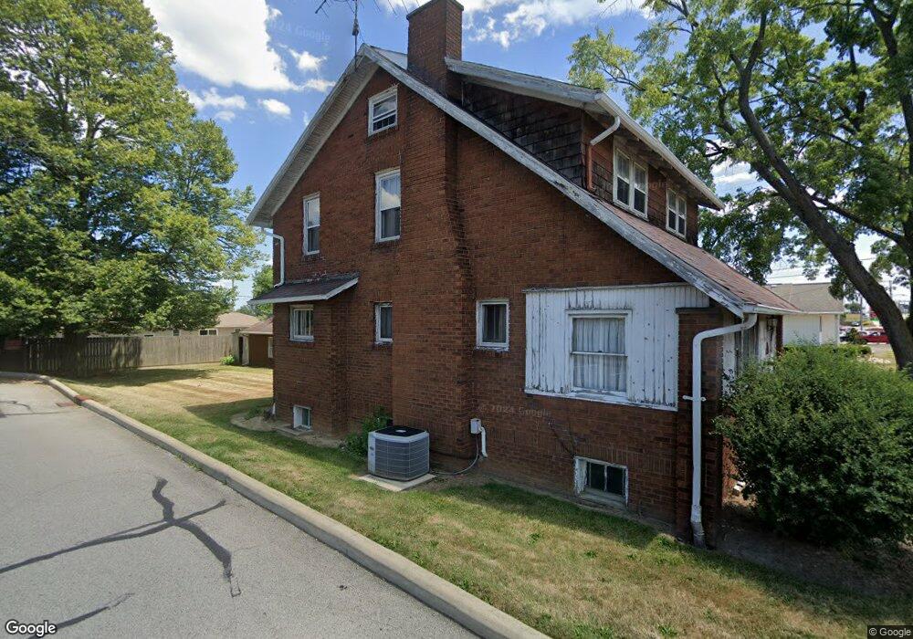
999 W State St Alliance, OH 44601
Estimated Value: $168,000 - $192,000
--
Bed
1
Bath
11,700
Sq Ft
$16/Sq Ft
Est. Value
About This Home
This home is located at 999 W State St, Alliance, OH 44601 and is currently estimated at $183,288, approximately $15 per square foot. 999 W State St is a home located in Stark County with nearby schools including Alliance Early Learning School, Alliance Intermediate School at Northside, and Alliance Middle School.
Ownership History
Date
Name
Owned For
Owner Type
Purchase Details
Closed on
Mar 30, 2023
Sold by
Whitedonuts Llc
Bought by
Slw Development Llc
Current Estimated Value
Purchase Details
Closed on
Dec 2, 2016
Sold by
Thakkar Mahendra K and Thakkar Usha M
Bought by
Whitedonuts Llc
Purchase Details
Closed on
Aug 8, 2008
Sold by
Thakkar Usha M
Bought by
Thakkar Mahendra K and Thakkar Usha M
Purchase Details
Closed on
Feb 19, 1993
Purchase Details
Closed on
Mar 2, 1992
Create a Home Valuation Report for This Property
The Home Valuation Report is an in-depth analysis detailing your home's value as well as a comparison with similar homes in the area
Home Values in the Area
Average Home Value in this Area
Purchase History
| Date | Buyer | Sale Price | Title Company |
|---|---|---|---|
| Slw Development Llc | -- | -- | |
| Whitedonuts Llc | $120,000 | None Available | |
| Thakkar Mahendra K | -- | Attorney | |
| -- | -- | -- | |
| -- | -- | -- |
Source: Public Records
Tax History Compared to Growth
Tax History
| Year | Tax Paid | Tax Assessment Tax Assessment Total Assessment is a certain percentage of the fair market value that is determined by local assessors to be the total taxable value of land and additions on the property. | Land | Improvement |
|---|---|---|---|---|
| 2025 | -- | $34,550 | $19,290 | $15,260 |
| 2024 | -- | $34,550 | $19,290 | $15,260 |
| 2023 | $1,664 | $31,400 | $17,540 | $13,860 |
| 2022 | $1,680 | $31,400 | $17,540 | $13,860 |
| 2021 | $1,672 | $31,400 | $17,540 | $13,860 |
| 2020 | $1,718 | $29,900 | $16,700 | $13,200 |
| 2019 | $1,676 | $29,910 | $16,700 | $13,210 |
| 2018 | $1,656 | $29,910 | $16,700 | $13,210 |
| 2017 | $1,548 | $27,070 | $12,710 | $14,360 |
| 2016 | $1,159 | $20,140 | $5,640 | $14,500 |
| 2015 | $593 | $20,140 | $5,640 | $14,500 |
| 2014 | $1,146 | $19,400 | $5,430 | $13,970 |
| 2013 | $1 | $19,400 | $5,430 | $13,970 |
Source: Public Records
Map
Nearby Homes
- 884 W College Rd
- 1515 S Rockhill Ave
- 2112 Blenheim Ave
- 2050 Federal Ave
- 1059 Oakwood Dr
- 1321 Parkway Blvd
- 2220 Western Ave
- 1201 Overlook Dr
- 2839 S Rockhill Ave
- 1038 Fairview Place
- 970 Kingsway St
- 738 Kingsway St
- 896 Parkway Blvd
- 3101 Ridgehill Ave
- 112 E College St
- 1475 Chatauqua Ct
- 734 Parkway Blvd
- 317 E State St
- 725 W Summit St
- 236 E Milton St
- 981 W State St
- 1005 W State St
- 1000 W State St
- 1005 999 W State
- 994 Hartshorn St
- 1004 Hartshorn St
- 966 Hartshorn St
- 966 Hartshorn St
- 1024 Hartshorn St
- 960 W State St
- 1915 Parkway Blvd
- 1034 Hartshorn St
- 1905 Parkway Blvd
- 1042 Hartshorn St
- 991 Hartshorn St
- 977 Hartshorn St
- 1005 Hartshorn St
- 1052 Hartshorn St
- 1015 Hartshorn St
- 1845 Parkway Blvd