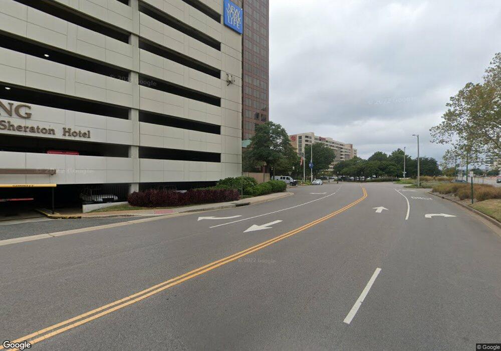
999 Waterside Dr Norfolk, VA 23510
Downtown Norfolk Neighborhood
Studio
--
Bath
421,856
Sq Ft
2.64
Acres
About This Home
This home is located at 999 Waterside Dr, Norfolk, VA 23510. 999 Waterside Dr is a home located in Norfolk City with nearby schools including P.B. Young Sr. Elementary School, Ruffner Middle School, and Blair Middle School.
Ownership History
Date
Name
Owned For
Owner Type
Purchase Details
Closed on
Dec 20, 2018
Sold by
Dominion Tower Lp
Bought by
Hertz Norfolk 999 Waterside Llc
Purchase Details
Closed on
Apr 21, 2016
Sold by
Dominion Tower Financial Associates Llc
Bought by
Dominion Tower Lp A Delaware Limited Par
Create a Home Valuation Report for This Property
The Home Valuation Report is an in-depth analysis detailing your home's value as well as a comparison with similar homes in the area
Home Values in the Area
Average Home Value in this Area
Purchase History
| Date | Buyer | Sale Price | Title Company |
|---|---|---|---|
| Hertz Norfolk 999 Waterside Llc | $79,000 | Attorney | |
| Dominion Tower Lp A Delaware Limited Par | -- | None Available |
Source: Public Records
Tax History
| Year | Tax Paid | Tax Assessment Tax Assessment Total Assessment is a certain percentage of the fair market value that is determined by local assessors to be the total taxable value of land and additions on the property. | Land | Improvement |
|---|---|---|---|---|
| 2025 | $1,142,148 | $81,003,400 | $8,618,800 | $72,384,600 |
| 2023 | $1,090,886 | $77,367,800 | $8,618,800 | $68,749,000 |
| 2022 | $1,079,403 | $76,553,400 | $8,618,800 | $67,934,600 |
| 2021 | $1,091,667 | $77,423,200 | $8,618,800 | $68,804,400 |
| 2020 | $1,091,667 | $77,423,200 | $8,618,800 | $68,804,400 |
| 2019 | $1,030,775 | $73,104,600 | $8,618,800 | $64,485,800 |
| 2018 | $816,334 | $57,896,000 | $6,895,000 | $51,001,000 |
| 2017 | $755,760 | $57,691,600 | $6,895,000 | $50,796,600 |
| 2016 | $755,760 | $63,636,100 | $6,895,000 | $56,741,100 |
| 2015 | $716,998 | $63,636,100 | $6,895,000 | $56,741,100 |
| 2014 | $716,998 | $63,636,100 | $6,895,000 | $56,741,100 |
Source: Public Records
Map
Nearby Homes
- 415 Saint Pauls Blvd Unit 407
- 415 Saint Pauls Blvd Unit 509
- 415 Saint Pauls Blvd Unit 205
- 415 Saint Pauls Blvd Unit 109
- 415 Saint Pauls Blvd Unit 309
- 415 Saint Pauls Blvd Unit 202
- 415 Saint Pauls Blvd Unit 504
- 415 St Pauls Blvd Unit 105
- 241 Granby St Unit 40
- 415 E Freemason St Unit 3A
- 215 Brooke Ave Unit 802
- 215 Brooke Ave Unit 1004
- 433 Saint Pauls Blvd Unit 2D
- 433 Saint Pauls Blvd Unit 4D
- 443 Saint Pauls Blvd Unit 1E
- 123 College Place Unit 801
- 123 College Place Unit 1204
- 123 College Place Unit 905
- 230 W Tazewell St Unit 209
- 388 Boush St Unit 122
- 1101 Water St
- 888 Waterside Dr
- 2 Commercial Place
- 810 Union St
- 3 Commercial Place
- 555 E Main St
- 777 Waterside Dr
- 1115 Water St
- 999 E Main St
- 1119 Water St
- 140 Saint Pauls Blvd
- 520 E Main St
- 580 E Main St
- 1125 Water St
- 321 E Main St
- 321 E Main St
- 500 E Main St
- 125 Saint Pauls Blvd
- 920 E Main St
- 149 Saint Pauls Blvd
