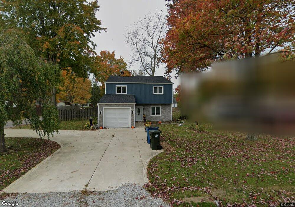
9990 Bryant Dr Columbia Station, OH 44028
Estimated Value: $182,000 - $255,000
3
Beds
2
Baths
1,461
Sq Ft
$153/Sq Ft
Est. Value
About This Home
This home is located at 9990 Bryant Dr, Columbia Station, OH 44028 and is currently estimated at $223,457, approximately $152 per square foot. 9990 Bryant Dr is a home located in Lorain County with nearby schools including Copopa Elementary School, Columbia Middle School, and Columbia High School.
Ownership History
Date
Name
Owned For
Owner Type
Purchase Details
Closed on
Feb 25, 2022
Sold by
Glancy Jennifer E
Bought by
Glancy Tyler J
Current Estimated Value
Home Financials for this Owner
Home Financials are based on the most recent Mortgage that was taken out on this home.
Original Mortgage
$142,000
Outstanding Balance
$132,109
Interest Rate
3.55%
Mortgage Type
New Conventional
Estimated Equity
$91,348
Purchase Details
Closed on
Jun 8, 2007
Sold by
Us Bank Na
Bought by
Glancy Jennifer E
Home Financials for this Owner
Home Financials are based on the most recent Mortgage that was taken out on this home.
Original Mortgage
$99,000
Interest Rate
6.2%
Mortgage Type
Purchase Money Mortgage
Purchase Details
Closed on
Oct 30, 2006
Sold by
Trowbridge Neil G and Trowbridge Faithann M
Bought by
Us Bank Na and Structured Asset Securities Corp Series
Purchase Details
Closed on
Dec 1, 2005
Sold by
Trowbridge Faith Ann
Bought by
Trowbridge Neil
Purchase Details
Closed on
Nov 1, 2002
Sold by
Hud
Bought by
Trowbridge Neil G and Trowbridge Faithann M
Home Financials for this Owner
Home Financials are based on the most recent Mortgage that was taken out on this home.
Original Mortgage
$113,223
Interest Rate
6.18%
Mortgage Type
FHA
Purchase Details
Closed on
Jun 14, 2002
Sold by
Napier Kenneth J and Finucan Julie M
Bought by
Hud
Purchase Details
Closed on
Apr 20, 2001
Sold by
Napier Julie M and Finucan Julie M
Bought by
Napier Kenneth J
Purchase Details
Closed on
Mar 23, 1998
Sold by
Hollingsworth Michael R and Hollingsworth Lori B
Bought by
Napier Kenneth J and Finucan Julie M
Home Financials for this Owner
Home Financials are based on the most recent Mortgage that was taken out on this home.
Original Mortgage
$112,219
Interest Rate
7.15%
Mortgage Type
FHA
Purchase Details
Closed on
Feb 28, 1996
Sold by
Cummings Gene T
Bought by
Hollingsworth Michael R and Hollingsworth Lori B
Home Financials for this Owner
Home Financials are based on the most recent Mortgage that was taken out on this home.
Original Mortgage
$97,700
Interest Rate
7.07%
Mortgage Type
New Conventional
Create a Home Valuation Report for This Property
The Home Valuation Report is an in-depth analysis detailing your home's value as well as a comparison with similar homes in the area
Home Values in the Area
Average Home Value in this Area
Purchase History
| Date | Buyer | Sale Price | Title Company |
|---|---|---|---|
| Glancy Tyler J | $177,500 | Laribee & Hertrick Llp | |
| Glancy Jennifer E | $99,000 | Attorney | |
| Us Bank Na | $107,000 | None Available | |
| Trowbridge Neil | -- | None Available | |
| Trowbridge Neil G | $115,000 | Lakeside Title & Escrow Agen | |
| Hud | $90,000 | -- | |
| Napier Kenneth J | -- | -- | |
| Napier Kenneth J | $112,500 | Premier Title Agency Inc | |
| Hollingsworth Michael R | $102,900 | -- |
Source: Public Records
Mortgage History
| Date | Status | Borrower | Loan Amount |
|---|---|---|---|
| Open | Glancy Tyler J | $142,000 | |
| Previous Owner | Glancy Jennifer E | $99,000 | |
| Previous Owner | Trowbridge Neil G | $113,223 | |
| Previous Owner | Napier Kenneth J | $112,219 | |
| Previous Owner | Hollingsworth Michael R | $97,700 |
Source: Public Records
Tax History Compared to Growth
Tax History
| Year | Tax Paid | Tax Assessment Tax Assessment Total Assessment is a certain percentage of the fair market value that is determined by local assessors to be the total taxable value of land and additions on the property. | Land | Improvement |
|---|---|---|---|---|
| 2024 | $2,763 | $64,208 | $17,493 | $46,715 |
| 2023 | $2,162 | $43,890 | $11,263 | $32,627 |
| 2022 | $2,109 | $43,890 | $11,263 | $32,627 |
| 2021 | $2,131 | $43,890 | $11,260 | $32,630 |
| 2020 | $1,999 | $36,950 | $9,480 | $27,470 |
| 2019 | $1,987 | $36,950 | $9,480 | $27,470 |
| 2018 | $2,022 | $36,950 | $9,480 | $27,470 |
| 2017 | $2,038 | $34,840 | $6,020 | $28,820 |
| 2016 | $2,053 | $34,840 | $6,020 | $28,820 |
| 2015 | $2,091 | $34,840 | $6,020 | $28,820 |
| 2014 | $2,095 | $34,840 | $6,020 | $28,820 |
| 2013 | $2,157 | $34,840 | $6,020 | $28,820 |
Source: Public Records
Map
Nearby Homes
- V/L Aldridge Dr
- 8748 Bottle Brush Dr
- 10128 Valleyview Dr
- 8809 Leatherleaf Dr
- 8839 Leatherleaf Dr
- 8924 Leatherleaf Dr
- 8960 Leatherleaf Dr
- 8896 Firethorne Dr
- 9757 Wainwright Terrace
- 8981 Leatherleaf Dr
- 10700 Whitewing Way
- 24628 Sprague Rd
- 23450 Wainwright Terrace
- 23390 Wainwright Terrace
- 9797 Sugarbush Cir
- 9675 E Northwood Dr
- 24835 W Northwood Dr
- 23155 Wainwright Terrace
- 23004 Chandlers Ln Unit 109
- 580 Crossbrook Dr
- 9968 Bryant Dr
- Lot B Bryant Dr
- 9997 Colfax Dr
- 10026 Bryant Dr
- 9985 Colfax Dr
- 10031 Colfax Dr
- 9961 Colfax Dr
- 9987 Bryant Dr
- 9940 Bryant Dr
- 10025 Bryant Dr
- 9955 Bryant Dr
- 10043 Colfax Dr
- 9941 Colfax Dr
- 9920 Bryant Dr
- 10055 Bryant Dr
- 9941 Bryant Dr
- 10071 Colfax Dr
- 9990 Colfax Dr
- 10032 Aldridge Dr
- 9956 Aldridge Dr